Palo Alto sits in a ring of small cities and hill towns that each feel different. Here is how they compare, how far they are and which ones you can reach without a car.
Palo Alto gets the attention, but it is only one piece of a patchwork. Within about ten miles you cross two counties and nine separate cities and towns, each with its own city hall, its own rules and its own feel. Some are dense and busy, with train stations and long restaurant rows. Others have no shops at all, by design. A few are mostly forest and horse trails.
This section covers the neighbors that matter most to visitors and to people thinking about moving here. Each town guide explains where the place is, its history, what to see, how to get there and what daily life is like. This hub helps you tell them apart. Population figures come from the 2020 census, which every town uses as its official count.
The big picture: two counties and a creek
San Francisquito Creek runs from the foothills to the bay along Palo Alto's northern edge. For most of its length it is also the line between Santa Clara County to the south and San Mateo County to the north. That line matters more than you might expect. It decides which bus system serves a street, which county parks are nearby and which sheriff or court handles local matters.
Santa Clara County side: Palo Alto, Mountain View, Los Altos and Los Altos Hills. Buses are run by VTA.
San Mateo County side: Menlo Park, East Palo Alto, Atherton, Woodside, Portola Valley and Redwood City. Buses are run by SamTrans.
The landscape splits the other way, from east to west. Near the bay you find flat ground, freeways and the Bay Trail. In the middle runs El Camino Real with the Caltrain line beside it. That is where the downtowns cluster. West of Interstate 280 the land rises into oak hills and redwood canyons. The towns there are rural on purpose.
The towns compared
Distances are rough driving distances from downtown Palo Alto. Traffic at rush hour can double the times you would expect.
Incorporation years come from each town's official website or the state's list of cities. Redwood City is the oldest city in San Mateo County. East Palo Alto is the youngest city in this group by far.
Advertisement
How the towns differ
The Caltrain cities
Menlo Park, Mountain View and Redwood City have proper downtowns on or near the train line. Each has a main street lined with restaurants, a civic center and a mix of apartments and single-family homes. They are the easiest neighbors to visit without a car and the most likely to have a hotel room when Palo Alto is full. Mountain View and Redwood City are each larger than Palo Alto by population.
The quiet residential cities
Los Altos and Atherton are almost entirely residential. Los Altos keeps its shops in a compact village downtown and a few small districts along El Camino Real and Foothill Expressway. Atherton has no commercial zoning at all, so its streets are almost entirely homes, private schools and a single town park. Both are known for large lots and very expensive homes.
The hill towns
Los Altos Hills, Portola Valley and Woodside sit in the foothills of the Santa Cruz Mountains. They were incorporated in the 1950s and 1960s by residents who wanted to keep the hills rural. Minimum lot sizes are large, roads are narrow and winding and horse trails are common. For visitors their appeal is the outdoors: open space preserves, county parks and some of the best road cycling in the Bay Area.
East Palo Alto
East Palo Alto stands apart. It is a working-class and middle-class city with a large Latino community, a long Black history and a Pacific Islander community. It has its own city government, schools and civic life, plus some of the best bay shoreline access on this side of the bay at Cooley Landing and the Ravenswood preserve. Its history is tied closely to Palo Alto's, sometimes painfully. Our guide covers it in detail.
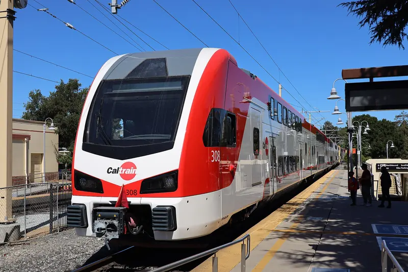
Electric Caltrain trains link Palo Alto with Menlo Park, Redwood City and Mountain View in a few minutes each. Photo: San Mateo County Transit District, Wikimedia Commons, Public domain
Getting between the towns
By train
Caltrain is the backbone. Heading north from Palo Alto, the next stations are Menlo Park and then Redwood City. Heading south, the line stops at California Avenue, San Antonio and Mountain View. Not every train stops at every station, so check the Caltrain timetable before you plan around a particular stop. Our guide to riding Caltrain covers fares, Clipper and tap-to-pay.
By bus
The Palo Alto Transit Center next to the downtown station is where VTA and SamTrans buses meet. SamTrans covers the San Mateo County side, including East Palo Alto, Menlo Park and Redwood City. VTA covers Mountain View and Los Altos. Buses to the hill towns are sparse or absent, so plan on a car, a bike or a rideshare for Woodside, Portola Valley and Los Altos Hills.
By car
El Camino Real links every Caltrain city. Highway 101 runs along the bay side and Interstate 280 runs along the foothills, with exits for Sand Hill Road, Alpine Road, Page Mill Road, Woodside Road and El Monte Road. If you are flying in and plan to explore the hills, compare rental cars before you land, since there is no practical transit to most trailheads.
By bike
The bay side is flat. The Bay Trail runs through Menlo Park, East Palo Alto, Palo Alto and Mountain View with almost no climbing. The foothills are the opposite: Portola Road, Cañada Road and Arastradero Road are famous with road cyclists for their climbs. Our biking guide covers both.
Which town fits which trip
A meeting on Sand Hill Road: Menlo Park, with the Rosewood Sand Hill hotel and most of the big venture firms.
Tech history: Mountain View for the Computer History Museum and the site of Shockley Semiconductor. Menlo Park for the garage where Google started.
A hike with a view: Portola Valley for Windy Hill, Woodside for Huddart Park and the redwoods.
Gardens and history: Woodside for Filoli and the Woodside Store, Los Altos for its history museum and apricot orchard.
Concerts and theater: Mountain View for Shoreline Amphitheatre and its performing arts center, Redwood City for the Fox Theatre, Menlo Park for the Guild Theatre.
Birds and bay views: East Palo Alto for Cooley Landing and the Ravenswood marshes.
Cheaper hotel rooms: Mountain View and Redwood City, which have far more rooms than Palo Alto.
If you are going farther afield, to the coast, the redwoods or San Francisco, our day trips guide picks up where this section ends.
Living in a neighboring town
People moving to the area often compare Palo Alto with its neighbors. A few practical differences come up again and again:
Utilities. Palo Alto runs its own electric, gas, water and fiber utility. Most neighbors are served by PG&E for power and gas, with water from a city department or a private water company.
Schools. District lines do not follow city lines. Parts of Los Altos Hills are in the Palo Alto Unified School District, while Menlo Park alone is split among several elementary districts. Always check the exact address.
Housing. The Caltrain cities have the most apartments and condos. The hill towns and Atherton are almost entirely single-family homes on large lots, which keeps prices among the highest in the country.
Services. Several small towns contract with their county sheriff for police and with fire districts for fire service rather than running their own departments.
Commutes. Living near a Caltrain station in Mountain View, Menlo Park or Redwood City can make a Palo Alto or Stanford commute easy without a car.
Our guide to living in Palo Alto covers the city itself. Each town page in this section ends with a neutral look at daily life there.
Good to know
Many addresses say "Palo Alto" even when they are not in the city. Stanford, parts of unincorporated Santa Clara County and even East Palo Alto have used Palo Alto mailing addresses or ZIP codes.
Menlo Park's station building dates from 1867 and is the oldest California station still in service, according to the city.
The hill towns get busy with cyclists on weekend mornings. Drive slowly and pass with plenty of room.
Open space preserves in the hills generally open half an hour before sunrise and close half an hour after sunset. Check the Midpeninsula Regional Open Space District for closures.
Palo Alto borders Menlo Park and East Palo Alto to the north, Mountain View and Los Altos to the south and east and Los Altos Hills and Portola Valley in the foothills to the southwest. Stanford University land also borders it to the west. Atherton, Woodside and Redwood City are a few miles farther north.
Which towns near Palo Alto can I reach by Caltrain?
Menlo Park, Redwood City and Mountain View all have Caltrain stations. Menlo Park is one stop north of Palo Alto and Mountain View has two stations to the south. Atherton's station closed in 2020 and the hill towns have no rail service at all.
Is East Palo Alto part of Palo Alto?
No. East Palo Alto is a separate city in San Mateo County. It incorporated in 1983 and had 30,034 residents in the 2020 census. The two cities share a border along San Francisquito Creek and share the 94303 ZIP code.
Which county are the towns around Palo Alto in?
Palo Alto, Mountain View, Los Altos and Los Altos Hills are in Santa Clara County. Menlo Park, East Palo Alto, Atherton, Woodside, Portola Valley and Redwood City are in San Mateo County. San Francisquito Creek forms much of the county line.
Which nearby town is best for hiking?
Portola Valley and Woodside have the most trails close at hand, including Windy Hill, Huddart Park and Wunderlich Park. Los Altos Hills has its own town pathway network and Hidden Villa. Our hiking guide ranks the best routes.