On this page
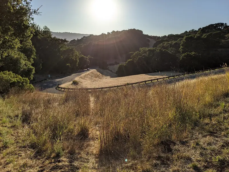
Head west from Stanford on Alpine Road, pass under Interstate 280 and the suburbs fall away. Oaks and redwoods close in, horse fences line the road and the green slope of Windy Hill rises ahead. This is Portola Valley, a town of about 4,500 people spread across a valley that sits almost exactly on the San Andreas Fault.
The town has no downtown in the usual sense, only a small cluster of shops where Alpine Road meets Portola Road and a civic campus called the Town Center. What it does have is open space. Hikers, trail runners, horse riders and road cyclists come from all over the Bay Area. This guide covers the town's history, the best ways to spend a few hours there and what life looks like for residents.
Where Portola Valley is
Portola Valley is in San Mateo County on the eastern slope of the Santa Cruz Mountains, west of Interstate 280. Its southwestern boundary follows Skyline Boulevard along the ridge. Woodside borders it to the northwest. Palo Alto's foothill lands border it to the southeast. Stanford's Jasper Ridge Biological Preserve lies to the north and the unincorporated neighborhood of Ladera sits along its northern edge.
Two roads carry most traffic. Alpine Road runs from the Stanford area up through the valley toward Skyline. Portola Road runs north along the valley floor into Woodside. Downtown Palo Alto is about 15 minutes away by car outside rush hour.
A short history
Ranchos, redwoods and Searsville
The town takes its name from Gaspar de Portolá, who led the 1769 Spanish expedition that first explored the Peninsula. According to the town, the Mexican government granted the 13,000-acre Rancho el Corte de Madera to Máximo Martínez in 1834. The name means "the place where wood is cut," and logging followed. After the gold rush, sawmills took most of the old redwoods to build San Francisco. By the early 1900s few big trees were left.
A logging town called Searsville grew up on Sand Hill Road in the 1850s and lasted until 1891. The town was later abandoned. A reservoir built nearby became Searsville Lake, now inside Stanford's Jasper Ridge preserve. Andrew Hallidie, the inventor of San Francisco's cable cars, owned a large estate running from Portola Road to the Skyline. He offered part of his Eagle Home Farm for a school and a small village grew around it.
The Alpine Inn and a famous picnic table
The Alpine Inn on Alpine Road dates to about 1852, when it began as a gambling house. Its owners describe it as one of the oldest continually operating bars in California. It has another claim to fame. On August 27, 1976, researchers from SRI International parked a specially equipped van beside it, ran wires to a picnic table and sent data from a radio network into the ARPANET. That linkup across separate networks was an early test of the protocols behind the internet. Our research labs page has more on SRI.
From ranches to a town
After World War II, ranches gave way to homes. The Ormondale Ranch was divided in 1947 to create the Westridge neighborhood. As development spread, residents chose to incorporate to control land use. Portola Valley became a town on July 14, 1964. Bill Lane, publisher of Sunset magazine, served as its first mayor. The new town adopted single-family zoning with large lots and set out to protect its open hillsides.
Windy Hill Open Space Preserve
Windy Hill is the town's signature landscape, a bare grassy summit visible from much of the Peninsula. The Midpeninsula Regional Open Space District manages the 1,414-acre preserve, which covers grassland ridges and forests of redwood, fir and oak. It opens half an hour before sunrise and closes half an hour after sunset.
- Sausal Pond loop: About 1.6 miles from the Portola Road lot with roughly 200 feet of climbing. Look for egrets, herons, wood ducks and, if you are lucky, western pond turtles.
- Summit loop: About 7.2 miles from the bottom using the Spring Ridge, Lost and Hamms Gulch trails. It is a real climb, rewarded on clear days with views of both the bay and the Pacific.
- Summit from Skyline: A trail of about 0.6 miles links the Skyline Boulevard parking areas and detours to the summit and the Herb Grench overlook. It is the easy way to get the view.
The lower lot on Portola Road has 47 spaces plus two accessible spaces and fills fast. Midpen asks visitors not to park on Portola Road and points to overflow parking at the Town Center, about 0.4 miles north via the Portola Trail. Dogs on leash and bicycles are allowed only on designated trails. Our hiking guide compares Windy Hill with other hikes near Palo Alto.

Other places to see
- The Town Center at 765 Portola Road holds Town Hall, the Portola Valley Library, playing fields and community buildings. The historic 1909 schoolhouse, listed on the National Register of Historic Places, stands on the grounds. The town calendar lists an afternoon farmers market and community events here.
- Our Lady of the Wayside on Portola Road is a small 1912 church designed by Timothy Pflueger, later known for San Francisco landmarks. It is on the National Register.
- Trails: The town maintains its own trail network that links neighborhoods with Windy Hill. Coal Mine Ridge, a privately owned area of about 235 acres, is set aside as open space by agreement with the town.
- Jasper Ridge Biological Preserve: Stanford's research preserve is known for spring wildflowers. Access is limited to research and scheduled docent-led visits.
- Nearby Palo Alto: Foothills Nature Preserve lies just over the hills to the southeast.
Getting there from Palo Alto
- Car: Take Junipero Serra Boulevard to Alpine Road and head west under Interstate 280, or take the freeway to the Alpine Road exit. Allow about 15 minutes from downtown Palo Alto.
- Bike: The loop on Sand Hill Road, Portola Road and Alpine Road is a classic Peninsula ride with rolling hills and little traffic on weekday mornings. Weekends bring large groups of riders. Our biking guide covers routes and etiquette.
- Transit: There is no train and bus service is minimal. Plan to drive, ride or use a rideshare. Do not count on finding a ride back from a trailhead.
Where to eat and stay
Rossotti's Alpine Inn at 3915 Alpine Road is the obvious stop after a hike. It is a casual beer garden known for burgers, beer and outdoor tables under the trees. The small commercial cluster around Alpine Road and Portola Road has a few everyday shops and food options. For a wider choice, Menlo Park and Palo Alto are 10 to 15 minutes away.
Portola Valley has essentially no hotels. The nearest high-end option is Rosewood Sand Hill in Menlo Park, a few minutes down the road. You can compare hotels near Portola Valley in Menlo Park and Palo Alto.
Living in Portola Valley
- Housing: Almost entirely single-family homes on large lots. Like other California towns, Portola Valley has had to plan for more housing under state law. Its housing plan lost state certification in 2024 and was certified again in 2025 after the town identified sites for multifamily housing.
- Schools: The Portola Valley Elementary School District runs Ormondale School and Corte Madera School. High school students attend Woodside High School in the Sequoia Union High School District. Woodside Priory School, a private Catholic school for grades 6 to 12, is in town.
- Services: The town contracts with the San Mateo County Sheriff's Office for police services. The Woodside Fire Protection District covers fire and emergency response.
- Hazards: The San Andreas Fault runs through the valley and the hills carry wildfire risk. Many residents keep go-bags ready. Our emergency preparedness guide covers both.
- Community: Town committees are active and volunteers do much of the civic work, from trail upkeep to a resident-run seismograph web page.
Good to know
- Windy Hill's lower lot is often full by mid-morning on weekends. Arrive early or use the Town Center overflow.
- Bring layers. The summit is often windy and much cooler than the valley floor.
- Watch for cyclists and horses on Portola Road and Alpine Road, especially on blind curves.
- Cell coverage can be patchy in the canyons. Download a trail map before you go.
Frequently asked questions
Where do you park for Windy Hill?
The lower Windy Hill lot is on Portola Road, with 47 spaces plus two accessible spaces. It fills quickly. Midpen says overflow parking is at the Portola Valley Town Center, about 0.4 miles north, connected by the Portola Trail. There is also roadside parking on Skyline Boulevard at the top of the preserve.
How hard is the Windy Hill hike?
It depends on the route. The Sausal Pond loop from Portola Road is about 1.6 miles with roughly 200 feet of climbing. The full loop to the summit from the bottom is about 7.2 miles with a long climb. From Skyline Boulevard a short walk of under a mile reaches the summit views.
What is the Alpine Inn known for?
Rossotti's Alpine Inn on Alpine Road is a beer garden that dates its founding to 1852. It is also known in internet history. On August 27, 1976, researchers from SRI parked a van beside it and ran wires to a picnic table to send data across linked networks.
Is Portola Valley part of Palo Alto?
No. Portola Valley is a separate town in San Mateo County. It incorporated in 1964 and had 4,456 residents in the 2020 census. Its southeastern edge borders Palo Alto's foothill land.
Is there public transit to Portola Valley?
Not in any practical sense for visitors. There is no train and bus service is minimal. Most people drive or ride a bike. Portola Road is one of the most popular cycling routes on the Peninsula.