On this page
Cross the creek on El Camino Real heading north from Stanford Shopping Center and you leave Palo Alto, Santa Clara County and the reach of Palo Alto's own utilities in about the length of a bridge. Menlo Park starts right there. It is a city of about 34,000 people with a compact downtown, a beautiful old railroad station and an outsized role in the technology economy. Venture capital firms line Sand Hill Road at its western edge. Meta's headquarters sits on the bay at its eastern edge.
For visitors, Menlo Park works as an extension of Palo Alto. Its downtown is quieter and smaller, its hotels are some of the closest to Stanford and a Caltrain ride between the two takes only a few minutes. This guide covers its history, what to see and practical details on getting there, eating, staying and living.
Where Menlo Park is
Menlo Park is in San Mateo County, directly north of Palo Alto. San Francisquito Creek forms most of the border. The city is long and narrow and runs from Interstate 280 in the southwest to the bay in the northeast. Along the way it touches Stanford land, Atherton, Redwood City, East Palo Alto and the western end of the Dumbarton Bridge.
Three areas matter most to visitors. Downtown, around Santa Cruz Avenue and El Camino Real, is about a mile and a half from downtown Palo Alto. The Sand Hill Road corridor lies west of downtown near Interstate 280. The bayfront east of Highway 101 holds Meta, Bedwell Bayfront Park and the Belle Haven neighborhood.
A short history
The gate that named a city
Ohlone people lived along the creeks here long before Spanish explorers passed through in 1769. The land later became part of Rancho de las Pulgas. In 1854, according to the city, two Irish immigrants named Dennis J. Oliver and D. C. McGlynn bought land beside the County Road, now El Camino Real. They built a wooden gate across their drive with tall arches. It read "MENLO PARK" in foot-high letters along with the date, August 1854. The name honored Menlough on Lough Corrib in County Galway. Nobody knows exactly why it was shortened.
The gate stood on the west side of El Camino Real until a motorist destroyed it in 1922. A reproduction was dedicated on March 17, 2019, near the main library at Ravenswood Avenue and Alma Street.
The railroad and a town
Trains from San Francisco reached the area on October 18, 1863. When the station opened it had no name, so a railroad official borrowed the one on the gate. The station building that still stands on the platform dates from 1867. It is California Historical Landmark No. 955 and the city says it is the oldest California station in continuous operation. San Francisco businessmen built country homes nearby and a town grew around the depot. A first attempt at incorporation in 1874 lapsed after two years. Menlo Park incorporated for good on November 23, 1927.
Camp Fremont, SRI and Sunset
During World War I much of Menlo Park became Camp Fremont, an Army training camp. Its hospital site later became the Veterans Affairs hospital on Willow Road. After World War II, Stanford Research Institute, now SRI International, set up on former military hospital land near Ravenswood Avenue. Sunset magazine had its headquarters in Menlo Park from 1951 to 2015 in a Cliff May ranch-style campus.
Technology
In 1998 Larry Page and Sergey Brin rented a garage from Susan Wojcicki in Menlo Park and ran Google from it before moving to downtown Palo Alto. Facebook moved from Palo Alto to the former Sun Microsystems campus by the bay in 2011 and took the address 1 Hacker Way. Our Google history page tells that story.
Downtown and Santa Cruz Avenue
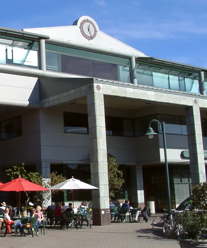
Santa Cruz Avenue is the main street. It runs west from El Camino Real through several blocks of cafes, restaurants, boutiques and banks, with wide sidewalks and outdoor seating. The Caltrain station is about a block east of El Camino, so you can step off the train and be downtown in a couple of minutes. The city describes the district as walkable and the description fits.
- Kepler's Books on El Camino Real has been a center of Peninsula literary life since Roy Kepler opened the first store in 1955. Its nonprofit runs author talks through the year. Our bookstores guide has more.
- The Guild Theatre on El Camino Real opened as a cinema in 1926 and reopened in 2022 as a live music venue. See our live music guide.
- The Civic Center is a short walk from the station. It holds City Hall, the main library, Burgess Park with its playground and field, the Arrillaga Family Gym, a public pool and a duck pond under heritage trees.
- The station itself is worth a look for its 1867 wooden depot on the platform.

Sand Hill Road and the west side
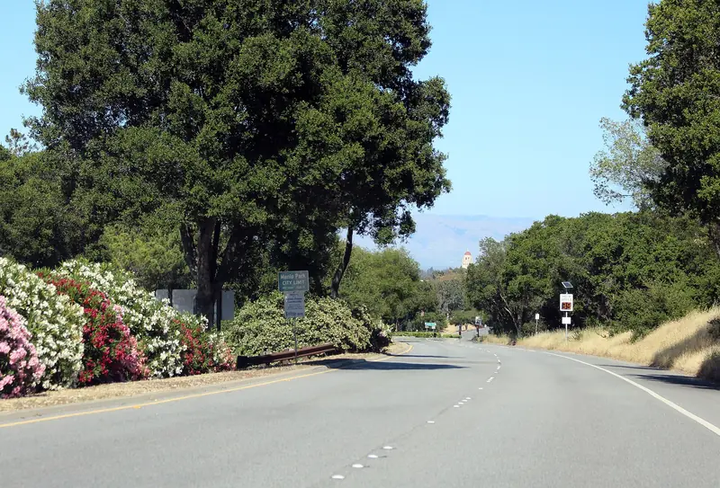
The city's own website calls Menlo Park the Capital of Venture Capital. The reason is the stretch of Sand Hill Road between Interstate 280 and Stanford, where low office buildings house Sequoia, Kleiner Perkins, Andreessen Horowitz and many more. There is nothing to tour, but it is part of Silicon Valley lore. Our Sand Hill Road guide lists the firms and the buildings.
Also on the west side are the Rosewood Sand Hill resort and SLAC National Accelerator Laboratory, a Stanford-run Department of Energy lab at 2575 Sand Hill Road. SLAC offers free public tours a couple of times a month. Our research labs page explains how to book one.

Parks and the bayfront
Bedwell Bayfront Park, at the end of Marsh Road, is the city's largest park. The city describes it as 160 acres of hiking trails, meadows, wildlife viewing and picnic areas along the bay, built on a former landfill. It connects to the San Francisco Bay Trail, which runs south through East Palo Alto to Palo Alto.
Flood Park, at 215 Bay Road, is a 21-acre San Mateo County park known for its old oaks and bay trees. The county reopened the first phase of a major makeover in June 2025 with new picnic sites, sports courts and a bike pump track. A new inclusive playground followed, with a ribbon cutting set for November 10, 2026. Check the county's Flood Park page before you go.
Getting there from Palo Alto
- Caltrain: Menlo Park is the next stop north of Palo Alto and the ride takes a few minutes. Both stations are in the same fare zone. Check the Caltrain timetable, since not every train stops at Menlo Park.
- Bus: SamTrans buses on El Camino Real link the Palo Alto Transit Center with downtown Menlo Park and continue north toward Redwood City.
- Car: El Camino Real gets you downtown in about five to ten minutes outside rush hour. Downtown has public parking lots behind the Santa Cruz Avenue storefronts. Sand Hill Road is the route to the west side.
- Bike: Downtown Menlo Park is an easy flat ride from downtown Palo Alto. The bayfront is reached on the Bay Trail.
Where to eat and stay
Downtown has the densest choice of restaurants, from casual cafes to places listed in the MICHELIN Guide. Yeobo, Darling, a contemporary Korean restaurant at 827 Santa Cruz Avenue, is listed in the guide. Madera at Rosewood Sand Hill is the classic choice for investor dinners. For a casual meal, walk Santa Cruz Avenue and its side streets and see what looks good. Our fine dining guide keeps that list current.
Menlo Park has a good range of hotels close to Stanford. The city's visitor page lists the Stanford Park Hotel, Park James, Rosewood Sand Hill, Hotel Nia, citizenM, Hotel Lucent, a Residence Inn, the Best Western Plus Riviera and The Cottages Hotel. Rates usually track Palo Alto's rather than undercutting them. Our page on staying in Menlo Park or Mountain View explains which ones sit near the train. You can also compare Menlo Park hotels in one search.
Living in Menlo Park
Menlo Park is mostly residential, with a mix of single-family neighborhoods, apartments near downtown and El Camino Real and newer housing on the bay side. A few points come up often for people considering a move:
- Schools: Elementary district lines split the city. Central Menlo Park is in the Menlo Park City School District, the Belle Haven area is in the Ravenswood City School District and the Sharon Heights area is in the Las Lomitas district. High school students are in the Sequoia Union High School District, mainly at Menlo-Atherton High School.
- Government: A five-member City Council is elected by district. The mayor rotates annually.
- Libraries: The main library at the Civic Center and a branch in Belle Haven.
- Employers: The city lists Meta, Snowflake, SRI International, Pacific Biosciences, Exponent and Grail among its major employers.
- Utilities: PG&E provides power and gas, unlike Palo Alto's city-run utility.
Commuting to Stanford or downtown Palo Alto is short by bike or train. For a closer look at the university next door, see our Stanford visitor guide.
Good to know
- Menlo Park and Palo Alto share a Caltrain fare zone, so the hop between them is inexpensive.
- West Menlo Park, along Alameda de las Pulgas, is unincorporated county land and not part of the city.
- Downtown parking lots are public but time limits apply. Read the signs.
- Sand Hill Road has fast traffic and few sidewalks. Do not plan to stroll along it.
Frequently asked questions
Is Menlo Park part of Palo Alto?
No. Menlo Park is a separate city in San Mateo County. It sits directly north of Palo Alto across San Francisquito Creek, which is also the county line. The two downtowns are roughly a mile and a half apart and one Caltrain stop apart.
Is Sand Hill Road in Menlo Park or Palo Alto?
Both, in part. Sand Hill Road starts at El Camino Real by Stanford Shopping Center in Palo Alto and runs west across Stanford land. The stretch lined with venture capital offices, Rosewood Sand Hill and SLAC carries Menlo Park addresses.
What is Menlo Park known for?
Menlo Park calls itself the Capital of Venture Capital because of the firms on Sand Hill Road. It is also home to Meta's headquarters and SRI International. Google started in a rented garage in Menlo Park in 1998 and its train station is the oldest in continuous operation in California.
How did Menlo Park get its name?
In 1854 two Irish settlers, Dennis J. Oliver and D. C. McGlynn, put up a wooden gate on their land with the words Menlo Park. They named the estate after Menlough in County Galway. The railroad later named its station after the gate and the town took the name.
Is Menlo Park, California related to Menlo Park, New Jersey?
Indirectly. Menlo Park, New Jersey, where Thomas Edison built his laboratory, is commonly said to have been named after the California town. The California name came first, from the 1854 gate.