On this page
Redwood City is the government center of San Mateo County and the busiest downtown between Palo Alto and San Mateo. With about 84,000 residents it is larger than Palo Alto. Its downtown packs a historic courthouse, a restored movie palace, a multiplex, dozens of restaurants and a growing number of apartment buildings into a few blocks around the Caltrain station.
From Palo Alto it is an easy train ride north, which makes it a good evening out or a cheaper base for a longer stay. This guide covers the city's history, its downtown and parks, how to get there and what daily life is like.
Where Redwood City is
Redwood City lies on the Peninsula between San Carlos to the northwest and Atherton to the southeast, with Woodside in the hills to the southwest. It stretches from the bay, where it includes the planned community of Redwood Shores and the marshes of Bair Island, up to the foothills. Highway 101, El Camino Real and Woodside Road are its main roads. Downtown sits between El Camino Real and Highway 101, about 7 miles north of downtown Palo Alto.
Several nearby areas use Redwood City addresses but are unincorporated county land, including North Fair Oaks and Emerald Hills. Redwood Shores is part of the city, though you cannot drive there from downtown without passing through a neighboring city.
A short history
A lumber port on Redwood Creek
Ohlone people lived here for thousands of years. Under Spain and Mexico the land was part of Rancho de las Pulgas, held by the Argüello family. After California joined the United States, the family's lawyer, Simon Mezes, secured part of the land and in 1854 laid out a settlement on Redwood Creek called Mezesville. The name did not stick. The creek's embarcadero was where redwood lumber cut in the Woodside hills was hauled down by ox team and floated to San Francisco. The town took its name from that trade.
County seat and city
When San Mateo County was formed in 1856, the town became its county seat. It still is. Redwood City incorporated in 1867, the first city in the county to do so. The current courthouse, with its glass dome, was completed in 1910.
Chrysanthemums and a slogan
In the early 1900s Japanese immigrant growers made Redwood City a center of flower farming, especially chrysanthemums. The incarceration of Japanese Americans during World War II helped end that era. In 1925 a local newspaper contest produced the slogan "Climate Best by Government Test," based on a climate survey from before World War I. It still appears on arches across Broadway. The city now cites about 255 sunny days a year.
Technology
Redwood City became a technology hub in its own right. NeXT, Steve Jobs's company, was based here before Apple bought it in 1997. Oracle and Electronic Arts built large campuses in Redwood Shores. Today many startups and software firms have offices downtown. For the bigger picture, see our Silicon Valley history.
Downtown and Courthouse Square
Broadway is downtown's main street, crossed by the slogan arches at either end. The heart of it is Courthouse Square, the plaza in front of the 1910 courthouse. The city removed a 1930s addition that had hidden the old building and replaced it with an open square flanked by fountains. The square often hosts community events. In the evening the courthouse dome glows with changing colored light.
- San Mateo County History Museum: Inside the old courthouse at 2200 Broadway. Its website lists hours of Tuesday to Sunday, 10 a.m. to 4 p.m. The same historical association runs the Woodside Store and the Sánchez Adobe.
- Fox Theatre: A historic theater at 2221 Broadway that books concerts, comedy, musicals and touring shows.
- Movies: A 20-screen multiplex opened downtown in 2006 with shops and restaurants at street level.
- Library: The downtown Redwood City Public Library, with branches in Redwood Shores and the Schaberg neighborhood.
Downtown has become one of the Peninsula's livelier places on a weekend night. Bars, beer halls and restaurants keep it busy after dark in a way that Palo Alto's downtown is not. Our bars, wine and beer guide lists breweries in the area.
Parks and the bay
- Edgewood Park and Natural Preserve: A 467-acre San Mateo County park off Edgewood Road near Interstate 280. Its serpentine grasslands are famous for spring wildflowers. Our hiking guide covers when to go.
- Stulsaft Park: A wooded city park at 3737 Farm Hill Boulevard established in 1951, popular with families.
- Bair Island and the bayfront: Restored marshes on the bay side of Highway 101 that are part of the Don Edwards San Francisco Bay National Wildlife Refuge, with walking paths and birdwatching.
- The Port of Redwood City: The city says it is the only deepwater port in the south bay. Cargo ships still dock there.

Getting there from Palo Alto
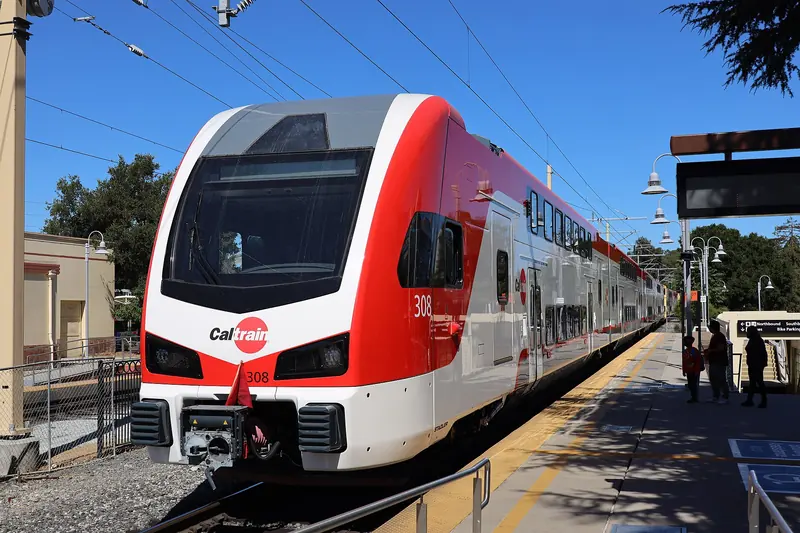
- Caltrain: The easiest way. Redwood City's station is downtown, a short walk from Courthouse Square. Many trains stop there, including express trains. Redwood City is one fare zone north of Palo Alto. See our Caltrain guide and check the Caltrain timetable.
- Bus: SamTrans buses run up El Camino Real from the Palo Alto Transit Center through Menlo Park and Atherton to Redwood City.
- Car: El Camino Real or Highway 101, about 15 to 20 minutes outside rush hour. Downtown has public garages.
- Bike: El Camino Real is busy. Experienced riders often prefer Middlefield Road or Alameda de las Pulgas through Menlo Park and Atherton.
Where to eat and stay
Downtown has the widest choice. Angelicas at 863 Main Street serves Latin American food. Gourmet Haus Staudt at 2615 Broadway is a German beer hall and deli. Freewheel Brewing on Florence Street pours its own beer. We confirmed all three are operating. The streets around Broadway and Main have many more choices, from taquerias to sushi.
For outdoor gear, Sports Basement has a large store at 202 Walnut Street, as our bike and outdoor gear guide notes.
Redwood City has many more hotel rooms than Palo Alto and rates are often lower, which makes it a sensible base if you do not mind a short train ride. Our budget stays guide explains how to use nearby cities to save money. You can also compare Redwood City hotels near the train station.
Living in Redwood City
- Housing: A mix of older single-family neighborhoods, newer downtown apartments and condos and waterfront homes in Redwood Shores. The city says it was the first in San Mateo County to have a state-approved housing plan in the current cycle and has received the state's Prohousing designation.
- Schools: Most of the city is in the Redwood City School District. Redwood Shores is served by the Belmont Redwood Shores School District. High schools are in the Sequoia Union High School District, including Sequoia High School. Cañada College, a community college, is in the hills on the west side.
- Government: As the county seat, Redwood City is home to the county courts and many county offices.
- Commuting: The downtown station and Highway 101 make commutes to Palo Alto, Stanford and San Francisco practical without a car for many people.
- Events: Redwood City has held a large Fourth of July parade for decades, organized by a local nonprofit.
Good to know
- Redwood City is one Caltrain fare zone north of Palo Alto, so the fare is a little higher than a hop to Menlo Park.
- North Fair Oaks and Emerald Hills have Redwood City addresses but are governed by San Mateo County.
- Edgewood Park's wildflowers peak in spring. Stay on the trails, since the serpentine grassland is fragile.
- Check the Fox Theatre's calendar before an evening visit. Big shows fill downtown parking garages.
Frequently asked questions
How far is Redwood City from Palo Alto?
Downtown Redwood City is about 7 miles north of downtown Palo Alto. The drive takes 15 to 20 minutes outside rush hour on El Camino Real or Highway 101. Caltrain connects the two downtowns with one stop, Menlo Park, in between. The old Atherton station closed in 2020.
What does Climate Best by Government Test mean?
It is Redwood City's slogan, chosen in a 1925 newspaper contest. It refers to a climate survey from before World War I that ranked the area among the best climates in the world. The words appear on arches across Broadway at the edges of downtown.
Is the San Mateo County History Museum worth a visit?
Yes, especially for its setting. The museum occupies the 1910 county courthouse at 2200 Broadway, topped by a glass dome that is lit at night. Its website lists hours of Tuesday to Sunday, 10 a.m. to 4 p.m., with the museum closed on Mondays.
Why is it called Redwood City?
The city grew up around an embarcadero on Redwood Creek where redwood lumber cut in the Woodside hills was loaded onto boats for San Francisco. The Port of Redwood City is still the only deepwater port on the south part of San Francisco Bay, according to the city.
Is Redwood City cheaper than Palo Alto?
Housing and hotels in Redwood City generally cost less than in Palo Alto, though both are expensive by national standards. Redwood City has far more apartments, many of them built downtown near the train station.