On this page
Belmont is the kind of Peninsula city most people know only as a Caltrain stop or a Highway 101 exit sign. It has about 28,000 residents, a downtown that is more crossroads than main street and a lot of green hills. It also has real history: a 19th century mansion that is a National Historic Landmark, a park that began as a Victorian beer garden and a city government that celebrated its 100th birthday this October.
For visitors from Palo Alto, Belmont is a slow afternoon rather than a full day. Pair it with San Carlos or San Mateo, both a few minutes away, for lunch and a museum. This guide covers how to get there, what Belmont is known for, its main areas and what is on.
Where Belmont is and how far
Belmont is in San Mateo County, between San Carlos to the south and San Mateo to the north. Its eastern edge reaches the bay at Belmont Slough beside Redwood Shores. Its western half climbs into the hills toward Interstate 280. Ralston Avenue is the main east to west road, crossing Highway 101, El Camino Real and Alameda de las Pulgas.
From downtown Palo Alto it is about 12 miles. Allow 20 to 25 minutes by car outside rush hour.
Getting there from Palo Alto
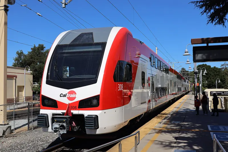
- Caltrain: Belmont station is near the corner of Ralston Avenue and El Camino Real, a short walk from Twin Pines Park. Caltrain's fare table puts Belmont in zone 2, so it is a two-zone fare from Palo Alto: $6.25 in October 2026 and $6.50 from January 1, 2027. Check which trains stop there in the timetable and see our Caltrain guide.
- Car: Take Highway 101 to Ralston Avenue, or Interstate 280 to Ralston Avenue for the hills. El Camino Real is slower but direct.
- Bus: SamTrans runs along El Camino Real from the Palo Alto Transit Center. VTA does not serve Belmont.
What Belmont is known for
A beer garden and a mansion
Like its neighbors, Belmont was once part of Rancho de las Pulgas. When the railroad reached the Peninsula in the 1860s, Carl Janke opened Belmont Park, a German-style beer garden and picnic ground on the site of today's Twin Pines Park. It drew large crowds from San Francisco until it declined late in the century and was broken up.
Around the same time, the banker William Chapman Ralston, founder of the Bank of California, bought a villa built by Count Leonetto Cipriani and expanded it into a grand country house, finished in 1867. Ralston Hall was designated a National Historic Landmark on November 13, 1966. The Sisters of Notre Dame de Namur bought the estate in 1922 and it sits on the Notre Dame de Namur University campus.
A small city in the hills
Belmont incorporated on October 29, 1926. After World War II, hillside subdivisions spread west and the city took the suburban shape it has today. The name is generally believed to come from the Italian bel monte, beautiful mountain, a fair description of the view from the ridges.
Today Belmont is known locally for its schools, its quiet streets and its open space. Carlmont High School, in the Sequoia Union High School District, is the city's public high school.
The main areas
Ralston Avenue and El Camino Real
The closest thing Belmont has to a downtown is the area around Ralston Avenue and El Camino Real, with the train station, Twin Pines Park, city offices and a cluster of restaurants and shops. It is spread out rather than a walkable main street.
The Notre Dame de Namur campus
West of El Camino Real on Ralston Avenue, the university campus holds Ralston Hall and Notre Dame High School. The mansion's ornate interiors were once open for public tours. Wikipedia reports that it closed in April 2012 pending renovation and that work was put on hold in February 2019 to focus on fundraising. Treat it as a building to see from outside unless open hours are announced.
The campus itself has changed hands. Notre Dame de Namur University sold it, including Ralston Hall, to UC Investments. The sale was completed on September 29, 2025. The university may stay on the campus for up to five years. It continues as a graduate and degree-completion university. Our Notre Dame de Namur University guide covers its programs and status.
The hills and Carlmont
Farther west, Ralston Avenue climbs into the hills past the Carlmont area to Interstate 280. This is where the views and the trails are.
The bay side
East of Highway 101 the city reaches the marshes of Belmont Slough, which divide Belmont from Redwood Shores.
Parks and trails
- Twin Pines Park: A 10-acre city park on Ralston Avenue a few blocks west of El Camino Real. Voters approved buying the land in 1972, when it was the site of the Twin Pines Sanitarium. A creek runs through it under tall trees. It has the Belmont Historical Society's museum, lawns for picnics and a stage used for summer concerts.
- Waterdog Lake Open Space: The best-known natural area in Belmont, in the western hills. Trails pass a small lake and climb through oak woodland. It is a good short hike when you want hills without driving to the coast. Our hiking guide covers longer options.
- Neighborhood parks: The city runs several smaller parks with playgrounds and sports fields across the hills.

Shopping and food
Belmont is a residential city, so shopping is mostly everyday: grocery stores, pharmacies and neighborhood centers along El Camino Real and Ralston Avenue. Restaurants are scattered along El Camino Real, with Italian, Mexican, Japanese, Chinese and American places. Iberia, a Spanish restaurant that has served the Peninsula since 1984, is now in Belmont. Our Spanish food and tapas guide has more.
For a walkable dining street, most visitors go a few minutes south to Laurel Street in San Carlos or north to downtown San Mateo. Most visitors stay in Redwood City or San Mateo, which have more hotel choice. To stay nearby, compare hotels in San Mateo and Belmont.
Events
Belmont celebrated its centennial through 2026. The city published these centennial events:
- Centennial Historic Walking Tour: Sunday, October 18, 2026, a free guided walk led by a volunteer historian from the Twin Pines Senior Center to the train station.
- Centennial Fest: Saturday, October 24, 2026, with a vintage car parade from Chula Vista Drive and Alameda de las Pulgas to a car show near Sixth Avenue and Ralston Avenue, a time capsule ceremony at the Twin Pines Senior and Community Center, a festival in Twin Pines Park and an evening drone show with art by Belmont youth.
- 100 Community Celebrations: The city invited residents to host gatherings through the year and count them toward 100.
Outside the centennial, Twin Pines Park hosts summer concerts and the historical society holds programs at its museum. Check the City of Belmont website for current dates.
Why a Palo Alto visitor might go
- A short hike with views. Waterdog Lake is close to the freeway and rarely crowded.
- Local history. Twin Pines Park, its museum and Ralston Hall tell the story of the Peninsula's railroad era. Our railroad history page covers the Palo Alto side.
- A quiet stop between bigger towns. Belmont fits neatly between San Carlos and San Mateo.
- Summer concerts. Free concerts in Twin Pines Park are a local tradition.
Good to know
- Belmont is a two-zone Caltrain fare from Palo Alto.
- Ralston Hall is on a private campus. Respect posted signs and do not enter buildings without permission.
- Hill streets in Belmont are steep and narrow. Park carefully and curb your wheels.
- Waterdog Lake trails can be muddy after rain. Wear shoes with grip.
Frequently asked questions
How far is Belmont from Palo Alto?
Belmont is about 12 miles north of downtown Palo Alto, roughly 20 to 25 minutes by car outside rush hour on Highway 101 or El Camino Real. Caltrain stops at Belmont station, which is a two-zone fare from Palo Alto.
Can you tour Ralston Hall?
Ralston Hall is a National Historic Landmark on the Notre Dame de Namur University campus, which the university sold to UC Investments in a sale completed September 29, 2025. It used to offer public tours, but Wikipedia reports it closed in April 2012 for renovation and that the work was put on hold in 2019. It is not a regular visitor attraction, so check for announced open hours before planning a visit.
What is Twin Pines Park?
Twin Pines Park is a 10-acre city park on Ralston Avenue a few blocks west of El Camino Real. It sits on the site of a 19th century picnic ground and a later sanitarium. A creek runs through it under tall trees. The Belmont Historical Society runs a museum in the park and summer concerts are held there.
When did Belmont celebrate its centennial?
Belmont incorporated on October 29, 1926, so it turned 100 in October 2026. The city held a Centennial Fest in Twin Pines Park on October 24, 2026, with a vintage car parade, a time capsule ceremony and a drone show, plus a historic walking tour on October 18.
Where does the name Belmont come from?
The name is generally believed to come from the Italian bel monte, meaning beautiful mountain. The area was part of Rancho de las Pulgas before the American era.