On this page
Ask a Palo Alto hiker where they go on a Saturday morning and Rancho San Antonio comes up more than anywhere else. It is close, it has trails for every fitness level and it hides a working farm a mile from the parking lot. That popularity is also its main problem. The lots fill early and the main trails can feel crowded on a sunny weekend.
This guide covers the park in more depth than our Los Altos and Los Altos Hills town pages. It explains how the two parks fit together, the main trails, how parking works and the rules that catch first-time visitors out.
Two parks under one name
Rancho San Antonio is really two public lands joined at the hip. The county park near the entrance has the parking lots, restrooms, lawns and flat paths. The open space preserve beyond it climbs west into the foothills toward Black Mountain. According to the Midpeninsula Regional Open Space District, the preserve covers 2,180 acres and the county park 293 acres, with more than 25 miles of trail between them.
Midpen manages both. It runs the county park under an operations and management agreement with Santa Clara County Parks. The land lies on the edge of Cupertino, Los Altos and Los Altos Hills, which is why addresses and maps label it differently. The preserve also borders Hidden Villa to the north and Monte Bello Preserve on the ridge above.
The park is free and open from half an hour before sunrise until half an hour after sunset.
Main trails
Midpen highlights four routes on its preserve page. Distances below are Midpen's figures.
| Trail | Length | What to expect |
|---|---|---|
| Wildcat Loop Trail | About 3 miles (loop) | Creek, a cool fern-walled canyon, chaparral, meadows on the middle ridge, back to Deer Hollow Farm |
| Stephen E. Abbors Trail (the old PG&E Trail) | 3.7 miles, 1,600 feet of gain | A steady climb under the power line towers toward Black Mountain with wide views |
| Chamise Trail | 2.1 miles | A gradual climb to a quiet meadow in the north of the preserve, next to Hidden Villa, once home to a ranch windmill |
| Black Mountain Trail | About 4 miles | Chaparral, grassland and oak woodland to the top of 2,800-foot Black Mountain and Monte Bello Preserve |
Wildcat Loop
This is the classic first visit. The trail leaves the farm road near Deer Hollow Farm and heads into Wildcat Canyon, which stays shady and cool even in summer. It then climbs onto open ridges where Midpen says lupine, poppies and blue-eyed grass bloom in spring. On a clear day you can see Mount Tamalpais to the north and Mount Hamilton to the east. Combined with the walk in from the parking lots, it makes a satisfying half-day loop.
The PG&E Trail
Local hikers have long called the steep route up the power line corridor the PG&E Trail. Midpen's preserve page now lists it as the Stephen E. Abbors Trail, so look for that name on new signs and maps. It is the hard workout of the park: 3.7 miles and 1,600 feet of climbing with little shade. Midpen suggests combining it with the Wildcat Canyon or Upper High Meadow trails for a longer loop. Start early in summer and carry plenty of water.
Black Mountain
For a full-day hike, continue to the summit of Black Mountain. From the top, Midpen says you can look west into Stevens Creek Canyon and across the Santa Clara Valley. This is a long outing with a big climb, so plan on most of a day.
Our guide to the best hikes near Palo Alto compares these routes with Windy Hill, Foothills Nature Preserve and others.
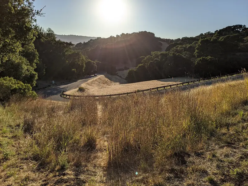

Deer Hollow Farm
About a mile in from the parking lots sits Deer Hollow Farm, a working farm with turn-of-the-century ranch buildings, an organic garden and animals including a cow, pigs, goats, sheep and chickens. Midpen also points to the restored Grant Cabin, furnished to show life in the late 1800s. The farm road from the county park to the farm is wide and gentle, which makes it a good walk with young children. See our full Deer Hollow Farm guide for visiting details.
Parking and how to avoid the crush
Parking is the single biggest planning issue here. Midpen's Rancho San Antonio parking page opens with a warning that the preserve is very crowded and suggests nearby Picchetti Ranch and Fremont Older preserves as alternatives. A few tools help:
- Check live counts. An electronic sign at the entrance gate shows available spaces in Lot 1 and in Lots 2 to 6. The same numbers appear on the parking page, so check before you leave home.
- Know the layout. There are several lots, including one for horse trailers. Midpen says the preserve trailhead is next to the 85-car lot in the northwest corner.
- Ride instead. Silicon Valley Hopper, an on-demand shared ride service, serves the park from Cupertino and from the Mountain View, Sunnyvale and Santa Clara Caltrain stations.
- Bike in. Midpen maps a bicycle-friendly entrance away from the main gate and has installed bike racks at several trailheads.
- Mind the speed bumps. Sensors and speed bumps just inside the entrance count cars. The road speed limit is 15 mph.
Midpen ran a one-year carpool parking pilot and has since suspended all carpool requirements while it studies long-term options. Carpooling is still encouraged.
Rules to know before you go
Rancho San Antonio follows Midpen's preserve rules. The ones that matter most to visitors:
- No dogs. Dogs are not allowed in this preserve. Service animals are accommodated. Try our dog-friendly places guide instead.
- Bikes on designated trails only. No bikes west of Deer Hollow Farm. Helmets are required. The trail speed limit is 15 mph and 5 mph when passing. Class 1 and Class 2 e-bikes are allowed only on a limited set of improved trails.
- Horses are allowed on designated trails. Everyone yields to equestrians.
- Model aircraft may fly only in the designated area of the county park near the entrance. Gas-powered models, rockets and drones are not allowed.
- No fires, smoking or weapons. Swimming and wading are prohibited.
- Pack it out. Most preserves have no trash cans.
- Groups of 20 or more need a general access permit from Midpen.
Safety, water and wildlife
Midpen recommends two quarts of water per person for every two hours of hiking, since drinking water is not available on most of its land. Cell service is patchy. Rattlesnakes are active in warm weather, poison oak grows along many trails and ticks are common. Mountain lions live in these hills and are occasionally seen. Midpen has also reported coyotes in the preserve and asks visitors not to leave children unattended. If you meet an aggressive coyote, back away slowly without turning your back.
Wildlife is a big part of the appeal. Deer graze in the meadows, wild turkeys strut along the trails and hawks circle overhead. Spring brings the best wildflowers. For emergencies call 911. Midpen's main office line for other issues is 650-691-1200.
A short history
Midpen says the Ohlone lived in the Rancho San Antonio area for more than 3,000 years before Europeans arrived, with a large village known as Partacsi nearby. The Anza expedition passed through in March 1776. In 1839 Governor Alvarado granted Rancho San Antonio to Juan Prado Mesa, a soldier at the San Francisco Presidio. Our page on the Spanish and Mexican era explains how the rancho system worked.
William Dana bought the rancho in 1853. In 1861 John and Martha Snyder bought 850 acres on Permanente Creek and grew grain, grapes and fruit. The Catholic Church bought the Snyder Ranch in 1923 and built St. Joseph's Seminary and the Maryknoll Seminary in 1926. St. Joseph's was badly damaged in the 1989 earthquake and later demolished. Santa Clara County bought 130 acres from the seminary in 1977 and 35 more in 1981, then built the county park in the early 1980s.
Getting there from Palo Alto
From Palo Alto, take Interstate 280 south and exit at Foothill Boulevard. Go south about 0.2 mile and turn right on Cristo Rey Drive. Continue about a mile, keep right around the traffic circle and turn left into the county park entrance. Without traffic the drive takes about 15 to 20 minutes. If you are visiting from out of town without a car, you can compare rental cars, though the Hopper ride service is worth a look first.
Good to know
- Arrive as early as you can on weekend mornings, or come on a weekday.
- Check openspace.org/rsa-parking for live space counts before you leave home.
- Leave the dog at home and bring more water than you think you need.
- Midpen docents lead guided outings here, such as a Black Mountain ramble and a Turkey Trot explorer hike. Check Midpen's activity calendar. Our nature programs guide has more.
Frequently asked questions
What time does Rancho San Antonio parking fill up?
Midpen does not publish a fixed time, but its parking page warns that the preserve is very crowded and the lots fill at busy times, especially weekend mornings. A sign at the entrance gate and the page at openspace.org/rsa-parking show live space counts. Come early, come on a weekday or ride in.
Is the PG&E Trail the same as the Stephen E. Abbors Trail?
Yes, as far as we can tell. Midpen's preserve page now describes the steep climb that follows the electrical towers up Black Mountain as the Stephen E. Abbors Trail: 3.7 miles with 1,600 feet of gain. Many hikers and older maps still call it the PG&E Trail.
Are dogs allowed at Rancho San Antonio?
No. Midpen does not allow dogs in Rancho San Antonio Preserve. Service animals are accommodated under the Americans with Disabilities Act. Our dog parks guide lists nearby places that welcome dogs.
How long is the Wildcat Loop at Rancho San Antonio?
Midpen describes the Wildcat Loop as about three miles. It follows a creek into a shady, fern-lined canyon, climbs through chaparral to meadows on the middle ridge and loops back to Deer Hollow Farm. The walk from the parking lots to the farm adds distance.
Can you bike at Rancho San Antonio?
Only on designated trails. Bikes are not allowed west of Deer Hollow Farm, helmets are required and the speed limit is 15 mph, or 5 mph when passing. Class 1 and Class 2 e-bikes may use a limited set of improved trails.