On this page
Woodside and Atherton are often mentioned in the same breath because both are small, wealthy and residential. On the ground they could hardly be more different. Woodside climbs into the Santa Cruz Mountains, with redwood canyons, horse trails and a tiny village center at a crossroads. Atherton spreads across the flat valley floor between Menlo Park and Redwood City, with big lots behind tall hedges and not a single shopping street.
Both are close to Palo Alto. Atherton is about ten minutes north up El Camino Real. Woodside is roughly 20 minutes northwest by Interstate 280 or Sand Hill Road. This guide covers each town in turn: where it is, its history, what visitors can do and what living there is like.
Woodside at a glance
Woodside is a town of about 5,300 people in San Mateo County. It sits on the eastern slopes of the Santa Cruz Mountains, with its southwestern edge reaching Skyline Boulevard. Redwood City, Atherton and Menlo Park lie between it and the bay. Portola Valley borders it to the south. The village center, around Woodside Road and Cañada Road, holds Town Hall at 2955 Woodside Road, a few restaurants and shops and a cluster of historic buildings.
Woodside history
Loggers and sawmills
The town's history page says Woodside was home to Ohlone people before Europeans arrived and that the Portolá expedition camped nearby in 1769. It was also one of the first places on the Peninsula settled by English speakers. In the 1830s a fur trader known as Bill the Sawyer made his home here. Charles Brown built the first sawmill on his Mountain Home Ranch. His adobe house of 1839 still stands. John Coppinger, a former British naval officer, received the Rancho Cañada de Raymundo and built the first wooden house in 1841 at Kings Mountain and Woodside roads.
The redwoods drew a rush of loggers. In 1849 Dr. Robert Orville Tripp, a dentist, arrived to recover from an illness and stayed. With M. A. Parkhurst he cut a road from the forests down to the tidewater on Redwood Creek, now downtown Redwood City, where lumber was rafted to San Francisco. By 1855 there were at least eight sawmills. Tripp and Parkhurst also opened the Woodside Store, which Tripp ran with a post office until his death in 1909.
Estates and incorporation
As the forests were cut, farms, cattle ranches and vineyards replaced the mills. From the 1880s San Francisco families built country estates, the grandest of which became Filoli. After World War II new subdivisions arrived. Worried about losing the town's rural character, residents voted 646 to 574 on October 20, 1956 to incorporate. Woodside became a town on November 16, 1956, with road maintenance, planning and zoning under local control.
Things to see and do in Woodside
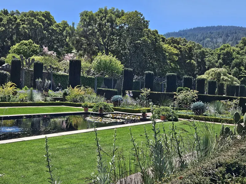
- Filoli: The 1917 Georgian Revival house and 16 acres of formal gardens, run by the National Trust for Historic Preservation, sit just north of the village along Cañada Road. Our Filoli and Woodside guide covers tickets and seasons.
- The Woodside Store: The 1854 store at Kings Mountain Road and Tripp Road is now a county museum run by the San Mateo County Historical Association. Its website lists Tuesday and Thursday 10 a.m. to 4 p.m. and weekends noon to 4 p.m.
- Woodside Community Museum: Next to Town Hall at 2961 Woodside Road, with exhibits on local history. The restored 1884 Independence Hall also stands beside Town Hall.
- Huddart Park: A San Mateo County park on Kings Mountain Road about 3.5 miles west of Highway 84, with cool redwood canyons, picnic areas, a playground and trails. A vehicle entry fee applies.
- Wunderlich Park: A county park of redwoods, meadows and oaks with trails shared by hikers and riders. The restored Folger estate stable stands near the entrance.
- Midpen preserves: Thornewood, a 167-acre preserve above town, has easy walks. El Corte de Madera Creek Preserve on Skyline Boulevard covers 2,908 acres with more than 34 miles of trail and is popular with mountain bikers.
- Horses and events: The town lists The Horse Park at Woodside and the Kings Mountain Art Fair among its things to do.
For the best of the big trees nearby, see our redwood forests guide.

Atherton at a glance
Atherton is a town of about 7,200 people in San Mateo County, between Menlo Park to the south and Redwood City to the north, with El Camino Real and Middlefield Road running through it. It has no commercial zoning, so there are no shopping streets. Its tree-lined roads, many without sidewalks, pass large homes behind gates and hedges, along with private schools and a single town park. Town Hall is at 80 Fair Oaks Lane.
Atherton history
The land was once part of Rancho de las Pulgas. In the 1860s the area was known as Fair Oaks. Wealthy San Franciscans built country estates here near the railroad. One was Faxon Dean Atherton, a merchant who had made his fortune in Chile. In 1923 Menlo Park moved to incorporate and wanted to take in Fair Oaks. The property owners chose to form their own town instead. Since the name Fair Oaks was already used elsewhere in California, they named the town for Atherton. It incorporated on September 12, 1923.
Atherton grew into one of the country's most expensive places to live. Its ZIP code, 94027, regularly appears at or near the top of national lists of the costliest ZIP codes. The town had a Caltrain station for many years, but service there ended in 2020.
Things to see in Atherton
For visitors, Atherton's main public attraction is Holbrook-Palmer Park at 150 Watkins Avenue, a 22-acre former country estate donated to the town in 1958. It has gardens, walking paths, tennis courts, a Little League field and historic buildings that can be rented for events. The town closed the playground for renovation starting in May 2026, so check its page if you are bringing children. Groups of 13 or more need a day-use permit.
Atherton is also home to Menlo College, Menlo School, Sacred Heart Schools and Menlo-Atherton High School. The Atherton Library is part of San Mateo County Libraries. Our private schools guide covers the independent schools that draw families from Palo Alto.
Getting there from Palo Alto
Woodside
Drive north on Interstate 280 to the Woodside Road exit, or take Sand Hill Road west to Portola Road and turn north. Either way it takes about 20 minutes. There is no transit worth planning around. Cyclists ride Sand Hill, Portola and Cañada roads in large numbers on weekends. Our biking guide covers the classic loops.
Atherton
Take El Camino Real or Middlefield Road north through Menlo Park. SamTrans buses run along El Camino Real. By train, get off at Menlo Park or Redwood City and continue by bike or rideshare. See our guides to Menlo Park and Redwood City.
Where to eat and stay
Woodside's village center has a famous pair. Buck's of Woodside at 3062 Woodside Road is a quirky diner known in Silicon Valley lore as a place where founders met investors. The Village Pub at 2967 Woodside Road holds a Michelin star. In Atherton, Selby's on El Camino Real also holds a star. Our fine dining guide covers both starred restaurants.
Neither town has much in the way of hotels. Most visitors stay in Palo Alto, Menlo Park or Redwood City. You can compare hotels near Woodside and Atherton across those cities.
Living in Woodside and Atherton
- Housing: Both towns are almost entirely single-family homes on large lots. Atherton generally requires lots of at least one acre. Both have had to plan for more housing under state law in recent years.
- Schools: Woodside has its own elementary district, with Woodside High School in the Sequoia Union district. Atherton has no school district of its own. Its children attend schools in several neighboring districts, plus Menlo-Atherton High School.
- Services: Woodside handles roads, planning and zoning itself and relies on the Woodside Fire Protection District and the county sheriff. Atherton has its own police department.
- Lifestyle: Woodside residents often keep horses and the town maintains a network of riding trails. Venture firm Benchmark lists an office on Woodside Road, as our Benchmark profile notes.
- Traffic: El Camino Real through Atherton is busy at commute hours. In Woodside, winding roads, cyclists and wildlife call for slow driving.
Good to know
- Filoli is close to Woodside but sits along Cañada Road north of the village. Allow time for both.
- Huddart Park charges a vehicle entry fee. Check the county park page for current fees and closures.
- Atherton streets often lack sidewalks. Walk facing traffic and stay visible.
- Weekend mornings bring hundreds of cyclists to Woodside roads. Pass with plenty of room.
Frequently asked questions
Are Woodside and Atherton the same town?
No. They are separate towns in San Mateo County. Woodside is a rural town in the foothills west of Interstate 280. Atherton is a flat residential town between Menlo Park and Redwood City along El Camino Real. They are about five miles apart.
Are there restaurants in Atherton?
Almost none. Atherton has no commercial zoning, so the town is homes, schools and a town park. Selby's, a Michelin-starred restaurant, uses an Atherton address on El Camino Real at the town's edge. Downtown Menlo Park and Redwood City are a few minutes away.
What is there to do in Woodside?
Visit Filoli's house and gardens, see the 1854 Woodside Store museum, hike under the redwoods at Huddart Park or Wunderlich Park and eat at Buck's or The Village Pub. Road cyclists and horse riders use the town's roads and trails heavily.
When is the Woodside Store open?
The San Mateo County Historical Association lists hours of Tuesday and Thursday from 10 a.m. to 4 p.m. and Saturday and Sunday from noon to 4 p.m. Hours can change, so check the association's website before making a special trip.
Is there a train station in Atherton?
Not anymore. Caltrain closed its Atherton station in 2020. The nearest stations are Menlo Park to the south and Redwood City to the north, both a short drive or bike ride away.