On this page
Pacifica is where the Peninsula meets the open Pacific. The city follows Highway 1 from the cliffs below Daly City to the tunnels at Devil's Slide, with neighborhoods tucked into valleys between green ridges. Surfers come for Linda Mar and hikers for the bluffs at Mori Point and the ridges above town. History buffs come for an 1840s adobe and the spot where Spanish soldiers first laid eyes on San Francisco Bay.
From Palo Alto it is the easiest stretch of coast to reach via Interstate 280, often quicker than Half Moon Bay when Highway 92 is jammed. It is also a working town of nearly 39,000 people, not a resort, which keeps it relaxed. This guide covers getting there, the history, the beaches and the closed pier, the trails, the Sánchez Adobe, weather and why the trip is worth it.
Where Pacifica is and how far
Pacifica is in San Mateo County on the coast between San Francisco and Half Moon Bay. Daly City lies to the north and Montara to the south, beyond Devil's Slide. Sweeney Ridge and the Santa Cruz Mountains separate it from San Bruno and the bay side of the Peninsula.
From downtown Palo Alto the city center is about 30 miles. Outside rush hour the drive takes 35 to 45 minutes. Fog can roll in fast, so drive the coast highway with headlights on.
Getting there from Palo Alto
By car
The quick route is Interstate 280 north to Highway 1, which drops into Pacifica from the north. Sharp Park Road from Skyline Boulevard in San Bruno is a scenic shortcut to the middle of town. A loop also works well: go out via Highway 92 to Half Moon Bay, drive north on Highway 1 through Montara and the Tom Lantos Tunnels at Devil's Slide, then come home on Interstate 280. If you need wheels for the day, you can compare rental cars near Palo Alto.
By transit
It is possible but slow. Take Caltrain north to Millbrae, BART to Daly City, then SamTrans Route 110 to the Linda Mar Park and Ride. SamTrans Route 112 runs between Colma BART and Sharp Park. Route 117 continues south from Linda Mar through Montara, Moss Beach and El Granada to Half Moon Bay. Check the SamTrans schedules page before you go.
History
Before Europeans arrived, two Ohlone villages stood here: Pruristac on San Pedro Creek and Timigtac on Calera Creek, in today's Rockaway Beach neighborhood. Our page on the Ohlone covers the people of the Peninsula.
On November 4, 1769, the Portolá expedition climbed Sweeney Ridge and sighted San Francisco Bay, the first recorded European view of it. From 1786 Mission Dolores ran a farm outpost, San Pedro y San Pablo, in the valley. In 1839 Francisco Sánchez received Rancho San Pedro, whose borders roughly match the modern city. He built his adobe home between 1842 and 1846. In 1908 later owners turned it into the Hotel San Pedro, a stop for tourists on the Ocean Shore Railroad. During Prohibition it became a speakeasy. See our page on the Spanish and Mexican era for the wider story.
The 20th century brought darker chapters. During World War II the Sharp Park Detention Station held Japanese Americans and others classed as enemy aliens. Stanford professor Yamato Ichihashi spent six weeks there. On February 20, 1956, sheriff's deputies raided Hazel's Inn in Sharp Park and arrested about 90 people in an anti-gay crackdown.
Pacifica incorporated on November 22, 1957, joining nine separate communities: Fairmont, Westview, Pacific Manor, Sharp Park, Fairway Park, Vallemar, Rockaway Beach, Linda Mar and Pedro Point. Its first elected mayor, Jean Fassler, was one of the first women mayors in California.
Beaches and the pier
- Pacifica State Beach (Linda Mar): a wide crescent of sand at 5000 Pacific Coast Highway and the town's surf center, with beginner waves on many days. State Parks lists a $9 vehicle day use fee, closes it at sundown and allows dogs. Check the state beach page for current fees.
- Rockaway Beach: a small cove backed by hotels, shops and restaurants, good for a short walk and a meal.
- Sharp Park Beach: a long, steep beach in front of the Beach Boulevard promenade.
The Pacifica Municipal Pier, an L-shaped concrete pier off Sharp Park Beach, has been a favorite for crabbing, salmon fishing and whale watching since the 1970s. On June 4, 2026 the city found cracking and separation near the abutment and closed it. The cafe at its entrance was torn down within days. In late August the city approved a plan to stabilize the structure while it waits for state emergency and insurance funding. Treat the pier as closed and check the city's notices. Our fishing guide lists other spots.
The ocean here is cold and rough. Sneaker waves and rip currents are common, so keep children well back from the water's edge, especially in winter.

Trails and viewpoints
- Devil's Slide Trail: a 1.3-mile paved trail on the old cliffside Highway 1, retired after the tunnels opened in 2013. It has separate lanes for walkers and bikes, benches, viewing scopes, restrooms and big views of the rocks below. San Mateo County Parks recommends SamTrans Route 117 on weekends because the lots fill fast.
- Mori Point: a 110-acre headland in the Golden Gate National Recreation Area with bluff trails and spring wildflowers, best in April and May. It is very windy on top. The final cliff scene of Harold and Maude was filmed here.
- Sweeney Ridge: a climb to the San Francisco Bay Discovery Site, where the Portolá party first saw the bay.
- San Pedro Valley Park: a 1,052-acre county park on the forks of San Pedro Creek, with a visitor center, picnic sites, a seasonal waterfall and steelhead spawning grounds. County parks charge a vehicle day use fee.
Our hiking guide compares these with trails closer to Palo Alto.
The Sánchez Adobe
The Sánchez Adobe on Linda Mar Boulevard is the second oldest building in San Mateo County, according to the San Mateo County Historical Association, which runs it. The five-acre site covers three eras: the Ohlone village of Pruristac, the Spanish mission outpost and the Mexican rancho. Digs in 1978 and 1990 uncovered the outpost's foundations. Start at the interpretive center at the back of the site. The association lists hours of 10 a.m. to 4 p.m. Tuesday through Thursday and noon to 4 p.m. Saturday and Sunday, with free admission and on-site parking. Its Rancho Day Fiesta brings early California music, dance and food.
Golf, theater and food
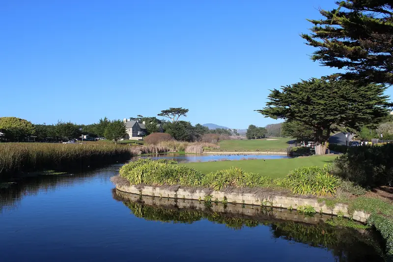
Sharp Park Golf Course, designed by Alister MacKenzie in the early 1930s, sits between Highway 1 and the ocean. Pacifica Spindrift Players stage community theater. Food in Pacifica is casual: fish and chips, taquerias, pizza, cafes and a few sit-down restaurants with ocean views around Rockaway Beach and Linda Mar. For a weekend, families often rent a house; you can browse coastside rentals along Highway 1.
Weather
Pacifica is cool. National Weather Service records give average January temperatures of about 46 to 57°F and average September temperatures of about 54 to 72°F, with September the warmest month. Summer fog often brings drizzle in the mornings. The southeastern valleys such as Park Pacifica are sunnier than the beaches. Our weather guide explains why the coast and Palo Alto differ so much.
Why a Palo Alto visitor might go
- The closest surf beach. Linda Mar is the nearest easy surf to the Peninsula.
- Big views on short walks. Devil's Slide and Mori Point deliver ocean cliffs in under an hour on foot.
- California's beginnings. Sweeney Ridge and the Sánchez Adobe tell the story of 1769 to the rancho era.
- A coast loop. Combine it with Montara and Moss Beach and Half Moon Bay in one drive.
Good to know
- Bring a warm layer and a windbreaker in every season.
- Highway 1 through Pacifica is slow on sunny weekends.
- Do not leave valuables in cars at beach and trailhead lots.
- Check the city's site for pier updates before planning a fishing trip.
Frequently asked questions
Is the Pacifica Pier open?
No. The city closed the pier on June 4, 2026 after cracking and separation appeared near where it meets the beach. The cafe at its entrance was demolished days later. In late August 2026 the city approved a plan to stabilize the structure while it waited on state and insurance funding. There is no reopening date.
How long is the Devil's Slide Trail?
San Mateo County Parks describes it as a 1.3-mile paved trail on a former stretch of Highway 1, with separate lanes for walkers and cyclists, benches, viewing scopes, drinking fountains and restrooms. It is part of the California Coastal Trail. Parking is limited, so the county suggests SamTrans Route 117 on weekends.
Can you surf in Pacifica?
Yes. Pacifica State Beach, also called Linda Mar, is one of the Bay Area's best known beginner surf spots. The water is cold all year, so most surfers wear thick wetsuits. State Parks lists a $9 vehicle day use fee and allows dogs.
How do I get to Pacifica from Palo Alto without a car?
Ride Caltrain to Millbrae, BART to Daly City, then SamTrans Route 110 to the Linda Mar Park and Ride. SamTrans Route 112 links Colma BART with Sharp Park. Expect the trip to take well over an hour each way.
What is the weather like in Pacifica?
Cool and often foggy, especially in summer mornings. Weather service records show September is the warmest month, with average highs near 72°F. January highs are in the mid 50s. Bring layers even when Palo Alto is hot.