On this page
Burlingame sits at the northern end of San Mateo County, right next to San Francisco International Airport. Most travelers see only its bayfront hotels and the view from Highway 101. Inland, though, the city is a calm and leafy place of about 31,000 people with two well-kept shopping streets, a historic train depot and avenues lined with towering eucalyptus.
From Palo Alto it is about 18 miles north. That makes Burlingame a natural first or last night on a trip that starts or ends at SFO and a pleasant afternoon of shopping and lunch if you are already on the Peninsula. This guide covers how to get there, the two main districts, the hotels, events and what else to know.
Where Burlingame is and how far
Burlingame lies between Millbrae and the airport to the north and San Mateo to the south. Hillsborough, a wealthy residential town, rises into the hills to the west. Highway 101 runs along the bay side and El Camino Real and the Caltrain line run through the middle of town.
Downtown Burlingame is about 18 miles from University Avenue. Outside rush hour the drive is about 25 to 30 minutes. The city says the airport is a few miles north of its bayfront hotels.
Getting there from Palo Alto
Caltrain
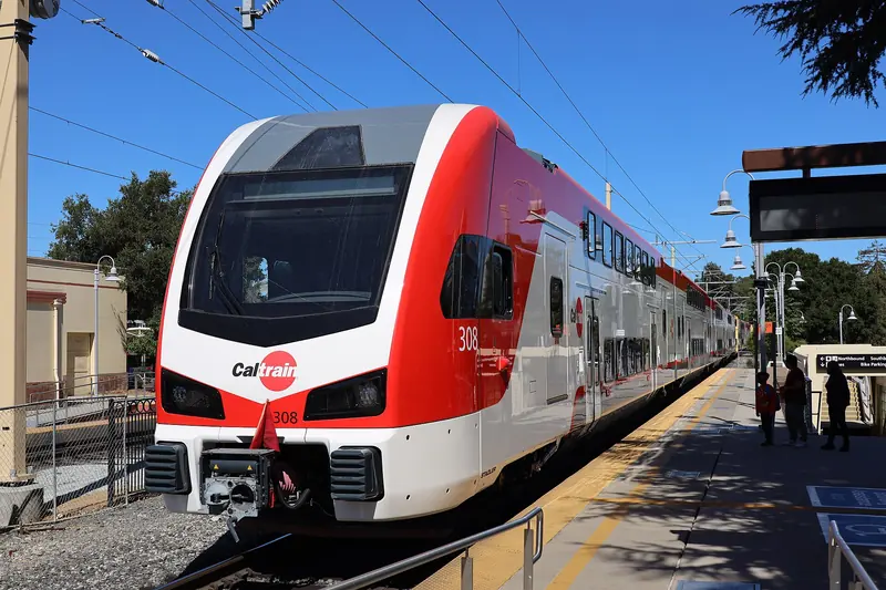
The Burlingame station sits at the foot of Burlingame Avenue, so the shopping district starts at the platform. Caltrain's fare table puts Burlingame in zone 2: from Palo Alto that is a two-zone fare, $6.25 in October 2026 and $6.50 from January 1, 2027. A second station, Broadway, serves the Broadway district, but service there is limited and the station is part of a grade separation project, so check the Caltrain timetable before you count on it. Our Caltrain guide covers tickets.
Car
Highway 101 is the direct route. Use the Broadway exit for the Broadway district and many of the bayfront hotels. El Camino Real is slower but scenic, shaded by old trees for much of its length through town. The city publishes parking maps of free and low-cost lots on its parking page.
Bus and BART
SamTrans buses run along El Camino Real. BART does not stop in Burlingame, but Millbrae station, just to the north, is a transfer point between Caltrain and BART and the easiest rail link to the airport. See our SFO guide for the options.
The Burlingame Trolley
The city says the free Burlingame Trolley links designated bayfront hotels with both shopping districts. It is handy if you are staying near the airport without a car. Check the city's site for the current schedule.
What Burlingame is known for
Before the town existed, William Davis Merry Howard owned the land and planted many of the eucalyptus trees that still define it. The banker William C. Ralston bought the property and in 1868 named it for Anson Burlingame, the American diplomat who negotiated the Burlingame Treaty between the United States and China that same year. A bust of Burlingame was unveiled at the public library in 2018 for the treaty's 150th anniversary.
The town grew slowly as a country retreat for wealthy San Franciscans. After the 1906 earthquake, many city dwellers bought lots and moved south and Burlingame incorporated on June 6, 1908. Its first board passed an ordinance protecting trees that same year. It annexed the neighboring community of Easton in 1910. Today the city calls itself the City of Trees and counts more than 18,000 public trees.
The Burlingame Caltrain depot is listed on the National Register of Historic Places and is still in use. Fans of quirky museums should know that the Burlingame Museum of Pez Memorabilia closed in July 2019.
The main areas
Burlingame Avenue
Burlingame Avenue runs from California Drive by the station up to El Camino Real. The city calls it the liveliest area in town, with hundreds of stores and restaurants. It mixes independent boutiques with national chains and designer brands and the side streets between Howard and Chapin Avenues hold more shops. The street is easy to walk end to end. The downtown business district keeps a directory of current shops.
Broadway
About a mile north, Broadway runs between California Drive and El Camino Real. The city describes it as a quieter shopping street with a 1950s feel, lined with family-owned shops and restaurants. It has its own merchant site and a printed directory and map on the city website.
The bayfront
East of Highway 101, along Old Bayshore Highway and Airport Boulevard, is the hotel district. The city counts twelve major hotels here. The shoreline path has views of planes approaching SFO and the city notes wetlands where you may see egrets, pelicans and great blue herons. The Bay Trail follows this shore.
The neighborhoods
West of El Camino Real, the residential streets climb toward Hillsborough under tall trees. They are quiet and good for a stroll.
Shopping and food
Shopping is the main reason to visit. Burlingame Avenue has clothing, shoes, home goods, cosmetics, kids' stores and more, from local boutiques to big brands. Broadway is better for small specialty shops and casual meals. Both streets have plenty of restaurants and cafes: Japanese, Chinese, Italian, Mexican, Mediterranean and American, with bakeries and coffee shops for a break. Because tenants change often, check the district directories before you go.
Compared with Palo Alto's shopping streets, Burlingame Avenue has a similar mix at a slightly smaller scale.

Staying near SFO
Burlingame's bayfront hotels are among the closest to SFO. Ask whether yours runs an airport shuttle. They suit an early morning flight or a late arrival when you do not want to drive to Palo Alto in the dark. You can compare Burlingame hotels near SFO for your dates, then use Caltrain or a car to reach Palo Alto the next day. Our budget stays guide explains other ways to save.
Events
The city lists a steady run of free community events, including:
- Sunday afternoon concerts.
- Family movie nights.
- Shakespeare in the Park.
- An annual pet parade.
- Arts festivals.
Dates change every year and the city's calendar sometimes shows nothing for a given month. Check the City of Burlingame calendar and the Burlingame Chamber of Commerce, at 417 California Drive, for current listings.
Why a Palo Alto visitor might go
- A night near the airport. Bayfront hotels make early flights simple.
- An afternoon of shopping. Burlingame Avenue is compact, walkable and right at the train.
- A stop on the way to San Francisco. Burlingame is about halfway between Palo Alto and the city. See our San Francisco day trip.
- Plane spotting. The bayfront path is one of the best places to watch jets land at SFO.
Good to know
- Burlingame is a two-zone Caltrain fare from Palo Alto.
- Broadway station service is limited and a grade separation project is planned there. Use the Burlingame station unless the timetable shows a stop.
- Check hotel parking and shuttle policies before you book if you have a car.
- Downtown has free and low-cost public lots. The city posts maps on its parking page.
Frequently asked questions
How far is Burlingame from Palo Alto?
Downtown Burlingame is about 18 miles north of downtown Palo Alto. The drive takes about 25 to 30 minutes outside rush hour on Highway 101. Caltrain connects the two cities and Burlingame is a two-zone fare from Palo Alto.
How close is Burlingame to SFO?
Very close. The airport is a few miles north of the city and Burlingame's twelve major hotels sit along the bay just south of it. Many travelers stay there for early flights. Millbrae station, one stop north of Broadway on Caltrain, connects to BART for the airport.
Is there a free trolley in Burlingame?
Yes. The city says the Burlingame Trolley runs free service between designated bayfront hotels and the two shopping districts, Burlingame Avenue and Broadway. Check the city's trolley page for the current schedule and stops.
What is the difference between Burlingame Avenue and Broadway?
Burlingame Avenue is the larger district, running from California Drive to El Camino Real with hundreds of shops and restaurants, including national brands. Broadway is a shorter street with a 1950s feel, family-owned shops and many restaurants. The city calls it the quieter of the two.
Why is Burlingame called the City of Trees?
The city has more than 18,000 public trees and protected them early. In 1908, the year it incorporated, its board passed an ordinance against cutting or damaging trees. Tall eucalyptus groves planted on the old estates still line many streets.