What it is really like to live in Palo Alto, from who your neighbors are and how the city-run utilities work to schools, commuting, parks and the cost of a home.
Palo Alto is a small city with an outsized reputation. It is the home of Stanford's neighbors, the birthplace of Hewlett-Packard and the place where Google and Facebook spent their early years. Day to day, though, it feels like a leafy college town with excellent parks, a strong civic culture and very expensive real estate.
This guide is for people thinking about moving here or who have just arrived. It covers who lives in Palo Alto, how city services work, schools, transportation, parks, the cost of living and how the neighborhoods compare. For the housing market itself, see our companion guide to Palo Alto real estate.
Who lives in Palo Alto
Palo Alto counted 68,572 residents at the 2020 census. The Census Bureau's estimate for July 2025 is 67,609. The California Department of Finance estimates 69,004 as of January 1, 2026, so the two sources differ, but both suggest a population that has been roughly flat in recent years. The city covers about 24.1 square miles of land, much of it open space in the foothills and along the bay.
It is one of the most highly educated cities in the United States. The table below uses the Census Bureau's QuickFacts figures, most of which come from the 2020 to 2024 American Community Survey.
Measure
Palo Alto
Adults 25 and older with a bachelor's degree or higher
82.3 percent
Residents born outside the U.S.
37.0 percent
Speak a language other than English at home
42.3 percent
Asian alone
38.1 percent
White alone
45.7 percent
Hispanic or Latino
7.9 percent
Under 18
22.2 percent
65 and older
19.9 percent
Median household income (2024 dollars)
$231,101
Mean travel time to work
21.4 minutes
The exact figures move a little with each survey release but the picture is consistent. Palo Alto is international, highly educated and has a large share of families with school-age children alongside a growing older population.
City government and services
Palo Alto has used a council and city manager form of government since 1950. A seven-member City Council sets policy and the city manager runs day-to-day operations. Council meetings are open to the public and draw strong turnout when housing, traffic or development is on the agenda.
The city runs its own police and fire departments, a large parks and recreation system, five libraries and an art center. It also runs a junior museum and zoo, a children's theater and community centers such as the Lucie Stern Community Center and Mitchell Park Community Center.
City-owned utilities
One thing that surprises newcomers is that the city owns its utilities. City of Palo Alto Utilities, known as CPAU, has served Palo Alto since 1896. It provides electricity, natural gas, water and wastewater service and it also sells commercial fiber optic service. You set up service with the city, not with PG&E.
The city has supplied carbon-neutral electricity since 2013. CPAU also offers time-of-use electric rates that make power cheapest during solar hours. For rooftop solar, CPAU pays for exported power through its own NEM 2 net metering program. Our solar and batteries guide explains how it works. Starting in October 2026, customers who pay their utility bill by credit or debit card cover the card processing fee themselves.
Garbage, recycling and compost collection run through the city's zero waste program. New residents should sort carefully. Palo Alto takes waste reduction seriously.
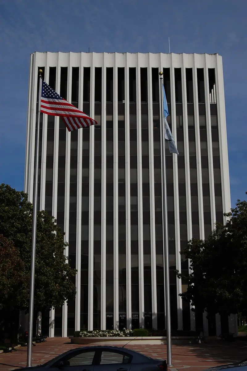
Palo Alto City Hall. The city runs its own utilities, libraries and parks. Photo: Eugene Zelenko, Wikimedia Commons, CC BY-SA 4.0
Advertisement
Schools
Public schools are the main reason many families move here. The Palo Alto Unified School District serves most of the city. High school students attend either Palo Alto High School, known as Paly, near Stanford or Henry M. Gunn High School near Stanford Research Park. There are three middle schools: JLS, Greene and Fletcher. Elementary schools are spread across the neighborhoods and attendance is based on address, so check boundaries before you sign a lease or make an offer.
Palo Alto also has many private schools, preschools and enrichment programs. Stanford sits next door. Our schools and universities guide covers the details.
Getting around
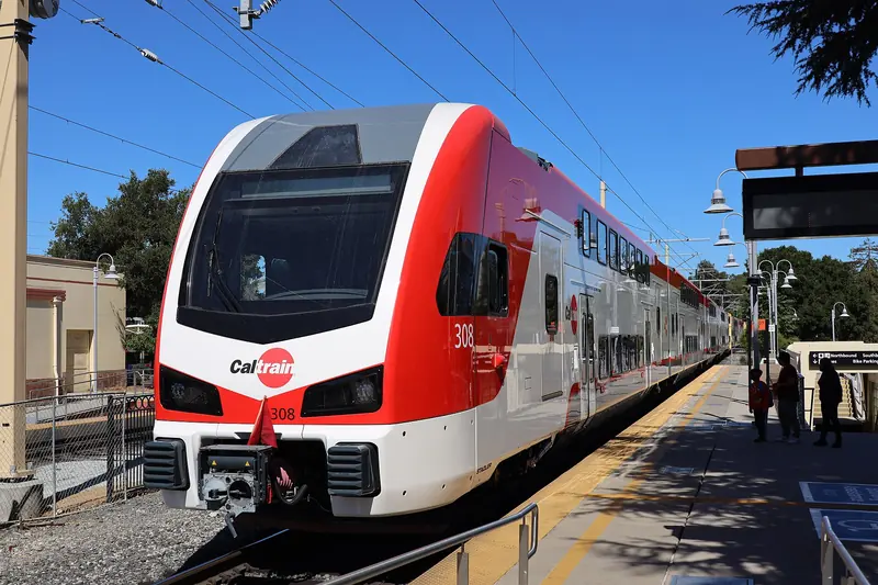
Palo Alto is one of the easier places in the Bay Area to live with fewer cars. Caltrain has two regular stations in the city. The main Palo Alto station downtown is the second busiest on the whole line after San Francisco's 4th and King. California Avenue station serves the south side of downtown and Stanford Research Park. Caltrain switched to electric trains in 2024, which brought faster and more frequent service.
Stanford's free Marguerite shuttles run between the Palo Alto station, the campus and nearby areas and anyone can ride. VTA buses cover El Camino Real and other main roads. Cycling is popular because the city is flat. Bryant Street is a long bike boulevard that runs parallel to busier streets. Many children bike to school.
Driving is still the norm for many trips. Highway 101 runs along the bay side of town and Interstate 280 runs through the hills to the west. Rush hour traffic on both can be heavy. See getting around Palo Alto for transit, parking and bike details.
Electric Caltrain service began in 2024. Palo Alto station is one of the busiest on the line. Photo: San Mateo County Transit District, Wikimedia Commons, Public domain
Parks, open space and libraries
Palo Alto has a lot of green space for its size. Beyond neighborhood parks such as Rinconada and Mitchell Park, the city owns large preserves at both ends of town.
Baylands Nature Preserve protects tidal marsh along San Francisco Bay, with levee trails and birding.
Foothills Nature Preserve in the hills was long open only to residents. It opened to everyone in the early 2020s.
Pearson-Arastradero Preserve offers rolling grassland trails in the foothills.
Esther Clark Park is a small oak and grassland park.
Elizabeth F. Gamble Garden is a public garden in Old Palo Alto.
The Palo Alto City Library has five branches: Mitchell Park, Rinconada, Downtown, College Terrace and the Children's Library. A library card gives you access to books, digital media, classes and events. For more ideas, see the outdoors and parks hub.
Advertisement
Cost of living
Palo Alto is one of the most expensive places to live in the United States. Housing drives most of that. According to the Census Bureau's 2020 to 2024 survey data, the median value of owner-occupied homes is above $2 million, which is the highest value the survey reports. The median gross rent is $3,484 a month. About 55 percent of homes are owner-occupied and the rest are rented.
Other costs are closer to the Bay Area norm. Groceries, dining and child care are expensive by national standards but not far from neighboring cities. CPAU describes its rates as competitive, though your water and energy use will matter a lot in a dry climate. Many residents trade a smaller home for a shorter commute and the public schools.
For detail on buying, renting and property taxes, read our real estate guide.
Community life
Palo Alto has a strong sense of civic participation. Neighborhood associations are active and city commissions draw plenty of volunteers. Avenidas serves older adults with classes and support services. The weekly farmers markets on Saturday downtown and Sunday on California Avenue are social events as much as shopping trips.
The calendar includes the May Fete children's parade, summer concerts, the Festival of the Arts on University Avenue and the Art Center's glass pumpkin patch in the fall. Stanford adds lectures, sports and performances, many of them open to the public. See our events calendar and the arts and culture guide.
Local news comes from Palo Alto Online, which publishes the Palo Alto Weekly. The Daily Post also covers the city. Both are good ways to learn what neighbors are debating.
Neighborhoods at a glance
Palo Alto is often split into north and south at Oregon Expressway. North Palo Alto has older homes from the first half of the twentieth century. South Palo Alto was largely built after World War II and includes many Eichler tracts.
Downtown: apartments and older homes within walking distance of University Avenue and Caltrain.
Professorville: a National Register historic district of early twentieth century homes.
Crescent Park: large lots near San Francisquito Creek north of downtown.
Old Palo Alto: stately older homes around Gamble Garden.
College Terrace: small lots on streets named for colleges, right next to Stanford.
Midtown and South Palo Alto: family neighborhoods with many Eichlers and ranch homes.
Barron Park: a semi-rural feel with creekside lots and few sidewalks.
Palo Alto had 68,572 residents at the April 2020 census. The Census Bureau estimated 67,609 residents as of July 2025, while the California Department of Finance estimated 69,004 as of January 1, 2026. The two sources use different methods. The city covers about 24.1 square miles of land in Santa Clara County.
Is Palo Alto a good place to live?
Many residents value the public schools, the parks and open space preserves, the city-run utilities and the short commute to Stanford and tech employers. The main drawback is cost. The median value of owner-occupied homes is above $2 million and the median gross rent is about $3,500 a month, according to Census Bureau survey data.
Who provides utilities in Palo Alto?
City of Palo Alto Utilities, which the city owns, provides electricity, natural gas, water and wastewater service and has served the city since 1896. It also sells fiber internet, including home service under the Palo Alto Fiber name in areas where it is available. The city has supplied carbon-neutral electricity since 2013.
What school district serves Palo Alto?
The Palo Alto Unified School District serves most of the city. Its two comprehensive high schools are Palo Alto High School and Henry M. Gunn High School. The district also runs three middle schools: JLS, Greene and Fletcher.
How diverse is Palo Alto?
According to Census Bureau estimates, about 37 percent of residents were born outside the United States and about 42 percent speak a language other than English at home. Roughly 38 percent of residents identify as Asian and about 46 percent as white.