On this page
Palo Alto's past is written on its sidewalks, if you know where to look. A bronze plaque in a boulder under the city's namesake redwood. A plaque set into the pavement at Channing and Emerson where the vacuum tube amplifier was born. A row of interpretive panels in a ballfield parking lot that tells the story of Mayfield. Most are free to see at any hour and many sit within a short walk or bike ride of each other.
This guide is about the markers themselves: what they say, who put them up and where they stand, using the locations published by the California Office of Historic Preservation, the Historical Marker Database and our own landmark pages. For what each registry means and the full list of National Register buildings, see our guide to historic landmarks.
Kinds of markers you will see
- California Historical Landmark plaques. Numbered bronze plaques for sites of statewide importance, often placed with a sponsoring group.
- Points of Historical Interest. State-registered sites of local importance, such as El Palo Alto itself.
- The 1969 city series. Small markers placed by the City of Palo Alto and the Palo Alto Historical Association, numbered with codes like SCL-003.
- The 1976 Bicentennial marker. Placed by the city's USA Bicentennial Committee.
- Professional and corporate markers. IEEE Milestone plaques and building markers such as the one at Facebook's first office.
El Palo Alto and the Portolá camp
Start with the tree that named the city. In El Palo Alto Park, at Alma Street and Palo Alto Avenue, the Native Sons of the Golden West set a bronze plaque in a granite boulder on November 7, 1926. It sits near the south end of the footbridge to Menlo Park. The tree is a California Point of Historical Interest, registered on March 15, 1974.
The state landmark is across San Francisquito Creek. California Historical Landmark No. 2, Portolá Journey's End, was registered on June 1, 1932. Its plaque stands at East Creek Drive and Alma Street in Menlo Park. A second plaque there says Father Francisco Palóu put up a cross at the site in 1774. Our El Palo Alto page covers a visit.
The technology plaques
Silicon Valley's best-known markers form a loose trail from downtown south to Mountain View:
| Marker | Location as published | Placed or registered |
|---|---|---|
| Pioneer Electronics Research Laboratory (No. 836) | Sidewalk, SE corner of Channing Ave. and Emerson St. | Registered 1969 |
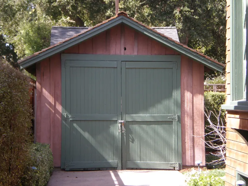
| Birthplace of Silicon Valley, the HP Garage (No. 976) | 367 Addison Ave. | Registered 1987, dedicated 1989 |
| First commercially practicable integrated circuit (No. 1000) | 844 E. Charleston Rd. | Marks Fairchild's 1959 work |
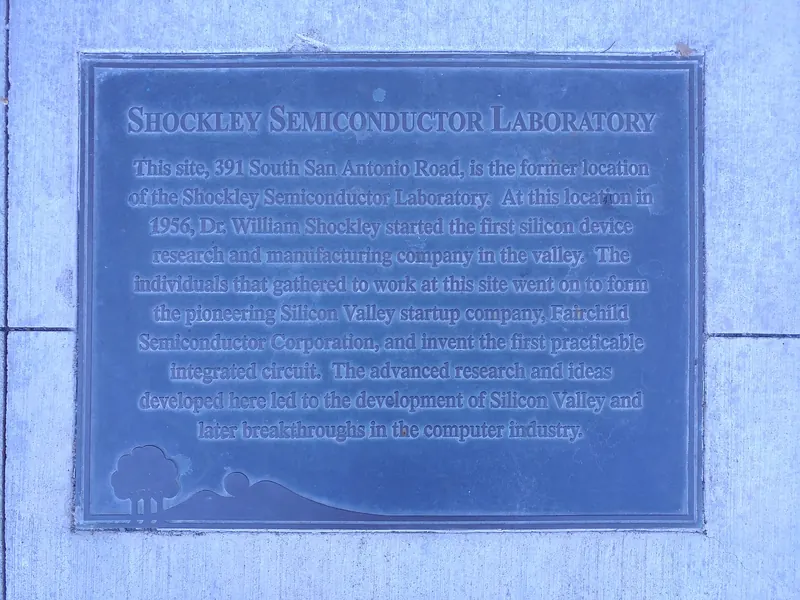
| Shockley Semiconductor Laboratory, IEEE Milestone | 391 San Antonio Rd., Mountain View | Dedicated August 15, 2018 |
| Facebook's first office marker | 471 Emerson St. | Building marker |
The Federal Telegraph plaque says that here Lee de Forest "devised the first vacuum tube amplifier and oscillator" between 1911 and 1913. Our Federal Telegraph page tells the story. The HP Garage plaque is readable from the sidewalk on Addison Avenue. The house and garage are owned by HP and are not open.

At 844 East Charleston Road, look for the state landmark marker outside the commercial building at that address. The Shockley site is just over the city line at 391 San Antonio Road in Mountain View, where a monument area holds the IEEE plaque, an information panel and sculptures of early semiconductor devices. Our Shockley and Fairchild page explains why these sites matter. At 471 Emerson Street, a marker on the building says Facebook leased it under the name The Face Book from January 10, 2005, to July 30, 2006.

Stanford's markers
Two state landmarks are on the Stanford campus. Landmark No. 834 honors Eadweard Muybridge's motion studies of 1878 and 1879 on the Palo Alto Stock Farm. State Parks and E Clampus Vitus placed the plaque on April 30, 1983, on Campus Drive West across from the Stanford driving range. It is on a busy road with a bike lane, so stop with care. Our Muybridge page covers the photographs. Landmark No. 913, the Lou Henry Hoover House at 623 Mirada Road, is the president's residence and is not open to visitors.
Downtown and the Hostess House
Near the Palo Alto Caltrain station, two markers tell one story. The state plaque for Landmark No. 895, placed on November 11, 1976, marks Julia Morgan's 1918 Hostess House at 27 University Avenue. Nearby on University Circle, a 1969 city marker titled "Palo Alto's First Community House" explains that the city bought the Camp Fremont building for one dollar and moved it here. It adds that a 205-foot flagpole, dedicated on The Circle in 1908 by the Native Sons of the Golden West, was later moved to the site. The state lists the spot as a Point of Historical Interest, "First Community Center and Palo Alto City Flag Pole," registered on November 3, 1969.
Another state plaque marks a private home. The John Adams Squire House, Landmark No. 857, is a 1904 Classical Revival mansion at 900 University Avenue. View it from the sidewalk.
The Mayfield markers
The old town of Mayfield, around today's California Avenue, has the densest cluster of markers in the city:
- Uncle Jim's Cabin. A 1969 city marker on the California Avenue side of the building at 2401 El Camino Real. It says James Otterson opened a hostelry near this corner in 1853, the first building in what became Mayfield.
- Herring Box School. A 1969 marker, SCL-003, at Birch Street and Sherman Avenue. It marks the area's first school, which stood under a great live oak.
- The playing fields panels. In the parking lot of the Stanford Palo Alto Community Playing Fields at Page Mill Road and El Camino Real stand several newer panels, including "Town and Gown," "The Crossroads of Mayfield," "Mayfield School" and "Play Ball!" The Crossroads panel recalls Juana Briones hauling hides to San Francisco and the farm of Jesus Ramos in 1856. The Mayfield School panel describes the 1923 grammar school torn down in 1982.
- Sarah Wallis Mayfield Farm. State Landmark No. 969, on La Selva Drive in Barron Park, with a plaque dedicated on October 11, 1986.
Our California Avenue walking tour links these with the old depot and the cannery. Our Mayfield page explains the town.
Other markers worth finding
- Juan Bautista de Anza. A 1976 marker from the city's USA Bicentennial Committee at Middlefield and Embarcadero roads, easiest to reach from the end of Coleridge Avenue. It records Anza's March 1776 passage while choosing sites for the presidio and mission of San Francisco.
- Juana Briones home site. State Landmark No. 524 on Old Adobe Road, registered in 1954 with a plaque placed on March 12, 2007. The house was taken down in 2011. See our Juana Briones page.
- America250 Liberty Tree Grove. A 2026 marker placed by chapters of the Daughters of the American Revolution and Sons of the American Revolution for the nation's 250th anniversary. The Historical Marker Database places it in the Sheraton hotel parking lot near El Camino Real and University Avenue.
- Camp Fremont. Just over the creek in Menlo Park, Fremont Park on Santa Cruz Avenue holds a bronze plaque first set up at a 1923 reunion of the 8th Division and the 319th Engineers.
A marker loop by bike
A mostly flat ride of roughly 8 to 10 miles links most of these. Start at El Palo Alto and the Hostess House by the Caltrain station. Ride to Channing and Emerson, then to 367 Addison Avenue. Head south through the neighborhoods to the Anza marker at Middlefield and Embarcadero. Cross to California Avenue for Uncle Jim's Cabin, the Herring Box School and the playing fields panels. Finish at 844 East Charleston Road, or continue to 391 San Antonio Road in Mountain View. For a full itinerary, see our history buff weekend.
Good to know
- Many of these markers stand on private frontage or busy streets. Stay on the sidewalk and respect residents.
- Street numbers for some state landmarks differ between sources. We give locations as the registries publish them.
- If a marker is missing or damaged, the Palo Alto Historical Association is the best group to tell.
Frequently asked questions
Where is the plaque at El Palo Alto?
A bronze plaque set by the Native Sons of the Golden West on November 7, 1926, sits in a granite boulder under the tree in El Palo Alto Park, near the south end of the footbridge to Menlo Park. The park is at Alma Street and Palo Alto Avenue. The state landmark plaque for the 1769 Portolá camp is across the creek in Menlo Park.
Where is the Federal Telegraph plaque?
It is set into the sidewalk at the southeast corner of Channing Avenue and Emerson Street, a few blocks south of University Avenue. It marks California Historical Landmark No. 836, where Lee de Forest developed the vacuum tube amplifier and oscillator from 1911 to 1913.
Is the Shockley marker in Palo Alto?
No. It stands at 391 San Antonio Road in Mountain View, just south of the Palo Alto line. The IEEE Milestone plaque, dedicated on August 15, 2018, is set into an information panel on a wall facing the street, with sculptures of early semiconductor devices nearby.
Can you visit the HP Garage plaque?
Yes, from the sidewalk. The state landmark plaque for No. 976, the Birthplace of Silicon Valley, is at 367 Addison Avenue. The garage and house are private property owned by HP and are not open to the public.
Who put up the small markers around California Avenue?
Several date from 1969, when the City of Palo Alto and the Palo Alto Historical Association marked early Mayfield sites such as Uncle Jim's Cabin and the Herring Box School. Newer interpretive panels stand in the parking lot of the playing fields at Page Mill Road and El Camino Real.