On this page
California Avenue began as the main street of Mayfield, a rail town with stores, a brewery and about 13 saloons. Leland Stanford asked it to go dry so it could serve his university. Mayfield refused, a new dry town grew up to the north and Palo Alto absorbed Mayfield in 1925. Little of the old town's fabric survives, but its sites are easy to find and the street itself has had a second life as a car-free dining promenade.
This walk connects the depot site, a cannery that once employed much of the area, the brewery corner and the roadhouse site where Mayfield began. It also picks up the public art installed nearby in recent years. Our California Avenue guide covers shops, parking and the farmers market.
Before you go
The route is about 1.8 miles one way and takes 1 to 1.5 hours. It starts at the California Avenue Caltrain station and ends across El Camino Real at the College Terrace Library. Sundays are the liveliest time, since the farmers market fills the western blocks from 9 a.m. to 1 p.m. Weekday mornings are quieter for reading signs and taking photos.
Restrooms and coffee are easy to find on the car-free blocks. Our California Avenue station guide covers trains and parking.
The route, stop by stop
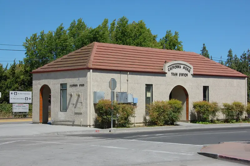
- California Avenue Caltrain station, 101 California Avenue. Regular trains reached Mayfield in October 1863 and the first station building went up in 1869. The stop was called Mayfield until 1941. Today's platforms date to a 2008 rebuild that added an underpass. Walk through it and back if you want to see Jerry Bowden Park on the far side.
- The Cannery, 340 Portage Avenue. Walk southeast along Park Boulevard to Portage Avenue. Thomas Foon Chew bought this site in 1918 and his Bayside Canning Company, of which this plant was one part, was among the largest canners in the country by the 1920s. Chew became known as the Asparagus King for canning green asparagus commercially. The building later housed Fry's Electronics. The Sobrato Organization celebrated its conversion into offices on May 12, 2026. Kyungmi Shin's mosaic mural on the retail frontage shows Chew, cannery workers, product labels and a patent drawing of an asparagus sorter. According to the developer, the city has renamed Portage Avenue in Chew's honor, so street signs may differ from maps.
- 350 Sherman Avenue garage. Walk back toward California Avenue on Sherman. Phillip Hua's temporary mural Everything Changes wraps this public garage.
- Public Safety Building, 250 Sherman Avenue. Peter Wegner's Space, Time & Palo Alto (2024) and 100,000 Decisions are part of the city's art collection here. See our public art page for more.
- Palo Alto Courthouse, 270 Grant Avenue. A Santa Clara County Superior Court building a block from the shops. It anchors the civic side of the district.
- California Avenue at Birch Street. The Mayfield Brewery opened at this corner in 1868. Today it marks the east entrance to the car-free blocks, with bollards, colored paving and planters installed in 2025.
- The car-free blocks. Walk west. The street closed to through traffic in June 2020 so restaurants could serve outdoors. On March 10, 2025, the City Council made the closure permanent and created a community street classification that allows bikes at up to 8 mph.
- California Avenue at Ash Street. In June 2023 Paz de la Calzada painted a ground mural at this intersection as part of the city's first large-scale mural event on the street. The city described all three murals that year as temporary. We could not confirm which remain, so treat any you find as a bonus.
- The farmers market blocks. Closer to El Camino Real, the Sunday market sets up year-round, rain or shine. Our farmers markets guide covers vendors and payment options.
- El Camino Real at California Avenue. James Otterson built a roadhouse called Uncle Jim's Cabin near this corner in 1853. It became a mail stop by 1855 and Otterson is credited with the name Mayfield. Local histories also place Stanford's 1886 meeting with Mayfield residents here, though no transcript survives.
- Mayfield Park and the College Terrace Library, Wellesley Street. Cross El Camino Real at the signal and walk into College Terrace, which joined Palo Alto with Mayfield in 1925. Mayfield Park keeps the old town's name beside the 1936 library at 2300 Wellesley Street.

Mayfield in five minutes
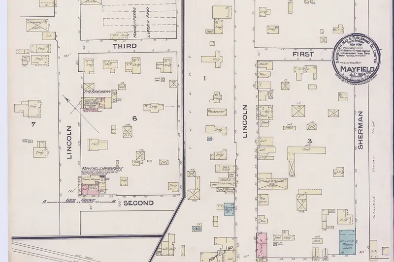
Mayfield grew from travelers on El Camino Real. The name echoes Mayfield Farm, the 250 acres Elisha Oscar Crosby bought in 1853 and passed to suffragist Sarah Wallis in 1856. That farm is now the Barron Park neighborhood. The railroad turned a crossroads into a town in the 1860s. By the 1880s Mayfield had stores, hotels, a blacksmith, a newspaper printed in English and Spanish and many saloons.
Stanford wanted his university town dry. Mayfield said no, so Timothy Hopkins laid out University Park to the north in 1887 and that town took the name Palo Alto. Mayfield incorporated in 1903 and banned saloons soon after, but growth had moved north. Palo Alto voters approved annexation in July 1925 and the towns consolidated on July 6, 1925. Our Mayfield history tells the full story and our page on Palo Alto's alcohol ban explains the dry rules.

Murals and public art, confirmed and not
Public art near California Avenue changes often, so here is what we could and could not confirm in October 2026:
| Work | Where | Status |
|---|---|---|
| Everything Changes, Phillip Hua | 350 Sherman Ave. garage | On the city's current mural list; temporary |
| Thomas Foon Chew mosaic, Kyungmi Shin | The Cannery, 340 Portage Ave. | Dedicated May 12, 2026 |
| Wegner sculptures | 250 Sherman Ave. | Permanent city collection |
| Nicole Ponsler mural | 149 California Ave. | Painted June 2023 as temporary; current status unconfirmed |
| Olivia Losee-Unger mural | 477 California Ave. | Painted June 2023 as temporary; current status unconfirmed |
| Paz de la Calzada ground mural | California Ave. at Ash St. | Painted June 2023 as temporary; current status unconfirmed |
Check the city's murals on view page before you go.
Tips for the walk
Good to know
- Cross streets such as Ash and Birch still carry cars. Look both ways at each corner.
- The Cannery is a private commercial building. Enjoy the mural and outdoor displays from the public frontage.
- The courthouse has security screening. Do not enter just to look around.
- Sunday market crowds make bikes impractical on the western blocks. Walk them.
Where to stop for food
The car-free blocks are lined with cafes and restaurants with outdoor tables. Our California Avenue shopping guide and the neighborhood guide list current picks. A Sunday walk can double as market shopping. Pack a bag for produce.
Extending the walk
From the library, continue with our College Terrace walking tour through the college-named streets. With a bike, ride south on El Camino Real side streets to La Selva Drive for the Sarah Wallis plaque, the first stop on our Barron Park walking tour. The railroad that made Mayfield is covered in the railroad and Palo Alto. For a guided commentary elsewhere in the Bay Area, browse self-guided audio tours.
Sources for this page include the City of Palo Alto's car-free streets and public art pages, the city's 2023 mural press release, the Sobrato Organization's May 2026 announcement and local histories summarized on our Mayfield page.
Frequently asked questions
Is California Avenue the old Mayfield main street?
Yes. It was Mayfield's Lincoln Avenue until Palo Alto annexed the town in 1925 and renamed the street to avoid a duplicate. The California Avenue Caltrain station stands where Mayfield's depot opened in 1869.
Are there murals on California Avenue?
The city painted three temporary murals in the California Avenue district in June 2023, including a ground mural at Ash Street. We could not confirm which survive. Confirmed works nearby in 2026 are Phillip Hua's temporary mural on the 350 Sherman Avenue garage and Kyungmi Shin's mosaic honoring Thomas Foon Chew at the Cannery on Portage Avenue.
Where was the Mayfield Brewery?
The Mayfield Brewery opened in 1868 at what is now the corner of California Avenue and Birch Street. Nothing of it survives, but the corner marks the east end of today's car-free blocks.
What is the Cannery in Palo Alto?
It is the former Bayside Cannery at 340 Portage Avenue, which Thomas Foon Chew started in 1918. The building later housed Fry's Electronics. The Sobrato Organization celebrated its conversion to a commercial building on May 12, 2026, with a mosaic mural and history displays honoring Chew.
Can you bike on car-free California Avenue?
Yes. When the council made the closure permanent in March 2025 it created a community street classification that allows bikes at low speed, with an 8 mph limit. Ride slowly around diners and walkers.