On this page
El Camino Real is the road everyone in Palo Alto uses and few people love. Six lanes of traffic run past car dealers, gas stations, hotels, a shopping center and a long chain of small motels. Yet the name promises something grander: the King's Highway, the road of the missions. The truth sits somewhere between the postcard and the strip mall.
This page traces the road through Palo Alto from its Spanish roots to the motel era and the plans reshaping it now. For hotels along the corridor today, see our guide to staying on El Camino Real.
The mission road, real and imagined
Spanish expeditions crossed this ground from 1769 on. Portolá's party camped by San Francisquito Creek that November. Juan Bautista de Anza's colonists passed through in 1776 on their way to found the presidio and mission at San Francisco. Mission Santa Clara de Asís followed in 1777. Riders, carts and cattle moved between Santa Clara and San Francisco along the flat land between the hills and the bay. Our Spanish and Mexican era page covers the people who lived along that route.
Historians caution against picturing one paved royal highway. Under Spanish rule there was no single road built to connect the missions. Travelers used a network of caminos reales, many following Native trading trails. The route shifted with weather and need. The single El Camino Real on modern maps owes much to boosters of the early 1900s, who revived the name during the Mission Revival craze to sell California's romantic past to motorists.
Stagecoaches and Mayfield's Main Street
After California became a state, the road carried stagecoaches and freight wagons between San Francisco and San Jose. It was rough and often muddy. Roadhouses grew up where teams could rest. One of them started a town. In 1853 James Otterson built a roadhouse known as Uncle Jim's Cabin near today's corner of El Camino Real and California Avenue. It became a mail stop and the seed of Mayfield.
In Mayfield the road was simply Main Street. It met Lincoln Avenue, today's California Avenue, at the town's busiest corner. Leland Stanford met Mayfield's leaders there in 1886 to ask them to close their saloons. Our Mayfield page tells how that meeting went. When the railroad opened in 1863 it drew long-distance traffic off the road for decades, but local farmers still hauled fruit and hay along it.
The bells
The bell markers came out of the same booster spirit that revived the name. In 1892 Anna Pitcher of Pasadena began a campaign for a commemorative route. The California Federation of Women's Clubs took it up in 1902. With no standard highway signs yet, organizers chose a distinctive marker: a cast bell hung from a tall post shaped like a shepherd's crook. The first was set in 1906. The bells carry two dates, 1769 for the first mission at San Diego and 1906 for the first bell.
The bells had a hard century. The original organization fragmented and the Automobile Club of Southern California and allied groups looked after the bells from the mid-1920s through 1931. Many were stolen or lost. In 2005 Caltrans installed 555 new bell markers, cast from the original 1906 molds.
The bells are also contested. For some Native people they symbolize the forced labor and cultural loss of the mission system. The Amah Mutsun Tribal Band has spoken against them. The University of California, Santa Cruz removed a bell from its campus in 2019. If you see one on the Peninsula, it is a marker of the 1906 revival as much as of the 1700s.
Paving the highway
The automobile brought the road back to life. A section of El Camino Real on the Peninsula was paved in 1912. Some local histories call it the first paved road in California. The route became the main north to south highway, later signed as part of U.S. 101.
Wider pavement meant other uses had to move. Electric interurban cars of the Peninsular Railway ran beside the highway between Mayfield and downtown Palo Alto. In 1929 the state Division of Highways announced plans to widen the road and asked the railway to remove or rebuild its tracks. The state Railroad Commission approved abandoning that stretch on September 17, 1929. Our page on streetcars and the interurban covers that line.
By the late 1930s the state was moving the main U.S. 101 route to the new Bayshore Highway near the bay. A Palo Alto publication of the time criticized the shift, according to a 1938 state highway letter. El Camino became a secondary route and, in a 1959 law, part of State Route 82 on the Peninsula. It remains a state highway today, which is why Caltrans rather than the city controls its lanes.
Motels and the strip
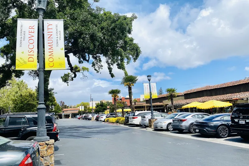
After World War II, El Camino Real became the place to build for drivers. Motels with neon signs, drive-ins and auto dealers lined the south end of town. New shopping arrived nearby. Town & Country Village opened on El Camino Real in 1953 and the first store at Stanford Shopping Center, just off the road, opened in September 1955.
Rickey's
The best known of the postwar lodgings stood near the Los Altos border. Restaurateur John Herman Rickey opened Rickey's Studio Inn at 4219 El Camino Real in 1954 with 52 units in one-story redwood buildings set around lawns, courts and pools. By 1957 it had 143 units. A six-story reinforced concrete wing designed by architect Ernest J. Kump Jr. was added in 1956 and 1957 and won a Progressive Architecture award citation in 1958. In December 1956 William Shockley's team toasted his Nobel Prize at Rickey's, a moment told on our Shockley and semiconductors page.
Rickey's later became Hyatt Rickey's. It was eventually torn down. In January 2006 developers broke ground on 181 homes on the site, from apartments near El Camino to single-family houses facing Wilkie Way.

Today's plans in general terms
Two forces are reshaping the road in the 2020s: safety work on the highway itself and new housing along its edges.
- Repaving and bike lanes: Caltrans began a repaving and accessibility project in Palo Alto on September 3, 2024, running from Sand Hill Road toward Mountain View. The plan included bike lanes, some separated by posts, in place of curbside parking. The City Council endorsed a revised version 5 to 1 on June 18, 2024, after debate among merchants and cyclists. Check the city's transportation pages for the current status.
- Housing: State laws now make it easier to build apartments on commercial corridors near transit. In March 2026 SummerHill Homes bought the Country Inn motel site at 4345 El Camino Real and its neighbor for about $18 million, with plans for 29 townhomes. On July 1, 2026, a developer filed to replace the Coronet Motel at 2455 El Camino Real with a six-story building of about 76 units.
- Vehicle dwellers: Removing parking for bike lanes displaced dozens of people living in RVs along the road. The city expanded a safe parking site on Geng Road in response.
Expect the strip to look different within a decade. Some motels will become apartments. Others will hang on, as they have since the 1950s. Our postwar growth page explains how this side of town filled in.
Seeing the history along the road
A slow drive or bike ride from north to south reads like a timeline. Start where El Camino crosses San Francisquito Creek at the Menlo Park line, then pass the entrance to Palm Drive. Pass Town & Country Village and the hotels near the shopping center. At California Avenue, look for the corner where Uncle Jim's Cabin and Stanford's meeting once stood. Continue past Barron Park and the motels of the south end to the Rickey's site near the Los Altos line. If you ride, use the parallel bike routes in our biking guide where the highway feels too busy.
Good to know
- Through Palo Alto, El Camino Real is State Route 82 and is managed by Caltrans.
- Addresses climb from north to south, from the hundreds near Stanford to the 4000s near Los Altos.
- Crossing El Camino on foot is easiest at signals. Six lanes of traffic make midblock crossings risky.
Frequently asked questions
Was El Camino Real really the road between the missions?
Only loosely. Historians note that the Spanish never built one continuous road linking the missions. Travelers used a network of trails, many following older Native routes. The single El Camino Real of today's maps was promoted in the early 1900s during the Mission Revival era.
What are the bells along El Camino Real?
They are commemorative markers. Women's clubs began the campaign in the early 1900s and the first bell went up in 1906. Most later vanished. In 2005 Caltrans installed 555 replacement bells cast from the original molds. Some Native groups see the bells as painful symbols of the mission system.
Is El Camino Real a state highway in Palo Alto?
Yes. Through Palo Alto it is State Route 82, owned and run by Caltrans. That is why the state, not the city, has the final say on lanes, parking and bike lanes along it.
What happened to Rickey's Hyatt in Palo Alto?
John Rickey opened Rickey's Studio Inn at 4219 El Camino Real in 1954 and added a high-rise wing in 1956 and 1957. It later operated as Hyatt Rickey's. The hotel was torn down and a 181-unit housing development broke ground on the site in January 2006.
Are the motels on El Camino Real being replaced?
Several are. In 2026 a builder bought the Country Inn site at 4345 El Camino Real for townhomes and another filed to replace the Coronet Motel at 2455 El Camino Real with a six-story apartment building. New state housing laws have sped up such projects.