On this page
Most of the famous hikes around Palo Alto are open grassland. The Dish, Arastradero, Windy Hill and Russian Ridge are beautiful in April and brutal at 2 p.m. in August. Shade is where the creeks are. Redwoods crowd the canyons on both sides of the ridge, oak and bay woodland fills the gullies and a few Skyline trails run through Douglas fir. Pick one of these on a hot day and the walk under the trees feels far cooler than the open hills nearby.
This guide lists nine trails with real canopy. Distances come from the managing agency or from our own park pages, which were checked against those agencies. Shade is never total, so we also flag the sunny stretches. For a wider list, see our guide to the best hikes near Palo Alto.
The shaded hikes at a glance
| Trail | Distance | Canopy | Dogs |
|---|---|---|---|
| Crazy Pete's loop, Coal Creek | 1.7-mile loop | Oak woodland, almost all shaded | Leashed |
| Wildcat Loop, Rancho San Antonio | About 3 miles | Fern canyon, open meadows on top | No |
| Zinfandel Trail, Picchetti Ranch | 1.9 miles | Madrone, oak and bay | No |
| Schilling Trail, Thornewood | 0.75 mile each way | Maple, oak, redwood | Leashed |
| Ancient Oaks Trail, Russian Ridge | Not published | Arching oak canopy | No |
| Saratoga Gap Trail | Nearly 2 miles each way | Oaks, then Douglas fir | No |
| Redwood trails, Huddart Park | About 0.7 mile and up | Second-growth redwood | No |
| Madrone and Redwood loop, Wunderlich | 2.6 or 3.2 miles | Bay, oak, redwood | No |
| Purisima Creek Trail | First mile gentle | Redwood canyon | No |
Oak and bay woodland
Crazy Pete's Road and Coal Road loop, Coal Creek
This is the shade pick with a dog. Midpen describes the 1.7-mile loop as almost entirely shaded and pleasant even in the middle of the day. It winds through oak woodland past a small seasonal waterfall, with glimpses of the South Bay through the trees.
- Trailhead: Upper Alpine roadside area off Skyline Boulevard north of Page Mill Road.
- Dogs and bikes: leashed dogs welcome, but not in the creek. Bikes are allowed, helmets required.
- Parking and fees: only 7 roadside spaces while Caltrans keeps the vista point pullout closed. No fee.
- Best season: summer for shade, winter for the waterfall.
- Watch for: mud in the wet months and poison oak along the edges.
See our Coal Creek guide.
Wildcat Loop, Rancho San Antonio
Midpen's classic loop runs about three miles from Deer Hollow Farm into a cool, narrow canyon walled with ferns. It is the shadiest stretch in the preserve. The loop then climbs through chaparral to open meadows on the middle ridge before dropping back to the farm, so expect sun for the top third.
- Dogs and bikes: no dogs. No bikes west of Deer Hollow Farm.
- Parking and fees: free county park lots off Cristo Rey Drive, often full by mid-morning on weekends.
- Best season: summer afternoons for the canyon, spring for meadow flowers.
- Watch for: coyotes, which Midpen says can be bold around pets in denning season.
Our Rancho San Antonio trail guide pairs it with the harder climbs.
Zinfandel Trail, Picchetti Ranch
Midpen calls this a 1.9-mile easy hike through shaded areas lush with ferns, with a view of Stevens Creek Reservoir. Forested canyons of madrone, coast live oak and California bay keep it cool. It crosses seasonal creeks before reaching the Stevens Creek County Park boundary, where you can turn back.
- Dogs and bikes: neither is allowed in this preserve.
- Parking and fees: the Picchetti Ranch lot on Montebello Road has 80 spaces plus 2 accessible and restrooms. Free.
- Best season: summer and fall. The historic winery next to the lot runs its own tasting hours.
- Watch for: rattlesnakes in warm weather and cyclists on narrow Montebello Road.
See our Picchetti Ranch guide.
Schilling Trail, Thornewood
Midpen describes two short, mostly shaded trails here. The 0.75-mile Schilling Trail passes bigleaf maples and moss-covered oaks and ends under redwoods around Schilling Lake. Return on the 0.75-mile Bridle Trail through Douglas fir and redwood for a different forest. A side path leads to the ruins of a 1920s estate garden.
- Dogs and bikes: leashed dogs allowed. No bikes.
- Parking and fees: just 5 spaces plus 1 accessible at the end of a narrow driveway off Highway 84, 1.6 miles past Portola Road. Free.
- Best season: any warm day. Arrive early on weekends.
- Watch for: oncoming cars on the one-lane driveway.
Our Thornewood guide covers the estate history.
Shade on the ridge
Ancient Oaks Trail, Russian Ridge
Russian Ridge is mostly open grass, which makes this trail stand out. Midpen says oak limbs arch over it to form a canopy. It links the Bo Gimbal Trail area with the Mindego parking area on Alpine Road. Midpen does not publish its length on the preserve page; use the downloadable map. POST's 3.6-mile Russian Ridge loop uses it for the middle section.
- Dogs and bikes: no dogs. Bikes on designated trails.
- Parking and fees: Ancient Oaks roadside has 4 spaces; the Mindego lot has 20 and a restroom. Free.
- Best season: late spring, when the ridge flowers bloom around the grove.
- Watch for: the Mindego Hill area closes on Red Flag Warning days.
See our Russian Ridge guide.
Saratoga Gap Trail
This Bay Area Ridge Trail segment runs nearly two miles beside Skyline Boulevard. Midpen describes weathered oaks at the start, then a cool Douglas fir forest with mossy trees and lichen-covered boulders. The grade is mostly gentle. Turn around at the Hickory Oaks crossing for about 4 miles round trip.
- Dogs and bikes: no dogs. Bikes and horses on designated trails.
- Parking and fees: Caltrans vista point lot at Skyline and Highway 9, 30 spaces plus 1 accessible. Free.
- Best season: summer.
- Watch for: busy weekend traffic at the junction.
Our Saratoga Gap guide has the details.

Redwood canyons
Huddart Park, Woodside
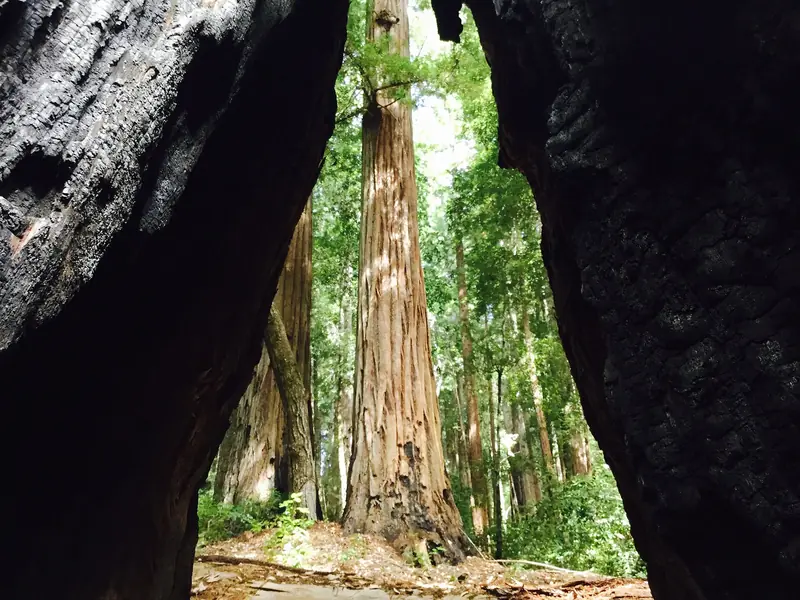
Huddart's creek bottoms are full of second-growth redwoods, sword fern and banana slugs. The Redwood Nature Trail, about 0.7 mile, is the gentle option. The Canyon Trail continues through redwood, madrone and oak. Any loop that climbs toward Skyline leaves the canyon for drier forest, so keep it low on hot days.
- Dogs and bikes: no dogs or other pets. Bikes only on paved roads and in parking areas.
- Parking and fees: $6 per vehicle as published by San Mateo County, with waivers for veterans and placard holders. Opens 8 a.m.; closes 5 p.m. from November 2, 2026, per the county's hours page.
- Best season: summer.
- Watch for: horses on shared trails. Step to the downhill side as they pass.
Our Huddart Park guide lists the trails.
Madrone and Redwood loop, Wunderlich Park
The county describes the Madrone Trail as forming a 2.6-mile loop in the lower park with the Bear Gulch or Meadow trails. Adding the Redwood Trail brings it to 3.2 miles with more big trees. Our park page calls it the short, shady choice. Wunderlich is quieter and less developed than Huddart.
- Dogs and bikes: no dogs. Bikes only on paved areas.
- Parking and fees: 4040 Woodside Road. Not on the county's list of fee parks. Closes 5 p.m. from November 2, 2026.
- Best season: summer and fall.
- Watch for: horses from the historic stable near the trailhead.
See our Wunderlich Park guide.
Purisima Creek Trail, coast side
On a hot inland day the coast side of the ridge often sits in fog. Midpen describes the Purisima Creek Trail as an old logging road that climbs gently for its first mile, with a few short pitches of 10 to 15 percent, beside the creek through redwood groves. An out and back on that first mile makes a cool, easy walk.
- Dogs and bikes: no dogs. Bikes on designated trails.
- Parking and fees: the Purisima Creek Road lot near Half Moon Bay has only 7 spaces plus 1 accessible. Free.
- Best season: summer, when fog keeps the canyon cool.
- Watch for: no water contact in the creek. Cell service is sporadic.
Our Purisima Creek Redwoods guide covers the ridge entrances too.
Tips for hot days
Shade helps, but heat still builds on any climb. Start before 9 a.m. from June to October. Carry water, since Midpen provides none on its trails and recommends two quarts per person for every two hours. If you have a dog, the shaded Coal Creek and Thornewood trails are far safer than open grassland in summer. Our dog-friendly hikes guide covers heat signs in dogs.
Creekside trails are also where the season's small waterfalls appear after winter storms. Our waterfalls guide covers the best of them.
Safety under the trees
Good to know
- Poison oak thrives in shade. Learn the leaves and remember the bare winter stems carry oil too.
- Ticks wait on brushy edges. Check yourself and your dog after every hike.
- Forest trails get dark early, especially now that daylight saving time has ended. Carry a light.
- Expect fallen branches and mud for days after storms.
None of these trailheads has practical transit. If you are visiting without a car, you can compare rental cars for a day in the hills.
Frequently asked questions
Where can I hike in the shade near Palo Alto?
Midpen calls the Crazy Pete's Road and Coal Road loop at Coal Creek almost entirely shaded, even at midday. Wildcat Canyon at Rancho San Antonio, the Zinfandel Trail at Picchetti Ranch and the redwood canyons at Huddart and Wunderlich parks in Woodside are also good picks.
Is there a shaded hike near Palo Alto that allows dogs?
Yes. The 1.7-mile Crazy Pete's loop at Coal Creek allows leashed dogs and Midpen describes it as almost entirely shaded. Thornewood Preserve off Highway 84 also allows leashed dogs on its short, mostly shaded trails to Schilling Lake.
Is the Stanford Dish shaded?
No. The Dish loop has almost no shade and no benches. On hot days, choose a forest trail instead or walk the Dish in the early morning.
What is the coolest hike on a hot day near Palo Alto?
Redwood canyons on the coast side of the ridge, such as the Purisima Creek Trail, often sit in fog and stay far cooler than the valley. On the bay side, the redwood trails at Huddart and Wunderlich parks are the closest options.
Do shaded trails have fewer ticks?
Not necessarily. Ticks live in brushy and grassy edges in both sun and shade and are most active from fall through spring. Stay in the middle of the trail and check yourself after every hike.