On this page
Palo Alto sits at the foot of some of the best hiking country in the Bay Area. Within the city limits you get grassy foothills and a famous paved loop. A 20-minute drive brings you to the ridgeline of the Santa Cruz Mountains, where open space preserves run for miles along Skyline Boulevard. Go a little farther and you are under redwoods with the Pacific in view.
This guide picks eight hikes, starting close to town and moving into the mountains. Most of the preserves beyond the city are run by the Midpeninsula Regional Open Space District, usually called Midpen, with others run by San Mateo County Parks. Each has its own rules about dogs, bikes and parking. Read the summary for each hike and check the official page before you go.
The eight hikes at a glance
| Hike | Best for | Typical outing | Dogs |
|---|---|---|---|
| Stanford Dish | A quick workout close to town | About 3.5 miles, paved | No |
| Pearson-Arastradero | Easy dirt loops, families | 1 to 5 miles | On leash |
| Foothills Nature Preserve | A full day in the hills | 3 to 8 miles | Weekdays only, on leash |
| Windy Hill | Big views from the ridge | 1 to 7.2 miles | On some trails, on leash |
| Rancho San Antonio | Farm animals and Black Mountain | 2 to 8 miles or more | No |
| Russian Ridge | Spring wildflowers and ridgetop walking | 2 to 5 miles | No |
| Huddart Park | Redwoods close to town | 0.7 to 5 miles | No |
| Purisima Creek Redwoods | A redwood canyon above the coast | 0.25 to 5 miles | No |
1. The Stanford Dish
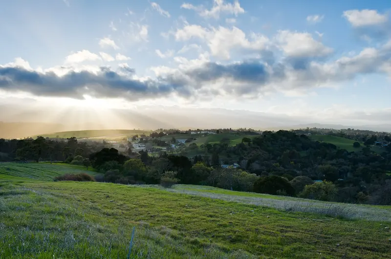
The Dish is the hike everyone in Palo Alto knows. A paved loop of about 3.5 miles circles a 150-foot radio telescope in the hills behind Stanford. The high point is about 526 feet and the climbs are short but steep. There is almost no shade. Stanford owns the land and sets its own hours by month. Dogs and bikes are banned. Start at the Stanford Avenue gate on Junipero Serra Boulevard. Our full Dish guide has hours, gates and parking.

2. Pearson-Arastradero Preserve
This 622-acre city preserve off Arastradero Road is the friendliest dirt hike in town. About 10 miles of trails loop through grassland and oak woodland between about 275 and 775 feet. The walk to Arastradero Lake is mostly flat and good for small kids. The 1.5-mile Redtail Loop gives a real climb and views toward the bay. Dogs are welcome on leash every day and bikes share the trails. Open 8 a.m. to sunset with free parking at 1530 Arastradero Road. See our Arastradero guide.
3. Foothills Nature Preserve
Up Page Mill Road above Interstate 280, the city's largest foothill preserve covers about 1,400 acres with around 15 miles of trail. You can circle Boronda Lake, climb Vista Hill for a view of the bay or follow the longer Los Trancos Trail through woods and ridges. The city charges a vehicle fee and caps the number of visitors inside at once, so the gate sometimes closes on busy weekends. Dogs are allowed on leash on weekdays only. Our Foothills guide covers fees and the visitor limit.
4. Windy Hill Open Space Preserve
Windy Hill is the bald, grassy peak you can see from much of Palo Alto, rising above Portola Valley. The Midpen preserve covers 1,414 acres of grassland ridges and redwood, fir and oak forest. On a clear day the summit gives a 360-degree view of San Francisco Bay and the Pacific Ocean. Hang gliders and paragliders launch from it with a permit.
There are two ways in. The lower lot on Portola Road has 47 spaces and fills quickly. Overflow parking is at the Portola Valley Town Center about 0.4 mile north. Parking on Portola Road itself is strictly enforced. The upper access is from small roadside lots on Skyline Boulevard, Highway 35.
- Easy: the 0.6-mile summit trail from Skyline, or about 1 mile as a loop.
- Moderate: the 1.6-mile Sausal Pond Loop from Portola Road, with about 200 feet of climbing.
- Hard: the 7.2-mile Windy Hill Loop from Portola Road on the Spring Ridge, Lost and Hamms Gulch trails. It climbs to the ridge and back down through the woods.
Dogs are allowed on leash on several named trails, including Spring Ridge and Hamms Gulch. Details are on Midpen's Windy Hill page.
5. Rancho San Antonio
Rancho San Antonio is one of the busiest preserves in the region and for good reason. A 2,180-acre Midpen preserve joins a 293-acre county park, with more than 25 miles of trail. The star attraction for families is Deer Hollow Farm, a working farm with ranch buildings, an organic garden, farm animals and the restored Grant Cabin. It is an easy walk from the parking lots.
For serious hikers the goal is Black Mountain. The trail climbs about four miles through chaparral, grassland and oak woodland to the summit at about 2,800 feet. It is the hardest hike on this list and the views from the top are wide.
Access is through the county park on Cristo Rey Drive, off the Foothill Boulevard exit of Interstate 280. Parking is often congested. Midpen posts real-time lot availability at the entrance and online. Dogs are not allowed. Bikes are allowed on designated trails only. See Midpen's Rancho San Antonio page.
6. Russian Ridge Open Space Preserve
Drive up Page Mill Road to Skyline Boulevard and the main Russian Ridge lot is right at the intersection, on the northwest corner of Skyline and Page Mill and Alpine roads. It has 37 spaces. The preserve covers more than 3,000 acres of open grassy ridgeline. The Bay Area Ridge Trail runs along it past Borel Hill, the highest named point in San Mateo County.
Spring is the season. Poppies and lupine bloom first, followed by mule's ears, farewell-to-spring and other flowers into May and June. All areas are closed to off-trail use during wildflower season, so stay on the path. A short but steep side trail leads to Fog Drift Vista for a 360-degree view. Dogs are not allowed. The Mindego Hill area closes during Red Flag fire warnings. More on Midpen's Russian Ridge page.

7. Huddart Park
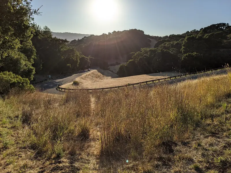
Huddart Park is a San Mateo County park at 1100 Kings Mountain Road in Woodside. It covers about 973 acres of redwood and fir forest, rising from about 550 to 2,000 feet. The redwoods are second growth, regrown after the original forest was logged. It is one of the closest redwood forests to Palo Alto.
The 0.7-mile Redwood Nature Trail is a gentle introduction. For a proper hike the county suggests the 5-mile Dean and Crystal Springs loop from the Zwierlein picnic area. The park opens at 8 a.m. daily and closing time changes with the season. There is a parking fee and pets are not allowed. Check the park's visitor information or the county parks site for current fees.
8. Purisima Creek Redwoods
On the coastal side of the ridge, Purisima Creek Redwoods Preserve covers 5,412 acres of forest overlooking Half Moon Bay. Most of the redwoods are about 100 years old. The 0.25-mile Redwood Trail, just off Skyline Boulevard, is flat and wheelchair accessible, with accessible picnic tables and a restroom. The North Ridge parking area on the ridge has 41 spaces.
For the classic canyon hike, start at the small lot on Purisima Creek Road near Half Moon Bay. A walk of about a mile up the Purisima Creek Trail leads to a loop of nearly five miles. The first mile climbs gently. That lot has only seven spaces, so arrive early. Dogs are not allowed. See Midpen's Purisima page. Our Half Moon Bay day trip shows how to pair the hike with the coast.
Hikes by theme
These eight are a starting point. Our themed guides go further, each with distances, dog rules and parking:
- Easy hikes: gentle trails for a relaxed outing.
- Short hikes: walks you can finish in under an hour.
- Loop hikes: routes from 1.5 to 7.2 miles that bring you back to the car.
- Hard hikes: big climbs such as Black Mountain, Mission Peak and Mount Umunhum.
- Shaded hikes: trails under redwoods, oaks and fir for warm days.
- Redwood hikes: from a flat quarter mile to old-growth giants.
- Ocean view hikes: Skyline summits and coastal paths with Pacific views.
- Bay view hikes: marsh levees and foothill lookouts over the bay.
- Accessible trails: paved or firm paths that agencies describe as accessible for wheelchairs and strollers.
Tips for hiking near Palo Alto
Good to know
- Hours. Midpen preserves open a half hour before sunrise and close a half hour after sunset. City preserves open at 8 a.m.
- Fire weather. Some areas close during Red Flag Warnings in late summer and fall. Check before you drive up.
- Heat and fog. Inland trails can be hot in summer while the coast side stays foggy and cool. Pack layers.
- Hazards. Poison oak, ticks and rattlesnakes are common. Stay on the trail and check for ticks afterward.
- Bikes. Midpen allows bikes only on designated trails with a 15 mph limit and bans e-bikes on most trails. Our biking guide has more.
- Dogs. Rules vary by preserve. See our dog guide before you bring one.
Most of these trailheads are hard to reach without a car. If you are visiting without one, you can compare car rentals in the Bay Area for a day in the mountains. For more redwood options farther afield, including Big Basin, see our guide to redwood forests near Palo Alto.
Frequently asked questions
What is the best easy hike in Palo Alto?
The Stanford Dish is the most popular easy hike. It is a paved loop of about 3.5 miles with some steep pitches and no shade. For dirt trails and fewer people, try the Arastradero Lake walk or the Redtail Loop at Pearson-Arastradero Preserve.
Where can I hike with my dog near Palo Alto?
Pearson-Arastradero Preserve allows leashed dogs every day. Windy Hill allows leashed dogs on several named trails. Foothills Nature Preserve allows leashed dogs on weekdays only. Dogs are banned at the Dish, Rancho San Antonio, Russian Ridge, Purisima Creek Redwoods and Huddart Park.
Where are the closest redwoods to Palo Alto?
Huddart Park in Woodside and Purisima Creek Redwoods Preserve on the ridge above Half Moon Bay are the closest big redwood forests. Both are second-growth forests that have regrown since logging. Each is roughly 30 to 45 minutes from downtown by car.
How hard is the Black Mountain hike?
It is the toughest hike on this list. From Rancho San Antonio the trail climbs about four miles through chaparral, grassland and oak woodland to the summit at about 2,800 feet. Most people do it as a long out-and-back, so plan for a full morning and carry plenty of water.
Do I need to pay to hike near Palo Alto?
Most hikes are free, including the Dish, Arastradero and all Midpeninsula Regional Open Space District preserves. Foothills Nature Preserve charges a vehicle fee and San Mateo County charges for parking at Huddart Park. Fees change, so check the official pages.