On this page
Waterfalls around Palo Alto are a winter event. The Santa Cruz Mountains have no snowpack to feed creeks through summer, so these falls run only after real rain. In a dry year some barely appear. After a wet week in January they pour off sandstone ledges and through redwood canyons within an hour or two of downtown.
It is late October as we write. The season has barely begun. The first storms mostly soak into dry soil. Most falls on this page will not be worth the drive until a few good storms have passed. This guide covers the best falls within a day trip, from short walks near town to the long hike to Alamere Falls on the Point Reyes coast. Each section gives the access rules, fees and closures each park published in October 2026.
At a glance
| Waterfall | Drive from Palo Alto | Hike | Dogs |
|---|---|---|---|
| Coal Creek | About 30 minutes | 1.7-mile loop | Leashed, out of water |
| Uvas Canyon | About 1 hour | 1-mile loop or longer | Leashed; check park map |
| Castle Rock Falls | About 45 minutes | 1.3 miles round trip, 320 feet of gain | No |
| Tiptoe Falls, Portola Redwoods | About 1 hour | About 2 miles | No |
| Brooks Falls, Pacifica | About 45 minutes | 2.2-mile loop | Not on the county's dog list |
| Alamere Falls, Point Reyes | About 2 hours | About 13 miles | No |
Drive times are rough estimates in light traffic. Mountain roads are slow and storms can close them.
Close to town: Coal Creek and Rancho San Antonio
You do not have to go far for a small fall. At Coal Creek Preserve, just off Skyline Boulevard north of Page Mill Road, Midpen's Crazy Pete's Road and Coal Road loop runs 1.7 miles through oak woods past a seasonal waterfall. Midpen says the falls appear in the wetter winter months. It is the only waterfall walk on this page where leashed dogs are welcome, though Midpen bans dogs from all streams and pools.
At Rancho San Antonio, Midpen's docents note that after rain you may see a waterfall beyond the pond in Rogue Valley. It is a modest cascade, but it comes with a solid workout loop. Dogs are not allowed in that preserve.
Uvas Canyon County Park
For the most falls in the shortest walk, go to Uvas Canyon County Park in the hills west of Morgan Hill. The county describes 1,147 acres of wooded canyon with 7 miles of trail. Its Waterfall Loop is about a mile long and follows Swanson Creek past many of the park's falls. The Peninsula Open Space Trust describes a longer 3.5-mile loop with about 800 feet of climbing that takes in Black Rock Falls, Basin Falls and Upper Falls.
- Reservation: a day use parking reservation is required every day, including weekends and holidays. Book on the county's GoOutsideAndPlay site, print the confirmation and leave it on your dashboard.
- Fee: the day use vehicle pass is $6, the standard Santa Clara County rate.
- Hours: 8 a.m. to sunset all year. Non-campers must leave when the gate closes.
- Getting there: the address is 8515 Croy Road, Morgan Hill. The county stresses that Croy Road is the only way in and that map apps may send you wrong. The road passes through Sveadal, a private resort, so drive slowly.
- Dogs: the county's general rule is a leash of 6 feet or less, with trail limits shown on each park map. Check the map at the entrance.
Uvas also has a campground, covered in our camping guide.
Castle Rock Falls
Castle Rock State Park sits on Highway 35, about 2.5 miles southeast of Highway 9. Its waterfall drops about 75 feet down a steep cliff, according to the Peninsula Open Space Trust, into a canyon that feeds the San Lorenzo River. A viewing platform looks out over the drop. From the main Kirkwood entrance, follow the Waterfall Connector Trail and then the Saratoga Gap Trail downhill to the platform. State Parks lists the walk at 1.3 miles round trip with 320 feet of elevation gain, with the climb on the return. The longer loop over the Ridge Trail and Castle Rock itself runs about 6 miles.
- Day use runs 6 a.m. to sunset. The vehicle fee is $10.
- Dogs are prohibited throughout the park, except service animals.
- There is no cell reception in or near the park.
- On October 30, 2026, State Parks listed climbing, trails and the trail camp as open. Climbing can close for up to 3 days after measurable rain.
Our Castle Rock State Park guide covers the climbing rules, trail camps and longer hikes.
Stay behind the platform railing. The rock beyond it is steep and slick when wet. In fall, Castle Rock's black oaks also turn orange; see our fall colors guide.
Big Basin and Berry Creek Falls
Berry Creek Falls, deep in a fern-lined canyon, was once the most famous waterfall hike in the Bay Area. The 2020 CZU Lightning Complex Fire burned about 97 percent of Big Basin Redwoods State Park and wrecked the trail network around it.
The park itself is open for day use from 8 a.m. to sunset. State Parks says parking reservations are highly recommended because spaces are limited. A reserved space costs $6 plus a $2 reservation fee, or you pay $10 at the gate if a space is left. There is no drinking water on site except bottles sold at the kiosk. All campgrounds remain closed.
What State Parks does not do is list Berry Creek Falls among the trails it has reopened. Its access advisory points to a park map of reopened roads and trails and says more will open as crews clear them. The America's State Parks website listed Berry Creek Falls and the Skyline to the Sea Trail under extended closure in June 2026 and estimated 7 to 10 years for full backcountry restoration. Treat the falls as closed unless the official map or the entrance kiosk says otherwise. Call the park at 831-338-8860 before you go.
Even without the falls, the old-growth redwoods are worth the drive. Our redwood forests guide covers the rest of the park's status.
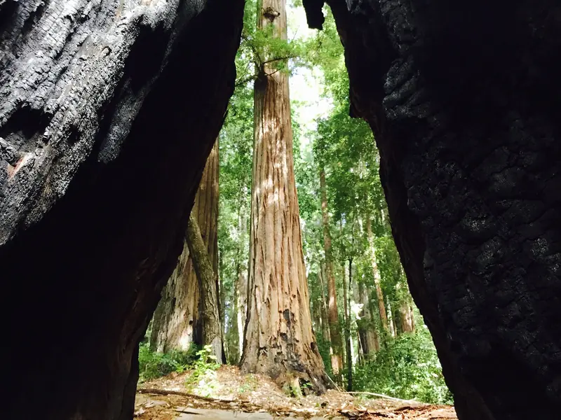

Tiptoe Falls and the Pescadero Creek canyon
Deep in the Pescadero Creek watershed, Portola Redwoods State Park has a small, pretty fall called Tiptoe Falls on Fall Creek, a short tributary of Pescadero Creek. Its main drop is only about 6 feet, but the setting under old redwoods makes up for it. The Peninsula Open Space Trust describes a 2.3-mile walk from the visitor center: follow the road toward the Iverson Cabin site, cross Pescadero Creek on the bridge, then take the Iverson Trail to a short spur up Fall Creek.
- Day use is 6 a.m. to sunset with a $10 vehicle fee. The visitor center is open weekends and holidays as staffing permits.
- Leashed dogs are allowed on paved roads, in picnic areas, in campsites and in parking lots. They may also use the Upper and Lower Escape Roads loop but not the hiking trails.
- There is no cell reception, no gas and no store nearby.
- From Palo Alto, take Page Mill Road over Skyline, continue on Alpine Road and turn onto Portola State Park Road. Use a low gear on the steep descent.
For camping, longer trails and the full rules, see our Portola Redwoods guide.
Brooks Falls, Pacifica
North of Half Moon Bay, San Mateo County's San Pedro Valley Park has the tallest fall on this list. The county says Brooks Falls drops 175 feet in three tiers during the rainy months of winter and spring. The Brooks Creek Trail and the Montara Mountain Trail form a 2.2-mile loop with views of the falls across the canyon and of the ocean from higher up. Bikes are not allowed off the paved areas. The park is not on the county's list of dog-friendly parks, so leave your dog at home.
Alamere Falls, Point Reyes
Alamere Falls pours about 40 feet off a coastal bluff straight onto Wildcat Beach. It is also, in the Park Service's words, the site of multiple search-and-rescue operations each year. Many visitors are tempted by the so-called Alamere Falls Trail, an unmaintained path with crumbling cliffs, poison oak and ticks. The Park Service says there is no park-sanctioned trail by that name and strongly advises against using it.
The safe, legal route is long:
- Start at the Palomarin, Bear Valley or Five Brooks trailhead. Round trips are about 13.2 miles from Palomarin, 14.8 from Bear Valley and 15.6 from Five Brooks.
- Hike the Coast Trail to Wildcat Campground. The Park Service calls the campground the only safe place to get onto Wildcat Beach.
- Take the trail on the south side of the campground down to the beach.
- Walk 1.1 miles south along the beach to the falls, at low tide only. If waves reach the base of the bluffs, turn back.
Pets are prohibited on all trails to the falls. The Palomarin lot fills early on weekends and rangers may close the area when it is full. Point Reyes is about two hours from Palo Alto, so this is a very long day. Many hikers stay nearby; you can compare hotels near Point Reyes. Our Point Reyes guide covers the rest of the seashore.
Waterfall safety
Good to know
- Stay off wet rocks at the top and base of falls. Algae and spray make them slick.
- Never cross a creek that is running fast or muddy after a storm.
- Mountain roads such as Highway 9, Highway 236 and Alpine Road can close for slides and fallen trees. Check conditions after big storms.
- Expect no cell service in most of these parks. Tell someone your plan.
- Watch for poison oak and ticks along creekside trails.
Before any winter trip, read our rain and storm season guide. The best plan is to wait for a clear day right after a soaking storm, start early and leave time to drive home in daylight.
Frequently asked questions
When is the best time to see waterfalls near Palo Alto?
From about December through April, after several winter storms have soaked the hills. The first rains of fall mostly soak into dry ground, so falls often stay thin until midwinter. A visit a day or two after a big storm gives the most water. By early summer most of these falls are a trickle or dry.
Is Berry Creek Falls open at Big Basin?
State Parks does not list Berry Creek Falls among Big Basin's reopened trails. A guide from America's State Parks, updated June 2026, lists the falls under extended closure after the 2020 CZU fire. Check the park's trail map or call 831-338-8860 before planning a hike.
Do I need a reservation for Uvas Canyon?
Yes. Santa Clara County requires a day use parking reservation at Uvas Canyon every day, including weekends and holidays. Book on the county's reservation site, print the confirmation and place it on your dashboard.
What is the safe way to hike to Alamere Falls?
The National Park Service says to hike to Wildcat Campground, take the trail on its south side down to Wildcat Beach, then walk 1.1 miles south along the beach at low tide. It is at least 13 miles round trip. The shortcut called the Alamere Falls Trail is not a park trail and leads to rescues every year.
Can I bring my dog to waterfall hikes near Palo Alto?
Mostly not. Dogs are banned throughout Castle Rock State Park, on Portola Redwoods hiking trails, on the trails to Alamere Falls and on most Big Basin trails. Coal Creek allows leashed dogs on its waterfall loop, but Midpen keeps dogs out of all streams and pools.