On this page
Drive out Arastradero Road past Gunn High School and Interstate 280 and the suburbs give way to open grass and big valley oaks. Soon a small parking lot appears beside a low visitor building and a trail map board. This is the main entrance to the Enid W. Pearson-Arastradero Preserve. Locals simply call it Arastradero. It is the gentlest of Palo Alto's three big open space preserves and the most versatile.
The preserve covers 622 acres of savanna grassland and evergreen forest. About 10 miles of trail wind through it. Hikers, mountain bikers and horseback riders all share the paths. Dogs are welcome on a leash every day of the week. There is no entry fee and no visitor cap. For many families it is the first real hill walk their kids ever do.
The preserve at a glance
Arastradero sits in the lower foothills on the southwest side of Palo Alto, between Page Mill Road and the town of Los Altos Hills. The city's own description is rolling savanna grassland and broadleaf evergreen forest. Elevation runs from about 275 feet in the northeast corner to about 775 feet in the southwest. The highest named spot on the trail map is Vista Point at 732 feet.
The preserve protects most of the Arastradero Creek watershed. Stanford's Felt Lake reservoir lies just beyond the northern boundary. Inside the preserve you will find Arastradero Lake, a small pond at 352 feet. Sobey Pond sits higher up at about 530 feet. To the west the preserve borders Foothills Nature Preserve. Together with the Baylands, the three city preserves add up to almost 4,000 acres.
The city is open about one thing: this is not wilderness. You will hear the freeway in places and see power lines. But the grass, oaks and wildlife are real. Within 15 minutes of the lot you can feel a long way from town.

A short history and the name
The name is older than the city. Arastradero comes from the Spanish word for dragging. An arrastradero was a place where dragging was done. In the Spanish period timber was hauled down the old road from the hills to help build Mission Santa Clara. The road kept the name and so did the creek.
The land itself nearly became a subdivision. In the 1960s and 1970s Palo Alto changed its general plan to limit building in the foothills. The city then bought the core of the preserve, 433 acres, from a private owner. It added 189 acres later. The land was dedicated as parkland in 1981.
In 2004 the city renamed the preserve for Enid W. Pearson, a former City Council member. In the early 1960s she helped organize a parks committee whose work led to the Park Dedication Charter Amendment. Voters adopted it in 1965 and it still bars the city from selling dedicated parkland without a public vote. The full name is a mouthful, so you will see Pearson-Arastradero or just Arastradero on most signs.
Volunteer restoration here began in 1997 as the Arastradero Stewardship Program. The nonprofit Grassroots Ecology now leads that work with the city. Volunteers pull invasive thistles and plant native grasses such as blue wild rye. If you see a crew on a weekend morning, that is likely who they are.
Trails and suggested walks
The trail map names 13 trails. Most are short and link together, so it is easy to build a loop of any length. These are the ones the city's map describes, with its own distances:
| Trail | Distance | What to expect |
|---|---|---|
| Arastradero Lake | 0.57 mile one way | Mostly flat, one short rise of 40 feet |
| Woodrat | 0.44 mile | Gentle steady slope in shaded oak woodland |
| Bowl Loop | 0.68 mile | Narrow dirt trail that climbs about 400 feet above the lot; seasonal |
| Redtail Loop | 1.5 miles | Hilly grassland with grades up to 15 percent |
| Juan Bautista de Anza | 1.28 miles one way | Very steep in places, mixed surfaces |
| Arastradero Creek | 1.44 miles | Wide gravel along the creek, steep at the west end |
| Meadowlark and Woodland Star | 2.45 miles | Climbs about 300 feet to Vista Point; partly seasonal |
Three easy plans
- With small kids: walk the flat path to Arastradero Lake, look for turtles and herons, then come back the same way. Plan on 45 minutes.
- A classic hour: the Redtail Loop from the parking lot. It climbs through open grass and gives you views back toward the bay.
- A longer morning: head up the Arastradero Creek Trail in the shade, then climb the Meadowlark and Woodland Star trails to Vista Point and loop back down. Expect 4 to 5 miles with real climbing.
Trails here are dirt or gravel and most are wide. Some are steep enough that you will want shoes with grip, especially when the grass is dry and slippery in late summer.
Seasonal trails and closures
Several trails are marked as seasonal. Rangers close them during wet weather and reopen them once the ground is firm. The Bowl Loop and parts of the Meadowlark and Woodland Star trails are on that list. Riding or walking on wet clay leaves deep ruts that last all summer, so please respect the gates.
The whole preserve can also close for fire danger or storm damage. The city posts current conditions on its open space alerts page. Check it after a big storm or during a heat wave.
The gateway facility and parking
The small visitor building by the main lot opened in 2006. The city calls it the gateway facility. Inside are a scale model of the preserve and exhibits on local plants and animals. It does not keep the same long hours as the trails, so call the city's open space office if you want to see the exhibits. A trail map board stands beside it.
Parking is free in the main lot at 1530 Arastradero Road. The preserve has four gates but public parking is only at this north side entrance. The lot fills on sunny weekend mornings. Parking is banned along some stretches of Arastradero Road, so do not assume a shoulder is legal. Riding a bike from town is easy. From Barron Park take the Bol Park bike path to Gunn High School, then follow Arastradero Road west. Our biking guide covers the route.
Hours and rules
The preserve is open every day from 8 a.m. to sunset. Last entry is half an hour before the closing time posted at the lot entrance. The gates are locked at closing, so do not leave your car inside after dark. The main rules from the city's trail map:
- Dogs must be on a leash at all times. In city open space the leash can be no longer than six feet.
- Bikes are welcome on the trails. Helmets are required and riders yield to hikers.
- Horses always have the right of way.
- Bikes and horses may not use the trail connection into Foothills Nature Preserve.
- Stay on marked trails. No fires, barbecues, smoking, hunting or camping.
- No feeding wildlife and no drones or other remote-control devices.
The city's ranger office for open space can be reached at 650-329-2423.
Wildlife and wildflowers
Deer are almost guaranteed, especially early and late in the day. Coyotes and bobcats are seen often in the open grass. Mountain lions live here too, though sightings are rare. Snakes include rattlesnakes, which come out on warm days from spring to fall. Watch where you step and keep dogs close.
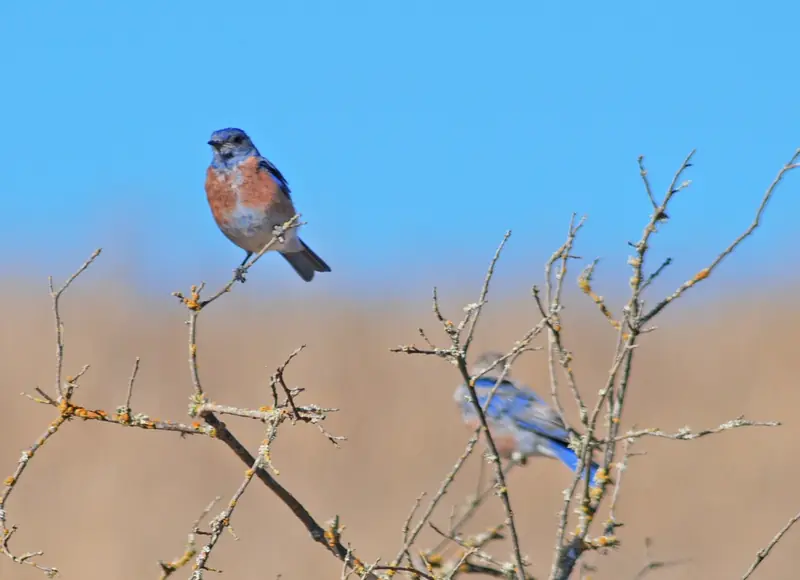
Birds are the big draw. Western bluebirds hunt from fence posts and low branches over the open grass. Hawks circle overhead on most days. A pair of bald eagles nested in a eucalyptus near Felt Lake from 2016 through 2020. Spring brings wildflowers to the slopes. After that the hills turn gold and stay that way until the rains return.
Good to know
- Shade is patchy. Bring water and a hat from May to October.
- Poison oak and ticks grow beside many trails. Stay on the path and check yourself afterward.
- Weekday mornings are quiet. Weekend mornings are busy but rarely crowded on the trail.
- Check the weather guide. Foothill afternoons are often warmer than downtown.
Nearby
Arastradero pairs well with other foothill outings. Continue up Page Mill Road for Foothills Nature Preserve, or drive back toward Stanford for the paved loop at the Dish. Tiny Esther Clark Park is a few minutes away, also off Arastradero Road. For a full list of longer hikes in the Santa Cruz Mountains see our hiking guide. If you are visiting without a bike, you can compare bike rentals in the Bay Area and ride out from town.
Frequently asked questions
How big is Pearson-Arastradero Preserve?
The preserve covers 622 acres. The city bought the first 433 acres in the 1970s and added 189 acres later. About 10 miles of trails cross it.
Are dogs allowed at Arastradero Preserve?
Yes. Dogs must stay on a leash at all times and the leash can be no longer than six feet in city open space. Dogs may not chase or disturb wildlife. There is no off-leash area in the preserve.
Can you ride a bike at Arastradero?
Yes. Bikes share the trails with hikers and horses and helmets are required. Riders yield to hikers and everyone yields to horses. Bikes are not allowed on the trail connection into Foothills Nature Preserve.
Where do you park for Arastradero Preserve?
Use the main lot at 1530 Arastradero Road, next to the gateway facility. Parking is not allowed along some stretches of Arastradero Road, so read the signs. The lot can fill on sunny weekend mornings.
What is the easiest walk at Arastradero?
The walk to Arastradero Lake is the gentlest choice. It is about half a mile each way and mostly flat, with one short rise. The Woodrat Trail is another short option through shaded oak woodland.