On this page
Downtown North is the part of downtown Palo Alto where people actually live. Walk two blocks north from University Avenue and the office buildings give way to cottages, small apartment houses and front gardens under old street trees. The train station sits at one corner and the creek that separates Santa Clara County from San Mateo County runs along the other. In between are some of the oldest residential blocks in the city.
This guide covers where the neighborhood begins and ends, how it grew, what the housing looks like, the parks and schools that serve it and the practical side of living a short walk from Caltrain.
Where Downtown North is
Palo Alto Weekly's neighborhood guide places Downtown North between University Avenue and San Francisquito Creek, with Alma Street on the west and Middlefield Road on the east. In practice the first block or so north of University Avenue is commercial, with hotels, restaurants and offices. The residential character takes over around Lytton Avenue and holds all the way to the creek.
The cross streets continue the downtown grid. High, Emerson, Ramona, Bryant, Waverley, Kipling, Cowper, Tasso and Webster streets run toward the creek. Lytton Avenue, Everett Avenue, Hawthorne Avenue and Palo Alto Avenue cross them. Palo Alto Avenue follows the creek along the northern edge. Across the water lie Menlo Park and East Palo Alto.
The neighbors are easy to place. Downtown and University Avenue are directly south. Crescent Park begins across Middlefield Road to the east. Stanford land and Stanford Shopping Center are across Alma Street and El Camino Real to the west.
How the neighborhood grew
Downtown North was part of University Park, the townsite Timothy Hopkins laid out in 1887 to serve the new university. The grid, the street names and the deed rules of that plan still shape it. Most accounts say Hopkins gave the city land along San Francisquito Creek in 1907, though a 2001 creek marker at El Palo Alto Park says he left it to the city at his death in 1936. That strip is now Hopkins Creekside Park.
Palo Alto Weekly has described Downtown North as Palo Alto's first working-class neighborhood. While professors built shingled houses south of University Avenue in what became Professorville, the blocks to the north filled with more modest homes for working families. Many of the surviving houses are Craftsman cottages and bungalows from roughly 1900 to 1930.
Over the twentieth century the area changed with downtown. Apartment buildings went up among the cottages over the decades. Graduate students and young workers rented rooms and flats within walking distance of the train. Later decades brought more families and young professionals, according to the same Weekly profile. Our history of Palo Alto's founding covers the University Park era in more detail.
Housing in general terms
Downtown North has one of the most mixed housing stocks in the city. On a single block you might see:
- small wood-frame cottages and Craftsman bungalows with front porches
- larger early twentieth century houses, some divided into units
- two and three story apartment buildings from the 1950s through the 1970s
- newer condominiums and townhouses closer to downtown
- remodeled older homes and a few contemporary rebuilds
Lots are generally small by Palo Alto standards, which keeps the streets walkable and the houses close to the sidewalk. Renters make up a large share of residents because of the apartments. Lytton Gardens at 656 Lytton Avenue provides affordable housing for older adults. For the wider market, see our Palo Alto real estate guide.

Parks and the creek
Johnson Park at 268 Waverley Street fills a whole block. The city bought the block in 1968 to give a crowded neighborhood some open space. It was first called Downtown Park North and was renamed in 1986 for Dr. Edith Eugenie Johnson, a longtime Palo Alto physician. It has a playground, a basketball court and shady lawns. Palo Alto Weekly quoted a parent who said local kids identify strongly with the park. Our playgrounds guide compares it with other downtown play spots.
Hopkins Creekside Park is a long, narrow strip of trees and paths beside San Francisquito Creek along Palo Alto Avenue. It is more of a walk than a destination, but it is cool on hot days and good for spotting birds along the creek.
El Palo Alto Park is the smallest of the three. It surrounds the coast redwood that gave the city its name, beside the railroad bridge at Alma Street and Palo Alto Avenue. Arborists put the tree at roughly 1,080 years old. Our guide to El Palo Alto tells its story.
The creek is a neighbor to respect. Parts of north Palo Alto near San Francisquito Creek fall in mapped flood zones. Anyone buying or renting near Palo Alto Avenue should check flood maps and insurance needs for the exact address.
Schools by attendance area
Downtown North is in the Palo Alto Unified School District. A 2019 Palo Alto Weekly neighborhood guide listed these schools for the area:
| Level | School listed for the area |
|---|---|
| Elementary | Addison Elementary |
| Middle | Frank S. Greene Jr. Middle School (formerly Jordan) |
| High | Palo Alto High School |
Attendance areas follow specific streets and the district has redrawn them before. Confirm any address with the PAUSD school finder before you sign a lease or make an offer. Our guide to Palo Alto public schools explains how enrollment works.
Shops, food and errands
Few Palo Alto neighborhoods have more within walking distance. University Avenue, Hamilton Avenue and the side streets of downtown are a few minutes away, with restaurants, cafes, bakeries, banks and pharmacies. The Saturday downtown farmers market runs year-round. For bigger shopping trips, Stanford Shopping Center is across El Camino Real, about a 15 minute walk from the station or a short shuttle ride.
The neighborhood has its own place in tech history too. Facebook rented offices at 471 Emerson Street in 2005 and 2006, on the block between University and Lytton avenues. Our page on Facebook's Palo Alto years has the full story.
Trains, buses and bikes
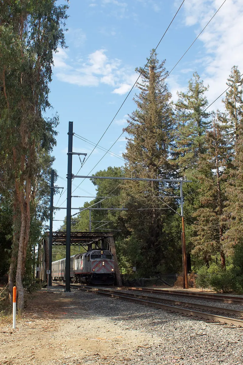
Transit is the neighborhood's biggest advantage. The Palo Alto Caltrain station at 95 University Avenue is at its southwest corner. Electric trains run north to San Francisco and south to San Jose. The station is also the main stop for VTA and SamTrans buses and for the free Stanford Marguerite shuttle. Marguerite's main lines run Monday to Friday. Our guide to riding Caltrain covers fares, zones and schedules.
Bryant Street is the city's best-known bike boulevard and runs through the neighborhood. The railroad crosses Palo Alto Avenue at street level near the creek, one of the city's few remaining level crossings. Expect bells, gates and occasional waits there.
Parking and traffic
Living next to downtown has a price in parking pressure. Palo Alto Weekly reported that commute traffic and nonresident parking led to traffic controls and a residential parking permit program, changes residents described as positive. Today many blocks fall under the downtown residential permit rules. Nonresidents can park only for the posted time limit. See our page on residential parking permits for how the program works and check the city parking page for current rules.
Neighborhood association
Downtown North has had an active residents' group for years. Its main issues have been traffic, parking, creek safety and the future of the Caltrain crossings. Contacts change often, so use the City of Palo Alto's neighborhood association listing or the Palo Alto Neighborhoods (PAN) network to find the current one.
Good to know
- Blocks near Alma Street hear train horns and bells. Blocks closer to Middlefield Road are quieter.
- Many buildings are rentals, so turnover is higher than in most Palo Alto neighborhoods.
- Check flood zone status for homes near San Francisquito Creek.
Visiting Downtown North
A short loop shows the neighborhood well. Start at the Caltrain station, walk north on Alma Street to El Palo Alto Park, then follow Palo Alto Avenue beside Hopkins Creekside Park. Turn south on Waverley Street to Johnson Park and finish on University Avenue for lunch. Allow about an hour.
Hotel Keen at 425 High Street is a block from the station, as our Hotel Keen guide explains. You can also compare hotels near University Avenue. If you want to cover more ground, look for a bike rental and ride the Bryant Street bike boulevard south through University South.
Frequently asked questions
Where is Downtown North in Palo Alto?
Downtown North lies between University Avenue and San Francisquito Creek, with Alma Street and the Caltrain tracks on one side and Middlefield Road on the other. The blocks closest to University Avenue are mostly commercial. The quieter residential streets begin around Lytton Avenue and run north to the creek.
Is Downtown North a good place to live without a car?
It is one of the easiest places in Palo Alto to live car-free. The Palo Alto Caltrain station, the Stanford Marguerite shuttle, VTA buses and the University Avenue restaurants are all a short walk away. Bryant Street is a signed bike boulevard for longer rides.
Which schools serve Downtown North?
A 2019 Palo Alto Weekly neighborhood guide listed Addison Elementary, Greene Middle School and Palo Alto High School. Assignments are made by address and boundaries can change, so confirm any home with the Palo Alto Unified School District school finder.
Is there a park in Downtown North?
Johnson Park at 268 Waverley Street fills a whole block and has a playground and a basketball court. Hopkins Creekside Park runs along San Francisquito Creek and tiny El Palo Alto Park surrounds the historic redwood near Alma Street.
Can you park on the street in Downtown North?
Long-term parking on many residential blocks is limited by the city's downtown residential parking permit program. Visitors can park for posted time limits or use the public downtown garages. Read the signs on each block and check the city's parking pages for current rules.