On this page
Palo Alto's name is Spanish and so is much of its early map. Before there was a town, Californio families held ranchos along the creeks and a woman named Juana Briones ran cattle in the foothills. Mexican-born settlers farmed around Mayfield. Later generations of Mexican and Mexican American workers picked and packed the valley's fruit. Today Latino residents make up a modest share of Palo Alto and a large share of its neighbor East Palo Alto.
This page gathers that history from city records, state landmark files, Stanford and local press. Where sources are thin, it says so. For the land grants in detail, see our page on the Spanish and Mexican era.
The Spanish arrival
The Spanish story here begins with a tree. Members of the Portolá expedition camped by San Francisquito Creek from November 6 to 11, 1769, near a tall redwood they called El Palo Alto. In 1774 Father Francisco Palóu put up a cross at the site and in 1776 Pedro Font mapped and measured the tree. The camp site is California Historical Landmark No. 2.
The same year, Lt. Col. Juan Bautista de Anza and his party passed through the area while choosing sites for the presidio and mission at San Francisco. A 1976 marker placed by the city's Bicentennial Committee at Middlefield and Embarcadero roads records that March 1776 journey. In 1777 Mission Santa Clara de Asís was founded and its grazing lands covered most of future Palo Alto.
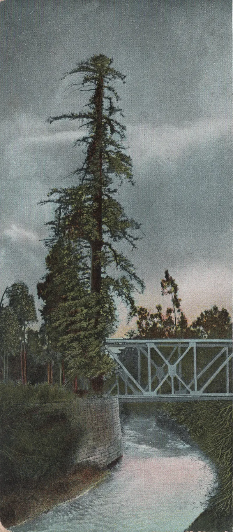

Californio ranchos
Mexico won independence in 1821 and later broke up the mission lands into private ranchos. Several covered parts of today's city:
| Rancho | Grant or purchase | Holder |
|---|---|---|
| Rancho San Francisquito | 1839 | Antonio Buelna |
| Rancho Rinconada del Arroyo de San Francisquito | 1841 | María Antonia Mesa |
| Rancho Rincón de San Francisquito | 1841, sold 1847 | José Peña, then Secundino and Teodoro Robles |
| Rancho La Purísima Concepción | Bought 1844 | Juana Briones de Miranda |
Rafael Soto and María Antonia Mesa had settled near the creek by 1835. The Robles brothers renamed their land Rancho Santa Rita. Some sources date their purchase to 1849 rather than 1847.
American rule changed everything. The Treaty of Guadalupe Hidalgo transferred California to the United States in 1848. The Land Act of 1851 forced rancho owners to prove their titles before a commission and the Robles and Soto families filed claims in 1852. Court action cut the Robles rancho to 6,981 acres by 1863. The 1906 earthquake ruined their old hacienda.
Juana Briones
The best-known Californio in local history is Juana Briones de Miranda. Born around 1802 near Santa Cruz, she was a businesswoman, healer and midwife and one of the early settlers of Yerba Buena, the village that became San Francisco. In 1844 she bought Rancho La Purísima Concepción, about 4,400 acres covering parts of today's Palo Alto and Los Altos Hills. She defended her title in the American courts.
She died near Mayfield on December 3, 1889. She is buried at Holy Cross Cemetery in Menlo Park. Her home site on Old Adobe Road is California Historical Landmark No. 524, though the house itself was taken down in 2011. Juana Briones Park and Juana Briones Elementary carry her name and Miranda Avenue recalls her married name. Our Juana Briones page tells her story in full.
Mayfield's Mexican pioneers
Mayfield, the town that grew from an 1853 roadhouse on El Camino Real, had Spanish speakers from its early days. By 1869 the Mayfield Enterprise newspaper was publishing in both English and Spanish. Our Mayfield page covers the town.
One early resident is still honored by name. The City of Palo Alto says Don Jesus Ramos was a native of Mexico who came to California in search of gold and arrived in the Mayfield area in 1851. A marker titled "The Crossroads of Mayfield," at the playing fields on Page Mill Road and El Camino Real, notes his farm across Page Mill Road in 1856. The same marker recalls that in the 1850s Juana Briones needed three days by wooden cart to haul cattle hides to San Francisco. Ramos Park, opened in 1958 on East Meadow Drive, was later renamed for him.
Orchard and cannery workers
In the 20th century the Santa Clara Valley became one of the world's great fruit regions and Mexican and Mexican American families did much of the work. San José State University's oral history project, Before Silicon Valley, focuses on Mexican agricultural and cannery workers from 1920 to 1960. It describes a period shaped by the Mexican Revolution, the Great Depression and two world wars, when labor and community organizing were at their peak. San Jose was the region's hub, with gathering places such as the Palomar Ballroom and Guadalupe Church.
Palo Alto's own share of that history is less documented. The city's biggest food plant was Thomas Foon Chew's cannery in Mayfield, open from 1918 to 1949. The valley's orchards reached into south Palo Alto until the 1950s. We have not found published records of who made up the Mayfield cannery's workforce, so we do not guess. Our page on orchards and agriculture covers the farm economy.
Stanford's Chicano and Latino students
Chicano and Latino enrollment at Stanford grew through the 1970s along with student organizing. In May 1977 a committee of faculty, staff and students asked the university to give MEChA and related groups a cultural center. Stanford agreed and the center opened in late 1978 in the renovated basement of the Nitery. At a community meeting it was named El Centro Chicano de Estanford.
The center hired its first full-time director in December 1989. It took the name El Centro Chicano y Latino in 2014, reported by the Stanford Daily that September. It is now in the Old Union at 514 Lasuen Mall.
East Palo Alto and the housing question
Housing costs and old covenant rules shaped where Latino families could live on the Midpeninsula. East Palo Alto, across San Francisquito Creek in San Mateo County, incorporated on July 1, 1983. It later became largely Latino and Pacific Islander alongside long-established Black families. It counted 30,034 residents in 2020. See our East Palo Alto page.
Inside Palo Alto the clearest recent example is the Buena Vista Mobile Home Park on El Camino Real, the city's last mobile home park. The Law Foundation of Silicon Valley described its roughly 400 residents as mostly Latino and low-income. When the owners sought to close the park, residents fought the closure. In 2017 Santa Clara County Superior Court Judge Brian Walsh ruled for the residents' association and ordered the city to revise its relocation assistance plan. The Housing Authority of Santa Clara County then approved a plan to acquire the park, with eminent domain as an option, so the residents could stay. Our 2010s page places that fight among the decade's other housing battles.
Latino Palo Alto today
The 2010 census counted 3,974 Hispanic or Latino residents in Palo Alto, about 6.2 percent of the city. The 2020 share was about 7.4 percent. Latino culture shows up across the city:
- Schools. Escondido Elementary has offered a Spanish Immersion program since 1995.
- Events. Día de los Muertos altars and celebrations appear each fall. See our Día de los Muertos page.
- Food. Taquerias and family restaurants line El Camino Real. Our Mexican and Latin American food guide lists them.
Good to know
- The Anza marker sits at the end of Coleridge Avenue near Middlefield and Embarcadero roads. The Crossroads of Mayfield marker is in the playing fields lot at Page Mill Road and El Camino Real.
- For research, start with the Palo Alto Historical Association, San José State's Before Silicon Valley project and the East Palo Alto Community Archive.
Frequently asked questions
Where does the name Palo Alto come from?
It is Spanish for tall stick or tall tree. Members of the Portolá expedition camped by San Francisquito Creek from November 6 to 11, 1769, near a tall redwood they called El Palo Alto. The tree still stands in El Palo Alto Park at Alma Street and Palo Alto Avenue.
Who was Jesus Ramos?
Don Jesus Ramos was a native of Mexico who came to California in search of gold and settled in the Mayfield area in 1851, according to the City of Palo Alto. A marker at Page Mill Road and El Camino Real notes his farm there in 1856. Ramos Park on East Meadow Drive carries his name.
What was the Buena Vista Mobile Home Park fight?
Buena Vista was Palo Alto's last mobile home park, home to about 400 mostly Latino, low-income residents according to the Law Foundation of Silicon Valley. After the owners sought to close it, residents went to court and a Santa Clara County judge ordered the city to revise its relocation plan. The county housing authority then moved to acquire the park so residents could stay.
When was El Centro Chicano founded at Stanford?
Stanford's Chicano student center opened in late 1978 in the basement of the Nitery, after a 1977 proposal by students, faculty and staff. It was renamed El Centro Chicano y Latino in 2014 and is now in the Old Union.
What share of Palo Alto is Latino today?
The 2010 census counted 3,974 Hispanic or Latino residents, about 6.2 percent. The 2020 census share was about 7.4 percent. Neighboring East Palo Alto has a much larger Latino population.