On this page
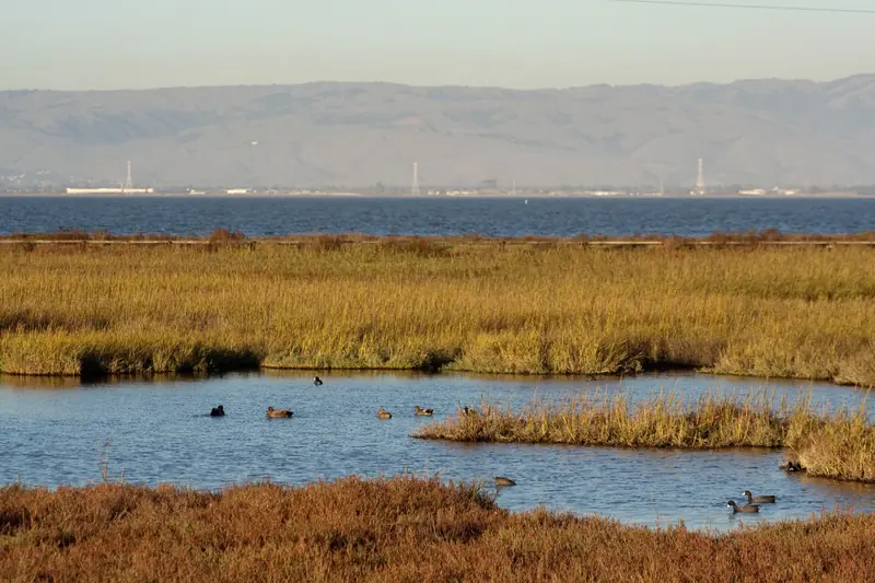
Drive to the end of Embarcadero Road today and you reach a boardwalk over pickleweed, a pond full of ducks and grassy hills with views across the bay. Almost none of it is as old as it looks. In the last hundred years the city dredged, filled, paved and dumped trash on this shoreline. Then residents spent decades fighting to give much of it back to the birds.
This page covers that history: the original marsh, the city engineer's grand plan, the harbor and the pool, the landfill and the preservation fights of the 1960s and 1970s. For trails, hours and birding tips, see our visitor guide to the Baylands Nature Preserve.
The marsh before the city
Before urban development, salt marsh ringed the entire bay. In Palo Alto it reached inland past the line where Highway 101 now runs. Sloughs wound through cordgrass and pickleweed. Ohlone people gathered shellfish and hunted waterfowl here. Shell mounds near the shore marked long use of the bay edge.
The American era brought a different use. A landing at the edge of the marsh served as a transfer point for goods and people bound for San Francisco by water. By the late 1800s much of the marsh near the landing had been drained or diked. Farther south, salt companies turned huge stretches of the South Bay into evaporation ponds. By the 1930s salt making was the biggest commercial use of land around the bay.

John Fletcher Byxbee's plan
The modern Baylands began with one city official. John Fletcher Byxbee Jr. was born in San Francisco in 1878, moved to Palo Alto in 1894 and graduated in the first class of Palo Alto High School. He studied civil engineering at Stanford under C. D. Marx, the founder of the city's utilities. He became city engineer in 1906. He held the job until 1941.
Byxbee saw the marsh as a future playground. At his request the Board of Public Works recommended in 1921 that the city buy its first 40 acres of marshland. Around 1930 he submitted a full plan. It called for a municipal airport, a golf course, a saltwater swimming pool, a yacht harbor, a clubhouse, picnic areas and a playground. The city kept buying land for decades. One local history counts 23 purchases through 1958 that grew the holding to nearly 1,950 acres. Another puts the total at almost 1,880 acres by 1960. Either way, Palo Alto came to own one of the largest municipal shorelines on the bay.
The harbor, the pool and the airport
Much of Byxbee's plan got built. Here is how the pieces arrived:
- Yacht harbor: Developed by 1928 near the old mouth of San Francisquito Creek, with a Sea Scout building added around 1941.
- Creek reroute: In the late 1920s levees moved the creek's mouth north, away from the harbor area.
- Saltwater pool: Built in the 1930s beside Embarcadero Road. It later became today's Duck Pond.
- Airport: Palo Alto Airport moved to the Baylands in 1935. Mud dredged from the harbor helped fill marsh for the runway. Our airport history covers it in full.
- Golf course: The municipal course opened in 1956 on more filled marsh. It was redesigned and reopened as Baylands Golf Links in 2018. See our golf guide.
The harbor never stopped silting up. Dredging was needed every few years. The dredged mud was dumped on surrounding marsh. Environmentalists later estimated the damage at about 500 acres of tidal habitat. After two votes went against further dredging, in 1980 and 1985, the boats left in 1986. Our page on kayaking and paddling tells that fight in detail.
The city dump
Like many bay towns, Palo Alto put its trash on the marsh edge. For decades garbage simply went onto the low ground east of the airport. In 1954 the site became a formal sanitary landfill with more modern operations. It took the city's waste for roughly 60 years in all.
The landfill grew into the only hills on Palo Alto's shoreline. Sections were closed and capped in phases. The first part of Byxbee Park, about 30 acres, opened in 1991 with land art designed for a capped dump where trees cannot root. The landfill stopped taking trash in 2011 and the final sections were capped and opened as Byxbee Park Hills in 2015. The hills still settle. The city made repairs and design changes in 2012 and 2013. Our Byxbee Park guide explains the pole field and the other artworks.
The dump also sparked one of the city's most recent Baylands votes. In 2011 voters approved Measure E, which undedicated about 10 acres of parkland next to the wastewater plant for a possible waste-to-energy facility. The plant was not built. By 2023 environmental groups were urging the council to return the site to parkland. Its future has stayed a live local question.
The fights of the 1960s and 1970s
By the 1960s the Baylands looked like prime real estate. Business buildings were going up along Embarcadero Road. Developers eyed the open marsh. Across the bay, the Save San Francisco Bay Association formed in 1961 to stop the filling of the bay. In Palo Alto a small group of residents took up the same cause on their own shoreline.
The people
- Lucy Evans graduated from Stanford in 1929 and taught at Mayfield School for 23 years. Her persistence earned her the nickname "Baylands Lucy." After she died suddenly in 1978, the nature center was rededicated in her name that December.
- Harriet Mundy moved to Palo Alto in 1949 and lived there until 1977. A birder and lecturer, she circulated a petition that led the City Council to stop a $30 million private proposal to develop the Baylands for commercial and industrial use.
- Florence LaRiviere moved to Palo Alto in 1951. Watching the city's clamshell dredge drop mud on the marsh turned her into an activist. She helped push for a national wildlife refuge in the bay.
- Enid Pearson served on the City Council from 1965 to 1975. She championed the ordinance that bars building on any city park or open space, the Baylands included, without a public vote.
The wins
In 1968 the council named the area the John Fletcher Byxbee Recreation Area, though most people simply called it the Baylands. The first boardwalk over the marsh went up in 1969. In 1972 Congress passed Rep. Don Edwards's bill creating a national wildlife refuge in the South Bay, a campaign LaRiviere and her allies had lobbied for. In 1979 Palo Alto annexed a large area of bayside marsh. Both the 1960s mood of protest and the new environmental laws helped. Our page on Palo Alto in the 1960s covers the wider era.
Restoration in the 1980s and 1990s
Once the threats eased, the work turned to repair. The Harriet Mundy Marsh, stretching from the nature center to Sand Point, was dedicated on October 23, 1982. The end of the yacht harbor in 1986 let tides back into the old basin. In 1992 the Emily Renzel Wetlands project restored salt marsh with bay water and created a 15-acre freshwater pond fed by recycled water from the city's treatment plant. It honors Emily Renzel, who served 12 years on the City Council and spent decades defending the Baylands. The 155-acre site was a former ITT property.
The nature center was renovated in 2017. The boardwalk, closed in 2014 for safety, reopened in 2019 on the same line with wider decking that meets accessibility standards.
Baylands timeline
- 1857: A federal survey maps about 1,142 acres of tidal marsh at the mouth of San Francisquito Creek.
- 1921: The city buys its first 40 acres of marsh.
- By 1928: The Palo Alto Yacht Harbor is in use.
- 1930s: The saltwater pool that becomes the Duck Pond is built.
- 1935: Palo Alto Airport moves to the Baylands.
- 1954: The dump becomes a formal sanitary landfill.
- 1956: The municipal golf course opens.
- 1968: The council names the John Fletcher Byxbee Recreation Area.
- 1969: The first boardwalk is built.
- 1972: Congress creates the national wildlife refuge.
- 1978: The nature center is rededicated to Lucy Evans.
- 1979: Palo Alto annexes a large area of marsh.
- 1982: The Harriet Mundy Marsh is dedicated.
- 1986: The last boats leave the yacht harbor.
- 1991: The first phase of Byxbee Park opens.
- 1992: The Emily Renzel Wetlands project is completed.
- 2011: The landfill closes.
- 2019: The rebuilt boardwalk reopens. Downstream flood work on San Francisquito Creek is completed.
Reading the history on a walk
A one-hour loop shows most of this story. Start at the Duck Pond, the old saltwater pool. Walk to the Lucy Evans nature center and out the boardwalk to open water. Look north toward the former harbor basin, now marsh again. Beyond it run the levees of the rerouted San Francisquito Creek. Then head south past the airport fence to the Byxbee Park Hills, the capped dump. From the top you can see the Renzel ponds and the line of the Bay Trail. Bring binoculars. Winter is the best season for the birds that the whole fight was about.

Frequently asked questions
Was the Palo Alto Duck Pond a swimming pool?
Yes. The pond beside Embarcadero Road was built in the 1930s as a saltwater swimming pool, part of city engineer John Fletcher Byxbee's plan for a bayside recreation area. It later became a pond for ducks, geese and gulls.
Did Palo Alto have a yacht harbor?
Yes. The Palo Alto Yacht Harbor was developed by 1928 near the old mouth of San Francisquito Creek. It needed constant dredging. After voters rejected more dredging in 1980 and a boater-run plan in 1985, the boats left in 1986 and the basin returned to marsh.
Is Byxbee Park built on a dump?
Yes. Byxbee Park sits on top of Palo Alto's former landfill, which took the city's trash for decades and closed in 2011. The first phase of the park opened in 1991 and the last sections were capped and opened around 2015.
Who saved the Palo Alto Baylands?
Many people. Lucy Evans, a teacher known as Baylands Lucy, Harriet Mundy, Emily Renzel, Florence LaRiviere and council member Enid Pearson are the names most often credited. The nature center, two marshes and the city's park dedication rules carry their legacy.
Why is it called Byxbee Park?
It honors John Fletcher Byxbee Jr., Palo Alto's city engineer from 1906 to 1941. He pushed the city to buy its first 40 acres of marsh in 1921 and drew up the plan for the airport, harbor, golf course and pool.