On this page
Drive east on Embarcadero Road past Highway 101 and the city falls away. Within a minute you are on a narrow road between marsh and open water, with pelicans overhead and the hills of the East Bay across the bay. This is the Palo Alto Baylands Nature Preserve, 1,940 acres of protected shoreline owned by the city. It is one of the largest tracts of undisturbed marshland left on San Francisco Bay.
The preserve is free, flat and open every day. It works for a 20-minute stroll on the boardwalk or a long bike ride on the Bay Trail. Birders consider it one of the best spots on the West Coast. Families come for the nature center and the ducks. Everyone else comes for the sunsets.
The preserve at a glance
The Baylands are a patchwork of habitats. Tidal salt marsh covers much of the shoreline, threaded with sloughs that fill and drain twice a day. Behind the levees are freshwater and brackish ponds, a flood basin and grassy hills. About 15 miles of multi-use trails tie it all together.
The preserve also includes some places that are not wild at all. The Palo Alto Airport and the city golf course both sit on land that was once marsh and was filled decades ago. You will also pass the Baylands Athletic Center, used for baseball and softball. Despite those neighbors, the marsh feels remote once you are a few hundred yards down a levee.
Most visitors start near the end of Embarcadero Road, where the nature center, the Duck Pond and the main parking areas sit close together. From there you can head north toward East Palo Alto or south toward Byxbee Park and Mountain View.
The Lucy Evans Baylands Nature Interpretive Center
The nature center stands on pilings at the edge of the salt marsh. It is named for Lucy Evans, a Stanford graduate who taught at Mayfield School for 23 years. She fought so hard to protect the marsh that people called her "Baylands Lucy." After she died in 1978, the center was rededicated in her memory.
Exhibits cover the plants and animals of the marsh. The city reports that the center hosts about 130 classes and camps a year and draws around 80,000 visitors. Hours are limited and change with the season. Call the center at 650-329-2506 or check the city's Baylands page before you plan around it.
The boardwalk
The boardwalk is the signature walk at the Baylands. It runs about a quarter mile from the nature center straight across the marsh to open water. At the end you get a wide view of the bay, the mudflats and on clear days the hills on the far shore.
The first boardwalk went up in 1969. By 2014 most of it had to be closed for safety. The city rebuilt it on the same line with new supports, railings and overlooks. The new version reopened in 2019. It is wider than before and is described as accessible for wheelchairs and strollers, though we could not confirm an official accessibility rating. Our accessible trails guide lists other paved and firm paths nearby. Interpretive stations on the nature center deck explain what you are looking at.
Go at high tide for the most water and the most birds close in. Go at low tide to see the mudflats, the channels and the shorebirds probing for food.

Birding by season
The Baylands sit on the Pacific Flyway, the migration route that runs the length of the Americas. In spring and fall the preserve is a major stopover. In winter it becomes home for huge flocks of ducks and shorebirds. This is the reason birders travel here from around the world.
Late fall and winter
From roughly November to February the marsh is at its busiest. Look for American avocets, black-necked stilts, long-billed curlews, greater yellowlegs and sanderlings on the mud. On the ponds you will find northern shovelers, northern pintails, buffleheads, ruddy ducks, American wigeons and scaup. The highest winter tides flood the marsh and push secretive birds toward the edges. That is your best chance to see the endangered Ridgway's rail, once known as the California clapper rail.
Spring
Migrants pass through on their way north and many birds put on breeding colors. The marsh turns green and songbirds such as marsh wrens and song sparrows are easy to hear.
Summer and early fall
Summer is quieter but rarely empty. American white pelicans often float on the ponds. Egrets and great blue herons hunt the sloughs year round. Northern harriers glide low over the marsh looking for voles. By September the first returning shorebirds show up again.
Bring binoculars and go early. Wind usually builds in the afternoon, which makes viewing harder and birds harder to find.
Trails and the Bay Trail
All the trails are flat, which makes the Baylands a good choice for runners, beginning cyclists and anyone who wants miles without climbing. Here are the most useful routes:
- The boardwalk. About half a mile out and back from the nature center.
- The Duck Pond and nature center area. A short, easy loop for kids and first visits.
- Byxbee Park Hills. Gravel paths over low hills south of Embarcadero Road with wide views of the marsh.
- The Adobe Creek Loop. A longer levee loop on the south side of the preserve near the Mountain View border.
- The San Francisco Bay Trail. The regional shoreline trail runs through the preserve. Head south and you can continue along the shore toward Shoreline Park in Mountain View. Head north and you can continue toward East Palo Alto and Menlo Park.
The trails are open to walkers, runners and cyclists. Bike helmets are required and the speed limit is 15 miles per hour. Skates and other coasting devices are not allowed. If you want to explore by bike without bringing your own, compare bike rentals nearby. The official Baylands map shows all routes and parking areas.
Byxbee Park
Byxbee Park Hills is the rolling, grassy section just south of Embarcadero Road. It is named for John Fletcher Byxbee Jr., the city engineer of Palo Alto from 1906 to 1941. The hills were built over the city's former landfill, which was capped and planted.
The park is known for its land art. A hillside grid of wooden poles is called Pole Field. Another piece, Overview, is a long concrete form that looks like a fish skeleton laid on the ground. The paths here give some of the best views in the preserve, especially in late afternoon.
The Duck Pond
The Duck Pond sits beside Embarcadero Road near the nature center. It was built in the 1930s as a saltwater swimming pool and later became a pond for ducks, geese and gulls. Generations of local kids have made it their first stop in the Baylands. Feeding wildlife is prohibited across the preserve, so leave the bread at home and just watch.
Sunsets and photography
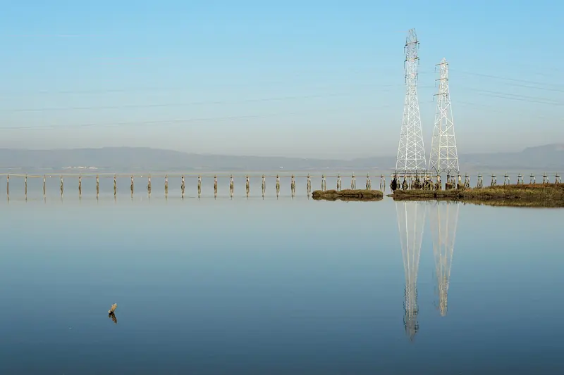
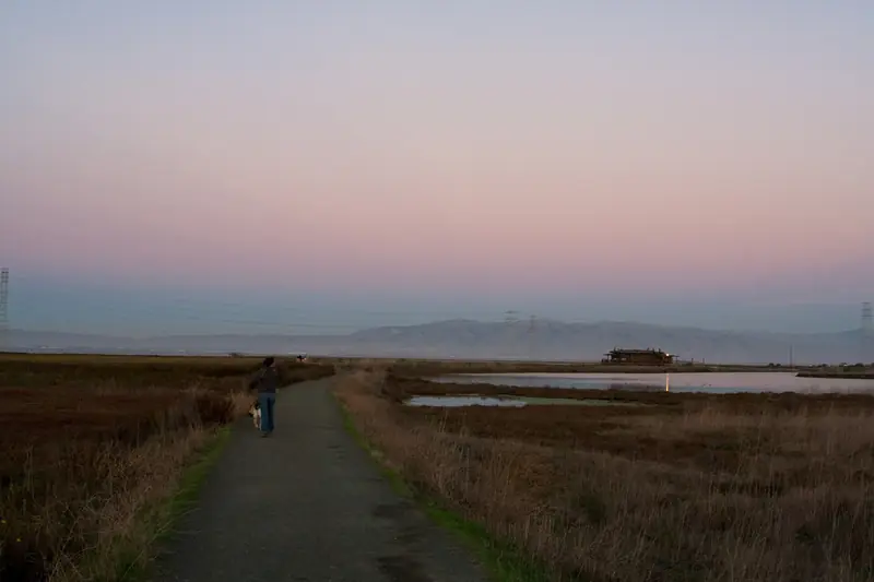
The Baylands face west across the marsh toward the Santa Cruz Mountains. On clear evenings the sun drops behind the ridges and the water and sloughs turn orange and pink. The boardwalk and the tops of Byxbee Park Hills are the favorite viewpoints. The power line towers that cross the marsh make strong silhouettes.
The preserve closes at sunset, so plan to watch the light from near your car rather than from the far end of a levee. Fall and winter often bring the clearest air and the most color. Summer evenings can be windy and cool even after a hot day inland. Our weather guide has month-by-month averages.

Practical tips
The preserve is open every day from 8 a.m. to sunset. Parking in the preserve lots is free. Drive east on Embarcadero Road from Highway 101 to reach the main entrance. There is no public transit to the door, so most people drive or bike.
Good to know
- Dogs must be on a leash and are not allowed on the trails around the Renzel Ponds.
- There is little shade. Bring a hat, sunscreen and water, plus a windbreaker for the afternoon breeze.
- Drones and remote-control aircraft are banned, as are smoking and feeding wildlife.
- Picnic areas and barbecues are first come, first served for groups of up to 24.
The Baylands pair well with other stops in town. Combine a morning walk with lunch on California Avenue or downtown. If you are traveling with children, see our guide to Palo Alto with kids. For more ideas, browse our full list of things to do or compare the Baylands with the other parks and preserves. If you need a base close to the shoreline, compare hotels in Palo Alto.
Frequently asked questions
Is the Palo Alto Baylands free?
Yes. There is no entry fee and parking in the preserve lots is free. Some nature center classes and camps charge a fee.
What are the Baylands hours?
The preserve is open every day from 8 a.m. to sunset. Gates near the Duck Pond and the Byxbee Park Hills lots close at times posted at the entrances. The nature center keeps its own shorter hours, so call or check the city website before you go.
Are dogs allowed at the Baylands?
Yes, on a leash. Dogs are not allowed on the trails around the Renzel Ponds. In open space the leash can be no longer than six feet.
When is the best time to see birds at the Baylands?
Late fall through early spring is peak season for ducks and shorebirds. The highest winter tides push marsh birds such as the Ridgway's rail into view. Early morning is the best time of day.
Can you bike at the Baylands?
Yes. Bikes are allowed on the preserve roads and levee trails. Helmets are required and the speed limit is 15 miles per hour.