On this page
Geocaching is a worldwide hide-and-seek game played with GPS. Someone hides a container, posts its coordinates online and others use a phone app to find it, sign the logbook and put it back. The Peninsula has a dense web of caches along its trails, creeks and shopping streets. Palo Alto's mix of city parks, regional open space and Stanford land makes it a good place to play, as long as you know whose rules apply where.
This guide explains how the game works, what each land manager publishes about caches and how to cache responsibly. We do not list cache coordinates. The official app is the right source for those. It also shows which caches are active.
How geocaching works
- Get the app. The official Geocaching app and geocaching.com offer a free basic membership. A paid tier unlocks more cache types and filters.
- Pick a cache. Each listing shows a difficulty rating and a terrain rating from 1 to 5, the container size, a short description and sometimes a hint.
- Navigate to the coordinates. Phone GPS is accurate to a few yards in the open and worse under trees or near tall buildings, so the final search takes patience.
- Sign the log. Every physical cache holds a logbook or log strip. Bring your own pen.
- Trade if you like. Larger caches hold small trinkets. Take one only if you leave something of equal or greater value.
- Log it online. Record your find, or a "did not find," so the owner knows the cache's condition.
Cache types you will see
- Traditional: a container at the posted coordinates.
- Multi-cache: a chain of stages, each giving clues to the next.
- Mystery or puzzle: you solve a puzzle to get the real coordinates.
- Virtual and EarthCache: no container. You answer questions about a place or a geological feature.
- Adventure Lab: a series of app-based stops with questions to answer at each location.
Rules in Midpen preserves
The Midpeninsula Regional Open Space District, which manages most of the open space in the hills above Palo Alto, has the clearest published rules. According to its geocaching page:
- Its preserves hold more than 350 privately owned caches, which the District monitors. The District also runs a cache series of its own.
- No permit is needed to place or search for a cache.
- Everyone in the program must read and accept the District's Geocaching Agreement and Release of Liability.
- Anyone placing a cache must be a registered geocaching.com user and follow both the District's guidelines and geocaching.com's.
- Placing and searching are allowed only during normal preserve hours.
- Upper La Honda Creek and Bear Creek Redwoods preserves need free advance permits for access.
The District's detailed guidelines cover placement, contents and maintenance. Read them before you hide anything. Questions go to [email protected] or 650-691-1200. One nearby example of the program: the District converted its cache at Ravenswood Open Space Preserve on the bay into a Geocaching Adventure Lab.
Midpen preserves within an easy drive of Palo Alto include Los Trancos, Monte Bello, Windy Hill and Rancho San Antonio. The general preserve rules apply while you hunt: stay on designated trails, keep dogs only where allowed and leave plants and wildlife alone.
Palo Alto's parks and preserves
The City of Palo Alto manages its own open space: Foothills Nature Preserve, Pearson-Arastradero Preserve, Esther Clark Preserve and the Baylands Nature Preserve. The preserves generally close at sunset. Foothills and the Baylands open at 8 a.m. The city posts a rules and regulations page for its preserves, but its text would not load for us, so we cannot summarize a city geocaching policy. Before placing a cache in a city preserve, contact the rangers at (650) 329-2423 and ask.
A few rules apply across city open space and matter to cachers:
- Drones are banned in Palo Alto's parks and open space, so no aerial scouting.
- Leave by closing time. The Foothills gate admits its last car 30 minutes before sunset.
- Keep dogs leashed on a six-foot leash where dogs are allowed. Foothills allows dogs on weekdays only.
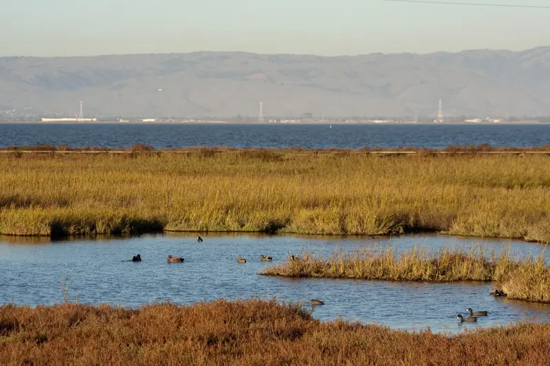
- Stay out of marsh and wetland areas at the Baylands, which protect nesting birds and endangered species.
Neighborhood parks such as Mitchell, Rinconada and Greer see heavy use from families and sports teams. A container hidden in a playground or near a sports field will be found by the wrong people quickly. Small, discreet hides near benches or signposts last longer, with the land manager's permission.
Stanford land
Stanford owns a large share of the open land around Palo Alto. It is private property that the university lets the public use on its own terms. We could not find a published Stanford geocaching policy. A few known rules shape what is possible:
- The Dish. Stanford sets the hours by month, about sunrise to sunset. Visitors must stay on the paved service roads. Dogs, bikes and drones are banned. See our Dish guide.
- Jasper Ridge Biological Preserve is a research preserve closed to the public except on guided tours.
- The central campus is busy with students, staff and events. Hiding containers near buildings can alarm people and may be removed.
Treat any cache on Stanford land as needing university permission and stick to the paths when you search.
Caching responsibly
Geocaching.com's own guidelines and the land managers' rules overlap on the basics:
- Never bury a cache. No digging, trenching or moving rocks to hide a container.
- Get permission. The cache owner must have permission from the land manager.
- Stay on the trail. Social trails to caches erode hillsides and trample plants.
- No food or dangerous items. Food attracts animals and gets containers chewed open.
- Maintain what you hide. Replace wet logs and broken containers or archive the listing.
- Mind poison oak and ticks. Both are common in the foothills. Check yourself after any off-pavement search.
Cache In Trash Out, the game's long-running cleanup tradition, is a good fit here. Grassroots Ecology runs habitat volunteer days at Pearson-Arastradero. Our volunteering guide lists how to join.
Planning a caching day
Palo Alto's weather makes caching possible year-round, but each season changes the plan. Spring brings green hills and wildflowers along with fast-growing grass that hides containers and ticks. Summer afternoons are hot and dry in the foothills, so hunt in the morning and carry more water than you think you need. Fall is the most comfortable season, with clear air and mild days. Winter storms turn foothill trails muddy. Some trails close after heavy rain to prevent damage. Check the city's open space alerts page and Midpen's trail status before you drive up.
- Phone and power. GPS drains batteries quickly. Bring a small power bank.
- Offline maps. Signal is weak in canyons and on parts of the ridge. Download the area before you leave town.
- Pen, gloves and a flashlight. Gloves help with spiky plants and a light helps peer into dark hiding spots.
- Layers. The bay shore is windy most afternoons and the hills cool fast near sunset.

Geocaching with kids
For young children, start with urban caches rated 1 or 1.5 for difficulty and terrain. Short loops through downtown or around a library branch give quick wins. Older kids enjoy multi-caches and puzzles, which turn a family hike into a project. Pack a pen, a few small trade items, water and sun protection. Our family hikes guide suggests easy trails where a cache hunt fits naturally.
Visitors from abroad will want mobile data for the app and maps. You can get a US eSIM data plan before you land.
Frequently asked questions
Is geocaching allowed in Midpen open space preserves?
Yes. The Midpeninsula Regional Open Space District runs a geocaching program and says more than 350 privately owned caches sit on its land. No permit is needed to place or search for a cache, but every participant must accept the District's Geocaching Agreement and Release of Liability and follow its guidelines.
Can I hide a geocache in a Palo Alto park?
Ask first. Geocaching.com requires permission from the land manager for every physical cache. For city preserves such as Foothills, Pearson-Arastradero and the Baylands, contact the Palo Alto rangers at (650) 329-2423 before you place anything.
Can you geocache at night near Palo Alto?
Not in the preserves. Midpen allows caching only during normal preserve hours and Palo Alto's preserves close at sunset. Urban caches on public streets are the only realistic choice after dark. Even then, stay off private property.
Is geocaching allowed at Stanford?
Stanford is private land and we could not find a published geocaching policy. The Dish area has strict rules, including set hours and paved service roads. Jasper Ridge is closed except to tours. Treat campus caches as needing university permission and never go off-trail in Stanford's foothills.
Is geocaching good for kids?
Very. Short urban hunts suit young children and many caches hold small trade items. Choose caches rated low for difficulty and terrain, bring a pen for the logbook and trade even or trade up when you take something.