On this page
Ride west from Palo Alto and the flat grid of the valley ends abruptly at the foothills. Beyond Interstate 280, quiet roads switchback through redwoods and oak woodland to Skyline Boulevard, about 2,000 feet above the bay. On a weekend morning these roads are full of riders on carbon bikes, many of them timing themselves against friends, past selves or the famous names who trained here.
This guide covers the five climbs local riders talk about most: Old La Honda, Page Mill, Kings Mountain, Tunitas Creek and Montebello. Distances and grades come from PJAMM Cycling, a well-known climb database, plus BikeClimbs for Page Mill. Different sources measure from slightly different start points, so expect small differences in what your computer reads. For riding in town, see our biking guide.
The climbs at a glance
| Climb | Distance | Gain | Average grade | Source |
|---|---|---|---|---|
| Old La Honda (Portola Road to Skyline) | 3.3 miles | About 1,300 feet | 7.5% | PJAMM |
| Kings Mountain Road | 4.1 miles | 1,641 feet | 7.5% | PJAMM |
| Montebello Road | 5.2 miles | 2,041 feet | 7.3% | PJAMM |
| Tunitas Creek Road | 9.4 miles | 2,082 feet | 3.9% (5% without the dips) | PJAMM |
| Page Mill Road (Foothill Expressway to Skyline) | About 9.9 miles | About 2,035 feet | 3.9%, with pitches far steeper | BikeClimbs |
Old La Honda Road
Old La Honda is the benchmark. It climbs from Portola Road in Woodside through shaded redwoods to Skyline on a narrow lane with no center stripe. PJAMM Cycling lists 3.3 miles with about 1,300 feet of gain at an average of 7.5 percent and calls the grade remarkably consistent: 99 percent of the climb falls between 5 and 10 percent, the steepest quarter mile is 8.8 percent and the steepest mile is 8.1 percent.
That even grade is why riders compare times on it the way runners compare mile splits. Alto Velo describes its fastest Saturday group as climbing it in 21 minutes or less and its easier Joy Ride at 30 to 35 minutes. Our cycling clubs guide covers those rides. PJAMM notes a wide spot on Portola Road about three tenths of a mile northeast of the start for anyone driving in.
Page Mill Road
Page Mill is the climb you can start from your front door in Palo Alto. It rises from the Stanford Research Park, crosses Interstate 280 and winds past the entrance to Foothills Nature Preserve to Skyline Boulevard at the Monte Bello and Russian Ridge preserves. BikeClimbs, which compiles rider-submitted segments, lists the stretch from Foothill Expressway to Skyline at about 9.9 miles and 2,035 feet of gain, an average of just 3.9 percent. The average hides the truth. Short ramps above Interstate 280 are much steeper and BikeClimbs records a maximum gradient of 17.6 percent.
- The lower section carries commuter traffic on weekdays. Ride it early on weekends.
- Above the preserve entrances the road narrows and the descent has tight, blind corners.
- At the top, Midpen's Monte Bello lot at 4301 Page Mill Road is a common regroup spot.

Kings Mountain Road
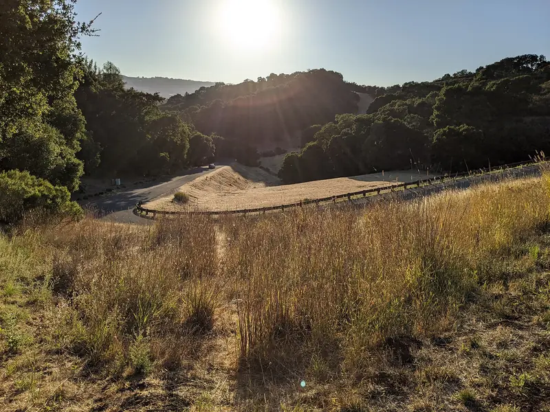
Kings Mountain Road climbs from Woodside past the entrance to Huddart Park to Skyline Boulevard, about 1.5 miles north of the Skeggs Point lot. PJAMM lists 4.1 miles with 1,641 feet of gain at an average of 7.5 percent, the same average as Old La Honda over a longer distance. It feels steeper in places and the redwood canopy keeps it cool on hot days. Riders often go up Kings, ride south along Skyline and descend Old La Honda or Highway 84. Watch for cars turning into Huddart Park and for hikers and runners crossing at trailheads.
Tunitas Creek Road
Tunitas Creek is the epic one. It starts near the coast south of Half Moon Bay and climbs through a deep, mossy gulch to Skyline, so most riders from Palo Alto reach it after crossing the ridge and descending to the ocean side first. PJAMM lists 9.4 miles with 2,082 feet of gain and calls it the most scenic climb in San Mateo County. The average of 3.9 percent includes dips; without them it is about 5 percent. The hard part comes in the redwoods, where PJAMM puts the steepest mile at 8.6 percent and about half a mile at 10 to 15 percent.
The road is narrow with no center stripe and services are scarce. Carry food, water and a layer, since the coast side is often foggy and damp. After big storms, check San Mateo County road alerts before you go.
Montebello Road
Montebello Road climbs from the western tip of Stevens Creek Reservoir above Cupertino toward Black Mountain. PJAMM lists 5.2 miles with 2,041 feet of gain at 7.3 percent, but it is the shape that hurts: the first 1.5 miles average nearly double digits, the steepest quarter mile is 12.3 percent and a continuous half mile runs at 10.6 percent. The top gives wide views east to Mount Hamilton, Moffett Field's hangars and Mount Diablo. The paved road ends at a gate, so on a road bike this is an out-and-back. Our Stevens Creek County Park guide covers the reservoir at the bottom.
Highway 84 and road safety
Highway 84, also called La Honda Road, links Woodside with Skyline at Sky Londa and drops to La Honda and the coast. It is a state highway with few shoulders, tight curves and motorcycles on weekends. Caltrans began a resurfacing project between La Honda and Woodside on September 14, 2026 and expects work to continue through winter, with one-way traffic control in places. Our La Honda guide has the details. Check Caltrans QuickMap before any ride that uses it.
Good to know
- Passing: California law requires drivers to give cyclists at least 3 feet when passing. Ride predictably and single file on narrow roads.
- Lights: use a front and rear light by day. Redwood shade makes riders hard to see.
- Descents: these roads are narrow and blind. Stay on your side of the road and brake before corners, not in them.
- Weather: Skyline can be much cooler and foggy when Palo Alto is warm. Carry a jacket. Wet leaves make winter descents slick.
- Water: few stops exist on the ridge. Fill bottles in Woodside or Palo Alto.
- Helmets: required by state law under 18 and wise for everyone.
Training for the climbs
If you are new to the hills, start with Old La Honda. Its steady grade teaches pacing better than any other local climb. Ride it at a pace you could hold for an hour, note your time and come back in a month. Kings Mountain is the natural next step, with the same average over a longer distance. Save Montebello for when you have gears low enough to spin up double-digit grades. Many riders fit a compact crankset and a wide-range cassette for these roads.
Putting rides together
Most riders link two climbs with Skyline Boulevard. A classic short loop from Palo Alto goes out through Portola Valley, up Old La Honda, north on Skyline and down Kings Mountain into Woodside. A longer day climbs Old La Honda, descends Highway 84 to San Gregorio, heads north on Stage Road and Highway 1 and returns up Tunitas Creek. Check our weather guide for the season and our list of bike shops for tune-ups. Visiting without a bike? You can compare road bike rentals in the Bay Area.
Frequently asked questions
How long and steep is Old La Honda?
PJAMM Cycling measures the climb from Portola Road in Woodside to Skyline Boulevard at 3.3 miles with about 1,300 feet of gain and an average grade of 7.5 percent. It says 99 percent of the climb sits between 5 and 10 percent, with the steepest mile at 8.1 percent. That steady grade makes it the local benchmark.
What is the hardest road climb near Palo Alto?
For steepness, Montebello Road above Cupertino stands out. PJAMM lists 5.2 miles at 7.3 percent with a steepest quarter mile of 12.3 percent and nearly double-digit grades in the first 1.5 miles. Tunitas Creek is longer but gentler on average.
How long does it take to climb Old La Honda?
It depends on fitness. Alto Velo describes its fastest group ride as climbing it in 21 minutes or less, its women's rides at 25 to 30 minutes and its Joy Ride at 30 to 35 minutes. Many first-timers take longer, which is normal.
Is Highway 84 safe for cycling?
It is a narrow, winding state highway with few shoulders, many blind curves and motorcycles on weekends. Caltrans began resurfacing it between La Honda and Woodside in September 2026, with one-way traffic control in places through winter. Many riders use Old La Honda or Kings Mountain instead and check Caltrans QuickMap before riding.
Where do group rides start for these climbs?
Alto Velo's Saturday rides meet at Summit Bicycles on California Avenue at 9 a.m. The Western Wheelers post rides from parks and lots around the Peninsula, rated by pace and hilliness. Our cycling clubs guide lists the details.