On this page
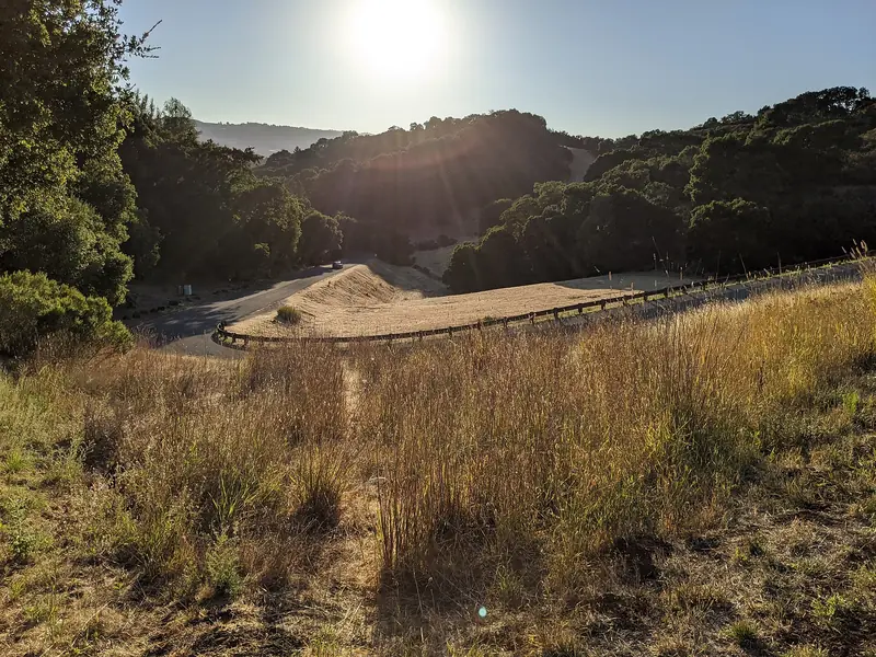
Most foothill roads near Palo Alto make you pay for height with steep pitches. Alpine Road does it slowly. It starts near the Stanford Dish, follows San Francisquito Creek past Ladera, runs through the middle of Portola Valley and keeps climbing up a narrowing canyon until the pavement ends below Skyline Boulevard. Turn around there and nearly the whole way home is downhill.
This page treats Alpine Road as an out-and-back from Palo Alto station. The lower part also forms one side of the Arastradero loop and the Portola Valley Loop, so you can mix and match. For steeper climbs, see our road cycling climbs guide.
The ride at a glance
Our numbers come from tracing the route on OpenStreetMap with a cycling router and sampling U.S. Geological Survey elevation data. Alpine Road climbs from roughly 150 feet near Stanford to around 900 feet at the end of the pavement. Read every figure here as an estimate.
| Section | Character | Approximate distance one way |
|---|---|---|
| Palo Alto station to Alpine Road | Flat to rolling through Stanford and on Sand Hill Road | About 3 miles |
| Junipero Serra to the Alpine Inn | Gentle climb past Ladera, Interstate 280 interchange | About 4 miles |
| Alpine Inn to Portola Road | Steady creekside climb | About 1 mile |
| Portola Road to the end of pavement | Steeper, narrower, wooded | About 2 to 3 miles |
| Round trip | About 20 miles, 900 to 1,100 feet |
Start and Caltrain
From Palo Alto station, ride up Palm Drive and turn right on Arboretum Road, which leads to Sand Hill Road beside Stanford Shopping Center. Follow Sand Hill west past the hospital to Santa Cruz Avenue, then turn left to reach the junction where Alpine Road begins at Junipero Serra Boulevard. If you prefer to drive, street parking near the junction is limited. Many riders park in Palo Alto and ride out.
Caltrain's electric trains carry two bike cars with room for 36 bikes each. On weekends, trains run about every 30 minutes.
Turn by turn
- Palm Drive and Arboretum Road to Sand Hill Road.
- Sand Hill Road west past Stanford Shopping Center and Stanford Hospital to Santa Cruz Avenue. Turn left.
- Alpine Road. At the junction with Junipero Serra Boulevard, bear right onto Alpine Road. It passes the homes of Stanford Weekend Acres along the creek.
- Interstate 280. Alpine crosses the freeway at an interchange. Watch every ramp.
- Ladera. The road passes the Ladera Country Shopper and climbs gently into Portola Valley.
- Arastradero Road junction. Rossotti's Alpine Inn is on the corner. Keep straight on Alpine.
- Portola Road junction. About a mile on, at Triangle Park and Roberts Market, keep left on Alpine Road. Portola Road goes right.
- Upper Alpine Road. Past Willowbrook Drive the houses thin out and the canyon narrows. Climb until the pavement ends, then turn around and descend the same way.
Surface and traffic
The road is paved all the way to the turnaround. Below Portola Valley it carries steady local traffic and has a bike lane or shoulder for most of its length. A separate path runs beside parts of Alpine Road between Ladera and Portola Valley, used by walkers, equestrians and slower riders. It is not the place for a fast descent.
Above Portola Road the character changes. The road gets narrower, the shoulder comes and goes and blind curves hide oncoming cars. Traffic is light, mostly residents, trail users and other cyclists. On the descent, stay on your side of the road and brake before the bends. Wet leaves and gravel collect in the shade from late fall onward.
Beyond the pavement: the Alpine Road Trail
Where the asphalt ends, the old road continues as a dirt route through Coal Creek Open Space Preserve, which Midpen manages. Its Coal Creek page mentions cyclists on the Alpine Road Trail. It is a gravel or mountain bike route, not a road bike route. Midpen allows bikes only on designated trails, requires helmets, sets a 15 mph limit (5 mph when passing) and does not allow e-bikes on most of its trails. Bikes yield to hikers and horses.
Midpen lists a tiny Upper Alpine roadside parking area with 7 spaces, open to hikers, cyclists and riders. Its Silicon Valley Vista Point pullout on Skyline Boulevard, owned by Caltrans, was listed as temporarily closed. On the Skyline side of the ridge, the road riders call West Alpine drops toward the coast. That is a separate and much bigger ride.

Water, restrooms and food
- Rossotti's Alpine Inn, 3915 Alpine Road. Its website lists the beer garden as closed Monday, open from 11:30 a.m. Tuesday to Friday and from 10:30 a.m. on weekends, when it serves brunch until 2:30 p.m. It takes no reservations. Our Woodside food guide covers its history.
- Roberts Market, 4420 Alpine Road. The Portola Valley store has a deli. Its website, updated in November 2026, says the stores close on Thanksgiving Day.
- Triangle Park, at Alpine and Portola roads. The town describes it as a place for cyclists and walkers to take a break, with picnic tables. It does not list restrooms.
We could not confirm a public restroom or drinking fountain on Alpine Road from an official 2026 page. Midpen lists no restrooms at Coal Creek. Midpen shows a restroom icon on its Windy Hill page without saying where it is. Fill two bottles before you leave and use the Alpine Inn or Roberts Market as a customer.
Closures we checked
- Coal Creek. Midpen's page said "No reported trail closures" when we checked in November 2026. The Vista Point parking on Skyline was temporarily closed.
- Windy Hill. Midpen listed the connector between the Hamms Gulch and Eagle trails as closed for bridge repairs from November 3 to 6 and told trail users to bypass it on Alpine Road. Expect a few more hikers on the road that week.
- Roads. We found no road closures on Alpine Road. Caltrans posted no work on it, since it is a county and town road.
Safety
Good to know
- Three-foot rule: California drivers must leave at least 3 feet when passing a bicycle and, since 2023, change lanes to pass when another lane is free.
- Lights: required after dark (white front, red rear reflector). The upper canyon is dim even at midday, so use them anyway.
- Helmets: required for riders under 18 by state law and for everyone on Midpen trails.
- Descending: the way home is fast. Control your speed on the narrow upper section and expect cars backing out of driveways in Ladera.
Seasons
Alpine Road is shaded in its upper canyon, which makes it a good summer choice when open ridges bake. In winter the same shade keeps the road damp and the dirt trail beyond the pavement can be muddy for days after rain. Midpen may close trails to bikes in wet conditions. Daylight saving time ended on November 1, 2026, so plan to be off the upper road well before sunset. For background on the town, see our Portola Valley guide and our weather guide for rain and heat by month.
Frequently asked questions
How long is the Alpine Road ride from Palo Alto?
Our estimate is about 20 miles round trip from Palo Alto station to the end of the pavement and back, with roughly 900 to 1,100 feet of climbing. Alpine Road itself is about 7 miles from Junipero Serra Boulevard to the end of the pavement. These figures are approximate.
Does Alpine Road go through to Skyline Boulevard?
Not on pavement. Above Portola Valley the paved road ends and the old route continues as the Alpine Road Trail, a dirt route through Midpen's Coal Creek Open Space Preserve toward Skyline. It suits mountain or gravel bikes. Midpen's bike rules apply there.
Is Alpine Road a hard climb?
Not by local standards. The lower miles through Ladera are gentle and the climb steepens past Portola Valley. Most riders find it a steady effort rather than a wall. The descent back is the reward.
Where can I stop for food on Alpine Road?
Rossotti's Alpine Inn at 3915 Alpine Road opens from 11:30 a.m. Tuesday to Friday and 10:30 a.m. on weekends, per its website. Roberts Market at 4420 Alpine Road, at the Portola Road junction, has a deli. Triangle Park next to it has picnic tables.
Are there closures on Alpine Road?
We found no road closures in early November 2026. Midpen's Coal Creek page reported no trail closures, though its Silicon Valley Vista Point parking on Skyline is temporarily closed. At Windy Hill, Midpen listed a trail connector closed for bridge repairs November 3 to 6 and suggested Alpine Road as the bypass.