On this page
The North Bay sits on the far side of the Golden Gate from the Peninsula. Marin County, Sonoma County and Napa County are close to Palo Alto in miles but every route has a choke point. Drivers cross the Golden Gate Bridge and then work through San Francisco, or loop through the East Bay over two more bridges. Transit riders combine a train, a ferry and Caltrain.
This page covers the trip from Marin, Sonoma and Napa. Heading north instead? See our day trips to Sausalito and Marin and Napa and Sonoma.
The options at a glance
| Route | Rough time from San Rafael | Toll |
|---|---|---|
| Golden Gate Bridge, then I-280 or US 101 | 1 to 1.5 hours | Golden Gate, southbound |
| Richmond-San Rafael Bridge, then a bay bridge west | 1.25 to 2 hours | San Mateo or Dumbarton, westbound |
| SMART or bus to Larkspur, ferry, Caltrain | 3 hours or more | Fares only |
Times are estimates for light to moderate traffic. Rush hours around San Francisco and on the bridges can double them.
Driving over the Golden Gate Bridge
From Marin, the most direct drive is US 101 south over the Golden Gate Bridge. In San Francisco you have two ways to reach the Peninsula:
- Park Presidio, 19th Avenue and Interstate 280. Follow State Route 1 through Golden Gate Park and down 19th Avenue to Interstate 280. It has traffic lights but usually flows. Leave 280 at Sand Hill Road for Stanford or at Page Mill Road for California Avenue.
- Through the city on US 101. Follow Lombard Street and Van Ness Avenue to the Central Freeway and US 101 south. It is direct on the map but slow at busy hours.
From San Rafael the trip is about 50 miles. From Petaluma it is about 70 and from Santa Rosa about 95. Our driving guide lists the Palo Alto exits from both freeways.
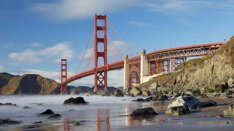

Golden Gate Bridge tolls by plate or FasTrak
The bridge has no toll booths and takes no cash at the plaza. The Golden Gate Bridge District collects the toll in one direction only, southbound into San Francisco. These rates took effect July 1, 2026, per the district's tolls page:
| Payment method | Two-axle car or motorcycle |
|---|---|
| FasTrak toll tag | $10.25 |
| License Plate Account or One-Time Payment | $10.50 |
| Toll Invoice mailed to the owner | $11.25 |
| Eligible carpool with FasTrak | $8.25 |
Paying by plate
If your car has no FasTrak tag, cameras photograph the front and rear plates. You then have three choices:
- One-Time Payment. Pay online or by phone up to 30 days before you cross or within 48 hours after. The district recommends this for visitors with out-of-state or foreign plates.
- License Plate Account. Register up to five plates and the toll is charged to your card each time you cross, with no prepaid balance when you use a credit card.
- Toll Invoice. Do nothing and an invoice goes to the registered owner. The invoice carries the toll only, but an unpaid invoice turns into a violation with a $25 penalty per crossing.
Rental cars are different. The district says renters must check the rental company's toll program, which often adds a fee. Ask at the counter before you head south.
The East Bay loop
From central or eastern Marin, or from Sonoma and Napa, the East Bay can be the better route. Cross the Richmond-San Rafael Bridge on Interstate 580, follow Interstate 80 and Interstate 880 south and cross back over the San Mateo Bridge (State Route 92) or the Dumbarton Bridge (State Route 84). From Napa or Sonoma, State Route 37 and Interstate 80 lead to the same freeways.
Bay Area bridges toll in one direction. On this loop you pay once, on the westbound San Mateo or Dumbarton crossing toward the Peninsula: $8.50 for a car in 2026. The Metropolitan Transportation Commission reports a FasTrak rate of $9.00 from January 1, 2027. Interstate 880 is one of the region's slowest freeways at rush hour, so check live traffic before choosing. Our guide to getting here from the East Bay covers the bridges in more detail.
SMART, ferry and Caltrain
Without a car, the published way to make the trip is a three-part journey: the SMART train to Larkspur, the Golden Gate Ferry to San Francisco and Caltrain to Palo Alto.
1. SMART to Larkspur
The SMART train runs between Windsor and Larkspur, with stops including the Sonoma County Airport, Santa Rosa, Petaluma, Novato and San Rafael. Extensions to Healdsburg and Cloverdale are planned. Fares are $1.50 per zone for adults, while youth 18 and under and seniors 65 and over ride free. Riders with disabilities or Medicare pay half. A $10 Weekend Day Pass is sold in the SMART e-Tickets app. SMART's schedule marks which trains connect with ferries at Larkspur. It flags connections under 10 minutes as not recommended if you are walking between the station and the ferry terminal.
2. Golden Gate Ferry to San Francisco
Ferries from Larkspur reach the San Francisco Ferry Building in about 35 minutes on the times SMART publishes for its connections. An adult fare was $9.50 with Clipper or a contactless bank card and $14.00 with a paper ticket on the Golden Gate Ferry fares page. Tap once when you board at Larkspur. Weekend schedules differ from weekdays, so check the ferry timetable too.
SMART's $10 Sail and Rail combo ticket, which covered one SMART ride and one ferry trip, is ending. SMART says the last day to buy it was October 31, 2026 and tickets can be used through November 30, 2026.
3. Across San Francisco to Caltrain
Caltrain's San Francisco terminal is at Fourth and King streets, beside Oracle Park. SMART describes the Ferry Building to Oracle Park walk as 1.2 miles, about 25 minutes, or a 15 minute Muni ride. From Fourth and King, express trains reach Palo Alto in about 40 minutes. It is a three zone ride, $8.50 for an adult in October 2026 and $9.00 from January 1, 2027. Our guide to getting here from San Francisco covers the Caltrain leg in detail.
Put together, a trip from Santa Rosa takes four hours or more. From San Rafael or Larkspur it is closer to three. Golden Gate Transit also runs buses from Marin and Sonoma into San Francisco, which can replace the train and ferry legs. Check its schedules on the same district site.
When to travel
- Weekday mornings: southbound traffic into San Francisco is heavy from Marin. The ferry and train avoid it.
- Friday and Sunday afternoons: wine country and coast traffic fills US 101 and State Route 37.
- Fog: the Golden Gate is often socked in during summer mornings. It slows traffic more than it closes anything.
- Late evenings: ferries and SMART thin out. Plan the return before you go.

Good to know
- FasTrak warns that it never asks for toll payments by text message. Ignore texts that demand bridge tolls.
- Driving down for a few days? You can compare rental cars in Santa Rosa or San Rafael and ask about toll programs before you book.
- Muir Woods and Point Reyes are in the North Bay too. See our Muir Woods guide if you are combining trips.
Arriving in Palo Alto
Caltrain stops at Palo Alto station, at the foot of University Avenue. Drivers on Interstate 280 reach Stanford and downtown in a few minutes from the Sand Hill Road exit. Our Caltrain guide covers the return trip. If you plan to stay, compare hotels near Palo Alto station.
Frequently asked questions
How much is the Golden Gate Bridge toll?
From July 1, 2026, a two-axle car pays $10.25 with FasTrak, $10.50 with a License Plate Account or One-Time Payment and $11.25 by mailed Toll Invoice. The toll is collected only southbound, into San Francisco, so you pay it on the way to Palo Alto from the North Bay.
How do I pay the Golden Gate Bridge toll without FasTrak?
There are no cash lanes. Cameras read your plate and you can make a One-Time Payment online or by phone up to 30 days before crossing or within 48 hours after. Otherwise an invoice goes to the registered owner. Rental cars follow the rental company's toll program, so ask at the counter.
Can I get from Santa Rosa to Palo Alto by train?
Yes, with three legs. Ride SMART to Larkspur, take the Golden Gate Ferry to the San Francisco Ferry Building, then get to Caltrain at Fourth and King and ride south to Palo Alto. Expect the whole trip to take four hours or more.
Is the Sail and Rail ticket still available?
SMART says its $10 Sail and Rail pilot, which combined a one-way SMART ride and a one-way Golden Gate Ferry trip, ends November 30, 2026. The last day to buy it was October 31, 2026. Tickets already bought can be used through November 30.
How long is the drive from Marin to Palo Alto?
From San Rafael it is about 50 miles. Allow about an hour in light traffic and much longer at rush hour, when the Golden Gate Bridge approaches and San Francisco streets slow down.