On this page
Muir Woods is a narrow canyon of old-growth coast redwoods on the lower slopes of Mount Tamalpais, about 12 miles north of the Golden Gate Bridge. The trees here escaped logging because the canyon was too steep to reach easily. In 1905 William Kent and Elizabeth Thacher Kent bought the land to protect it and in 1908 President Theodore Roosevelt proclaimed it a national monument. Kent asked that it be named for the naturalist John Muir.
It is a small park and a crowded one. A flat boardwalk runs along Redwood Creek past trees that reach more than 250 feet, most of them several centuries old. From Palo Alto it is a long half-day on its own, so most people pair it with Muir Beach, Mount Tamalpais or Sausalito. The catch is access. You cannot simply drive up and park. This guide explains the reservation system exactly as the National Park Service and its concessioner publish it in late 2026, then covers the trails and the best ways to round out the day. For a comparison with the groves closer to home, see our redwood forests guide.
Getting there from Palo Alto
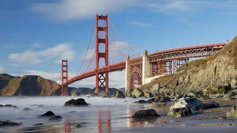
The drive is about 50 miles. Take Interstate 280 north into San Francisco, follow 19th Avenue and Park Presidio Boulevard through Golden Gate Park and cross the Golden Gate Bridge on US 101. In Marin, take the Highway 1 exit toward Stinson Beach and Mill Valley, then follow the signs up Panoramic Highway and down Muir Woods Road. Plan on about 1.5 hours each way with light traffic. Weekend mornings in San Francisco and the last few miles of winding road can easily add half an hour.
- The Golden Gate Bridge charges its toll southbound only, on your way home. It has no cash lanes. Rental cars are billed through the rental company.
- Muir Woods Road is steep and twisty. Vehicles longer than 35 feet are not allowed at all and anything over 17 feet needs an oversized reservation.
- There is no cell service or Wi-Fi at or around the park. Download your reservation and an offline map before you leave home.
- Leave Palo Alto by 7:30 a.m. if you want one of the first arrival windows.
If you do not have a car, the cleanest option is a guided trip. Many Muir Woods tours from San Francisco handle the driving and the reservation. You can reach their pickup points on Caltrain. To drive yourself you can compare rental cars from Palo Alto or SFO for the day.
Parking and shuttle reservations, as published
Since 2018 the park has used a reservation system run by ACE Parking, an NPS concessioner, at GoMuirWoods.com. The rules below come from that site and the NPS Know Before You Go page, last updated in August 2026.
- Every vehicle needs a reservation. Parking is not sold in the lots. Reservations frequently sell out on weekends and holidays.
- Pick the right size. Standard parking for vehicles under 17 feet costs $10. Medium spaces for 17 to 22 feet cost $30 and large spaces for 22 to 35 feet cost $45. There are only six of each oversized type and those stays are limited to 1 hour and 45 minutes.
- Arrive inside your 30-minute window. Standard, accessible and EV reservations come with a 30-minute arrival window. Once parked you can stay until closing. The NPS says arrivals less than 20 minutes outside the window will very likely be accommodated and you can call ACE Parking at 800-410-2419 if you are running well early or late.
- Accessible and EV spaces are booked too. The ten accessible spaces cost $10. The two EV charging spaces cost $13, which includes a $3 charging fee.
- No reservation needed if you walk, bike or use a rideshare. But there is no signal to call a ride home. The visitor center has limited Wi-Fi and a pay phone.
The Muir Woods shuttle
The shuttle runs from the Larkspur Ferry Terminal at 101 East Sir Francis Drake Boulevard to the park entrance. According to GoMuirWoods.com it operates Friday through Sunday and on federal holidays from early spring through September, then on Saturdays and Sundays only in October. Tickets cost $4 per adult round trip and riders 15 and under go free. You need a reservation for both the ride out and the ride back. Parking at the ferry terminal is free on weekends and federal holidays. As of November 1 the 2026 season is over, so plan on driving until it returns in spring 2027.
The car-free version from Palo Alto is long but doable in season: Caltrain to San Francisco, a Golden Gate Ferry from the Ferry Building to Larkspur, then the shuttle. Allow about three hours each way.
Entrance fees and hours
Parking and entrance are separate charges. The NPS fees page lists these for 2026:
| Item | Price | Notes |
|---|---|---|
| Entrance, ages 16 and up | $15 per person | Buy with your reservation or at the visitor center |
| Entrance, under 16 | Free | |
| Muir Woods annual pass | $45 | US citizens and residents; holder plus three adults |
| America the Beautiful pass | $80 residents, $250 nonresidents | Covers entrance for the holder plus three adults |
| Standard parking reservation | $10 per vehicle | Not covered by any pass |
Entrance fees never sell out. Parking does. Muir Woods is open every day of the year from 8 a.m. until about sunset, with closing times that shift through the seasons. The visitor center opens at 8 a.m. and closes 30 minutes before the park. The cafe and gift shop run from 9 a.m. until about an hour before closing and hot food starts at 11 a.m. Eating is allowed only in the entrance plaza and on the cafe patio, not in the forest. Pets, bikes, smoking and picnics are not allowed on the park's trails.
The main trail and its three loops
Almost everyone walks the main trail, which starts at the entrance plaza and follows Redwood Creek up the canyon on both banks. The NPS lists it as 2 miles with just 30 feet of elevation gain. The surface is a mix of boardwalk, asphalt and packed earth. Four footbridges cross the creek, so you choose your loop by where you turn back.
| Loop | Distance | Time | Surface |
|---|---|---|---|
| To Bridge 2 | About 0.5 mile | About 30 minutes | Boardwalk, stroller and wheelchair friendly |
| To Bridge 3 | About 1 mile | About 1 hour | Mostly accessible; the west side between bridges 2 and 3 is rougher |
| To Bridge 4 | About 2 miles | About 1.5 hours | Retrace to Bridge 3 to stay on the accessible route |
The highlights come early. Founder's Grove is near the start and Cathedral Grove, a quiet stand where the Park Service asks visitors to keep their voices down, lies between bridges 2 and 4. In May 1945 delegates who had come to San Francisco to draft the United Nations Charter held a memorial for Franklin Roosevelt there. For a slightly higher view, return from Bridge 4 on the Hillside Trail, a narrow dirt path above the creek with a few steps.
Longer hikes into Mount Tam
Muir Woods is surrounded by Mount Tamalpais State Park, so trails climb out of the canyon in every direction. Two good choices:
- Fern Creek to Camp Alice Eastwood: a family favorite that follows a fern-lined side creek, then loops back on the Plevin Cut or Camp Alice Eastwood Trail.
- Ben Johnson and Dipsea loop: a steep climb through redwoods to grassy ridges with views of the ocean and San Francisco, returning on the Dipsea Trail. The Redwood Creek footbridge on the Dipsea closes every winter for coho salmon spawning, which adds about 0.75 miles on fire road and pavement.
Our guide to the best hikes in and near Palo Alto has redwood walks that need no reservation at all.
Pairing with Muir Beach
Muir Beach is a crescent of sand and a lagoon where Redwood Creek meets the ocean, a short drive down Muir Woods Road and Highway 1. It is part of the Golden Gate National Recreation Area and closes one hour after sunset. Picnics are allowed here, unlike in the woods, so it is the natural place for lunch. The surf is cold and rough, so treat it as a walking beach.
You can also walk there. The NPS describes a route that follows Muir Woods Road for half a mile, then picks up the Redwood Creek Trail to Highway 1 and Pacific Way. Note that this trail has no redwoods and plenty of poison oak and ticks. Before you leave the area, stop at the Muir Beach Overlook on Highway 1 just north of the beach for a big view down the coast. On the way home, the drive to Sausalito and the Marin Headlands takes about 25 minutes.
Pairing with Mount Tamalpais
From the top of Muir Woods Road, Panoramic Highway climbs past Mountain Home and Pantoll to the summit roads of Mount Tamalpais State Park. A morning in the redwoods followed by sunset on East Peak is one of the best single days in Marin. Mount Tam has no entrance fee but charges for parking at East Peak, Pantoll and Bootjack. Our Mount Tamalpais guide covers the summit, the West Point Inn and the Mountain Theater in detail. The two parks share a trail network, so strong hikers can climb from Muir Woods to East Peak on foot on the all-day route the NPS describes via the Canopy View, Hogback and Old Railroad Grade.
A sample day
- 7:30 a.m. Leave Palo Alto with your parking reservation saved offline.
- 9 a.m. Arrive in an early window, when the canyon is quietest. Walk the Bridge 4 loop.
- 11 a.m. Drive down to Muir Beach for a picnic and a walk on the sand.
- 1 p.m. Head up Panoramic Highway to Mount Tamalpais for the view from East Peak.
- Late afternoon. Drive home over the bridge before the Sunday evening rush, or stay over in Mill Valley.
A night in Marin lets you be first into the woods the next morning. You can compare hotels in Mill Valley and Marin for the dates you want. If you have another day free, the wilder coast of Point Reyes is an hour farther north.

Good to know
- Book parking as soon as your date is firm. Midweek in winter is the easiest time to get a slot.
- Dress in layers. The canyon floor is shady, damp and often 10 to 15 degrees cooler than Palo Alto. Our weather guide explains the fog belt.
- Bring water and snacks. The cafe closes about an hour before the park.
- Park closures for weather, power outages or bad air are posted on the NPS alerts page and social media.
Frequently asked questions
Do you need a reservation to visit Muir Woods?
Yes, if you arrive by car or shuttle. Every vehicle needs a parking reservation booked in advance at GoMuirWoods.com and parking is not sold on site. Shuttle riders need a shuttle ticket instead. Visitors who walk, bike or arrive by rideshare do not need a parking reservation but still pay the entrance fee.
How much does it cost to visit Muir Woods?
The National Park Service charges $15 per person 16 and older, with children under 16 free. On top of that, GoMuirWoods.com lists $10 for a standard parking reservation or $4 per adult for a round trip shuttle ticket. America the Beautiful passes and the $45 Muir Woods annual pass cover the entrance fee but not parking.
How long does it take to walk Muir Woods?
The main trail along Redwood Creek has three easy loops. The loop to Bridge 2 is about half a mile and 30 minutes, Bridge 3 is about a mile and an hour and Bridge 4 is about 2 miles and 1.5 hours. Most visitors spend 1.5 to 2 hours in the park.
Is there a shuttle to Muir Woods in winter?
No. GoMuirWoods.com says the shuttle from Larkspur Ferry Terminal runs Friday to Sunday and on federal holidays from early spring through September, then on Saturdays and Sundays in October. From November until spring you need a car, a tour, a bike or strong legs.
Can you combine Muir Woods with Muir Beach or Mount Tamalpais?
Yes. Muir Beach is a short drive down Muir Woods Road to Highway 1 and you can also walk there on the Redwood Creek Trail. The Panoramic Highway climbs from just above Muir Woods to Mount Tamalpais State Park, so a morning in the redwoods and an afternoon on East Peak fits one long day.