On this page
Alum Rock Park fills a steep, narrow canyon where Penitencia Creek leaves the Diablo Range foothills on the east side of San Jose. Wikipedia calls it California's oldest municipal park, established in 1872 on land that had been public since the pueblo of San José was founded in 1777. The City of San Jose manages 720 acres here, with about 13 miles of trail.
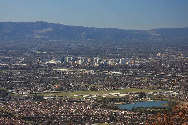
The park mixes two moods. On the canyon floor are lawns, picnic areas, stone bridges and old grottos built around mineral springs, relics of its heyday as a spa resort. Above, switchbacks climb to the North Rim and South Rim trails with views back across the Santa Clara Valley toward the Peninsula. This guide covers the drive, hours and parking, the trails, the rules and what to pair it with.
Getting there
From Palo Alto, take Highway 101 south through San Jose, then head east into the foothills toward Penitencia Creek Road. Allow about 35 to 45 minutes outside rush hour. Wikipedia notes that landslides after the 1998 El Niño storms closed the old vehicle entrance from Alum Rock Avenue in 2000. Cars now enter from Penitencia Creek Road, so follow your map app to that entrance rather than the end of Alum Rock Avenue.
The road into the canyon is narrow. On warm weekends the lots can fill by late morning, so arrive early. The city says lots stop accepting vehicles at 6:30 p.m.
VTA's Orange Line light rail ends at Alum Rock station, but that is in the flats several miles from the park, not at the trailhead.
Hours, parking and contacts
- Hours: the city's facility page lists 8 a.m. to 8 p.m. Winter dusk comes far earlier, so plan to be off the rim trails well before dark.
- Parking: the city says all parking inside the park is free for now and no fees are being collected in any lot. The park has charged vehicle fees before, so check before you go.
- Eagle Rock lot: the city has closed it for police training on some dates. Look for notices on the park page.
- Rangers: park operations and ranger staff, 408-259-5477. Permits and reservations, 408-794-7275.
The city's park page carries a notice from an earlier reopening saying drinking fountains were closed. Bring your own water either way. Check the city's Alum Rock Park page before you go; it refuses automated checks, so open it in a browser.
Trails
The city counts about 13 miles of trail. Hikers may use all of them. About 6 miles are open to horses and about 3 miles to bikes. Wikipedia describes trails ranging from fairly level paths along Penitencia Creek to sharp switchbacks climbing to the South Rim and North Rim trails. The city does not publish distances for individual trails on its park page, so pick up a map or use the city's trail map online.
Along the creek
The canyon floor trail follows Penitencia Creek past the old spring grottos and stone bridges. It is the easiest walk in the park and the best choice with small children. Kids can play at the creek edge in the picnic areas.
The rim trails
The South Rim and North Rim trails are the park's big views, looking west over San Jose to the Santa Cruz Mountains. The city says the South Rim switchbacks have been closed since December 2019 because of concerns about a retaining wall, with no reopening date. Plan your loop around that closure and check the city's online trail status page.
Into Sierra Vista
Some park trails are part of the Bay Area Ridge Trail. Wikipedia says the Todd Quick Trail connects to the Santa Clara Valley Open Space Authority's 1,600-acre Sierra Vista Open Space Preserve on the ridge above. The city notes that Open Space Authority trails close occasionally in poor weather.

Mineral springs and the resort years
The canyon has many mineral springs. From the late 1800s through the 1930s, Wikipedia says, the park was known across the country as a health resort advertising hot and cold sulfur, soda and magnesia springs. Plumbing carried some springs to bathtubs and drinking fountains. Into the 1970s the park had a natatorium, a large indoor pool of heated sulfur water, along with rentable mineral baths and a restaurant. Many springs were enclosed in stone grottos. Stone bridges were built over the creek.
By the 1960s crowds from the fast-growing valley had worn the park down. In the 1970s the city removed most of the buildings and shifted the emphasis to nature. Much of the stonework remains. Some springs still flow; Wikipedia notes that the 2007 Alum Rock earthquake set a dry spring running again.
Getting here was once part of the fun. A narrow-gauge railway reached the park from downtown San Jose by 1896. The interurban Peninsular Railway served it from 1913 until service into the park ended on July 11, 1932. Our streetcars history covers that network, which also reached Palo Alto.
Youth Science Institute and picnics
The Youth Science Institute, a nonprofit science and nature center open to the public since 1953, has a museum in the park. The city lists its hours as Tuesday to Friday noon to 4 p.m. and Saturday noon to 4:30 p.m. YSI also runs a nature center at Vasona Lake County Park in Los Gatos.
Some picnic areas can be reserved through the city; others are first come, first served. Reservation holders must arrive before 10 a.m. with a copy of their approved application and keep an adult on site. If they do not, the site opens to the public at 10 a.m. Beer and wine are allowed in picnic areas only. Amplified sound, balloons, smoking, bounce houses and dunk tanks are not allowed. During fire season, fires and barbecues may be severely restricted or the park closed.
Dogs, bikes and horses
- Dogs: not allowed. The city says the park is a protected wildlife sanctuary. Our dog-friendly hikes guide lists alternatives.
- Bikes: designated bicycle trails only, about 3 miles. Bikes may not use service roads or hiker-only trails.
- Horses: designated horse trails only, about 6 miles. The city allows ponies at the Log Cabin and Rustic Lands picnic areas.
- Vehicles: not allowed on service roads or trails.
Seasons and safety
Spring brings green hills and full creeks. Summer afternoons on the rim trails are hot and exposed; walk the creek trail then, or come early. Winter storms have closed the park before: Wikipedia records a nearly six-month closure after the February 1998 landslides and a closure for fallen trees and flooding in February 2017. After heavy rain, call the rangers before you drive over.
Good to know
- Poison oak grows along the creek and the lower switchbacks. Stay on the trail.
- Ticks wait in tall grass on the rim trails, mostly from fall through spring.
- Heat: carry water on any climb from May to October. Our heat waves guide lists warning signs.
- Mountain lions live in the Diablo Range foothills. Keep children close; never run from a lion.
- Earthquake country: the Hayward and Calaveras faults meet near the park, Wikipedia notes. Stay off unstable slopes after storms.
What pairs nearby
- Lick Observatory: the long, winding drive up Mount Hamilton starts nearby. Check its status first; the main building has been closed since a December 2025 storm.
- Ed R. Levin County Park: 20 minutes north in Milpitas, with dog-friendly trails and hang gliders.
- San Jose: lunch downtown or in Japantown on the way home.
Frequently asked questions
Are dogs allowed at Alum Rock Park?
No. The City of San Jose says dogs are not allowed because the park is a protected wildlife sanctuary. For a dog hike on the same side of the valley, try Ed R. Levin County Park in Milpitas, where leashed dogs use the trails north of Calaveras Road and a city dog park sits inside the park.
Does Alum Rock Park charge for parking?
The city's park page says all parking inside the park is free for now and no fees are being collected in any lot. The park has charged a vehicle fee in the past, so check the city's page before you go in case that changes.
What are Alum Rock Park's hours?
The city's facility page lists 8 a.m. to 8 p.m., with parking lots closing to incoming vehicles at 6:30 p.m. Expect earlier dusk in winter and confirm hours with the rangers at 408-259-5477.
Why is it called Alum Rock?
Wikipedia says the park was first known simply as the reservation. It took its current name around the start of the 20th century, when rocks near the entrance containing the mineral thenardite were mistaken for alum.
Is the South Rim Trail open at Alum Rock Park?
The South Rim switchbacks have been closed since December 2019 because of concerns about a retaining wall, the city says. It gives no reopening date. Other parts of the rim trail system remain in use. Check the city's online trail status page before you go.