On this page
Green Acres is a name that tells you what used to be here. Before the houses came, this corner of southwest Palo Alto was orchard country, mostly apricots. Today it is two small residential neighborhoods of low ranch homes on either side of Arastradero Road. Their biggest selling point is simple. Families can walk to an elementary school, a middle school and a high school without crossing a major highway.
This guide explains where Green Acres I and Green Acres II sit, how the land was developed, what the houses are like and which parks, schools and shops serve the area.
Where Green Acres is
Green Acres lies in the southwest part of the city, between El Camino Real and the Gunn High School campus. Arastradero Road divides it into two pieces. Palo Alto Online's neighborhood profile gives these boundaries:
| Section | Boundaries | Character |
|---|---|---|
| Green Acres I | Arastradero Road to Glenbrook Drive, Los Palos Avenue to Pomona Avenue | Small, purely residential pocket south of Arastradero beside Ellen Fletcher Middle School |
| Green Acres II | Maybell Avenue to Arastradero Road, Coulombe Drive to Georgia Avenue | Larger area north of Arastradero, next to Barron Park and Juana Briones Elementary |
Barron Park wraps around Green Acres II to the north and west. The Barron Park Association also serves residents of Green Acres II. The small Palo Alto Orchards neighborhood sits to the east near El Camino Real. Charleston Meadows is across El Camino. Gunn High School and the foothills are to the west.
From apricot orchards to ranch houses
Like most of south Palo Alto, this land was once part of Rancho Rincón de San Francisquito. By the early twentieth century it was planted in fruit trees. Apricots were a signature crop of the Santa Clara Valley. Juana Briones Park on Maybell Avenue was itself an apricot orchard. Volunteers have planted small apricot groves around its edges to honor that past.
After World War II the orchards were sold and subdivided, as happened across the valley. The nearby Palo Alto Orchards tract had owners moving in by 1950. A local brokerage dates much of Green Acres to the suburban expansion that continued into the 1960s, when the remaining orchards gave way to ranch and bungalow style homes. Exact tract dates and builders are not well documented in published sources.
The area stayed in the news because of its schools and traffic. In November 2013 Palo Alto voters rejected Measure D, a rezoning that would have allowed affordable senior apartments and market-rate houses on a former orchard site on Maybell Avenue. Opponents focused on traffic along Maybell and Arastradero, the main routes to three public schools.
Housing in general terms
Green Acres is single-family territory. Expect:
- single-story ranch houses with attached garages and deep backyards
- some modest bungalow-style homes from the postwar years
- remodeled and expanded originals
- newer two-story homes where older houses were replaced
Palo Alto Online described Green Acres I as purely residential and dominated by single-family homes. Residents also point to underground utilities as a plus, since overhead lines are still common in neighboring Barron Park. Lots are generous compared with older north Palo Alto neighborhoods. For the wider market, see our Palo Alto real estate guide.
The streets feel suburban in the classic postwar sense. Front lawns run to the curb, driveways lead to attached garages and mature street trees shade most blocks. Through traffic stays mostly on Arastradero Road and Maybell Avenue, so the interior streets are quiet outside school hours. Kids on bikes are a constant sight in the afternoon. Because the houses are mostly one story, backyards stay private, though rebuilds have added more second stories over the years. Buyers who care about that should look at each block closely.

Schools by attendance area
Schools are the reason many families choose Green Acres. Palo Alto Online's profile listed three public schools:
- Juana Briones Elementary at 4100 Orme Street, on the Green Acres II side.
- Terman Middle School, renamed Ellen Fletcher Middle School in 2018, beside Green Acres I.
- Gunn High School at 780 Arastradero Road, at the western end of the neighborhood.
That puts every level of public school within a walk or short bike ride. Arastradero Road has bike lanes and heavy student bike traffic before and after school. Attendance areas can change, so confirm any address with the PAUSD school finder. Our guide to Palo Alto public schools explains enrollment.
Parks and open space
Briones Park at 609 Maybell Avenue, often called Juana Briones Park, is the neighborhood park for Green Acres II. It has open lawns, play structures and the apricot trees that recall the orchard years. Terman Park at 655 Arastradero Road sits next to the Fletcher campus and serves Green Acres I.
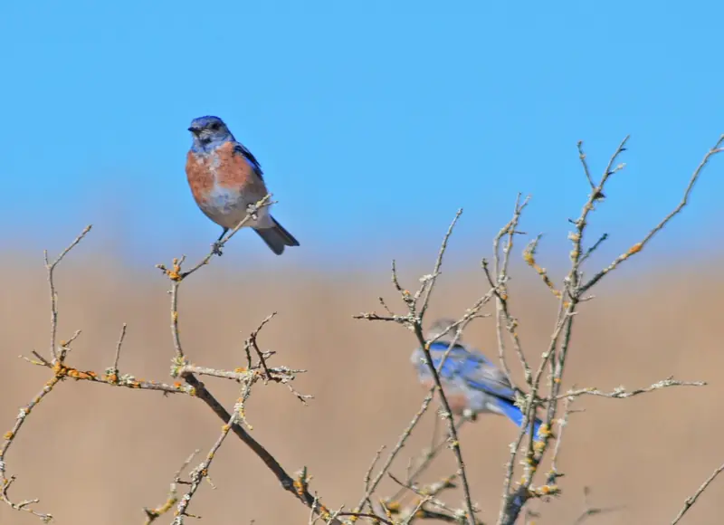
Bigger outdoor options are close. Bol Park and its bike path are a short ride through Barron Park. Head west on Arastradero Road past Gunn and you reach Pearson-Arastradero Preserve, with oak woodland, grassland trails and bluebirds in spring. Foothills Nature Preserve is a longer drive up Page Mill Road.
Shops and errands
Green Acres has no stores of its own. Residents told Palo Alto Online that this is the neighborhood's biggest drawback. Everyday shopping happens along El Camino Real, at the large San Antonio shopping area just over the line in Mountain View and in downtown Los Altos. California Avenue, with its Sunday farmers market and restaurants, is a 10 minute drive north.
Getting around
Green Acres is a car and bike neighborhood. VTA buses run along El Camino Real. The nearest Caltrain stations are California Avenue in Palo Alto and San Antonio in Mountain View, both a bike ride away. Foothill Expressway and Page Mill Road connect drivers to I-280 and Stanford Research Park. Arastradero Road and Maybell Avenue are busy at school drop-off and pickup times, so plan errands around them.
Neighborhood associations
Each half of Green Acres has had its own neighborhood association. Palo Alto Online named volunteer leaders for both the Green Acres I and Green Acres II groups. Green Acres II residents can also join the Barron Park Association, which counts them in its service area and runs events such as May Fete and a holiday craft fair. Volunteer contacts change, so check the City of Palo Alto's neighborhood association list for the current contact.
Good to know
- Expect heavy bike and car traffic near the schools before and after classes on school days.
- There are no shops inside the neighborhood. Budget a short drive for groceries.
- Confirm school assignments by address with PAUSD, even next door to a school.
Visitors coming to see family here usually stay along El Camino Real, where you can compare hotels on El Camino Real. A bike is the best way to explore the nearby preserves, so consider a bike rental for a longer stay. Our South Palo Alto guide covers the rest of the south side.
Frequently asked questions
Where is Green Acres in Palo Alto?
Green Acres is in southwest Palo Alto along Arastradero Road, between El Camino Real and Gunn High School. Palo Alto Online describes two parts. Green Acres I runs from Arastradero Road to Glenbrook Drive and from Los Palos to Pomona avenues. Green Acres II runs from Maybell Avenue to Arastradero Road and from Coulombe Drive to Georgia Avenue.
What is the difference between Green Acres I and Green Acres II?
They are separate tracts on opposite sides of Arastradero Road. Green Acres I is the smaller pocket south of the road near Ellen Fletcher Middle School. Green Acres II is larger and sits north of the road beside Barron Park. Each has had its own neighborhood association.
Which schools serve Green Acres?
Palo Alto Online listed Juana Briones Elementary, Terman Middle School and Gunn High School. Terman was renamed Ellen Fletcher Middle School in 2018. All three are within walking or easy biking distance. Confirm any address with the Palo Alto Unified School District school finder.
Are there stores in Green Acres?
No. Residents told Palo Alto Online that the lack of shops is the main drawback. Most errands happen along El Camino Real, at the San Antonio shopping area in Mountain View or in downtown Los Altos.
What was the Maybell Avenue Measure D vote?
In November 2013 Palo Alto voters rejected Measure D, which would have rezoned a former orchard site on Maybell Avenue for affordable senior apartments and market-rate houses. The debate centered on traffic near the schools along Arastradero Road and Maybell Avenue.