On this page
Palo Alto has more named neighborhoods than most cities its size. The umbrella group Palo Alto Neighborhoods, founded in 1998, lists 38 associations and residents use even more names than that. A few go back to the town's first year. Many more were coined by builders in the 1950s when orchards turned into tract homes. Some describe a place plainly, some honor a person and a handful are little more than an intersection.
This page explains where the best-known names came from, using our neighborhood guides, Palo Alto Weekly and Palo Alto Online neighborhood profiles and published local histories. Boundaries in Palo Alto are informal and maps disagree, so treat the edges as approximate. For the full list of districts, see our neighborhoods hub.
First, the city's own name
The city is named for El Palo Alto, the tall redwood beside San Francisquito Creek that the Portolá expedition camped near in November 1769. The name did not start out belonging to this town. In 1887 developer Alexander Gordon called his new tract south of the Stanford campus Palo Alto. Leland Stanford wanted the name for the dry town Timothy Hopkins was laying out north of the campus, which Hopkins had called University Park. Gordon agreed to rename his tract and University Park took the name Palo Alto in 1892.
The first neighborhoods: 1887 to 1920
Professorville
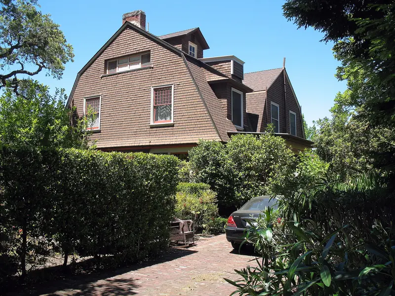
Stanford's founding grant kept the university's land off the market. Faculty could build on campus only on leased lots, so professors who wanted to own a house bought land in the new town south of University Avenue. So many did that the blocks became known as Professorville. "Professorville was the closest place to campus that was not controlled by the Stanfords," Palo Alto's longtime city historian Steve Staiger told the Palo Alto Weekly in 2001. The name became official in a sense in 1980, when the Professorville Historic District joined the National Register. Our Professorville guide maps the houses.

College Terrace
Alexander Gordon's renamed tract became College Terrace. It gained a set of college street names in alphabetical order. It developed alongside Mayfield and came into Palo Alto with the 1925 annexation. Our College Terrace page covers its parks and library and our street names page covers the colleges.
Downtown North and University South
Both names are geography. Downtown North is the residential part of University Park north of University Avenue. University South covers the blocks south of downtown, with Professorville inside it.
Crescent Park
Crescent Park takes its name from its streets, which curve in crescents that follow the bend of San Francisquito Creek. The city adopted the name in 1920, when it annexed much of the former farmland of William Newell under the name Crescent Park 1. Newell's own name survives on Newell Road. Our Crescent Park guide covers the big houses along the creek.
Evergreen Park
According to Palo Alto Weekly, the Evergreen Park name dates to 1907, when the land across El Camino Real from Stanford was marketed to buyers drawn by the new university. The area joined Palo Alto with Mayfield in 1925 and the old tract name faded. It returned in 1980, when residents formed the Evergreen Park Neighborhood Association. See our Evergreen Park page.
Names that mislead
Old Palo Alto is not the oldest part of town. It grew in the early twentieth century, starting with the house Edwin and Elizabeth Gamble built in 1902, the first home south of Embarcadero Road. The name reflects its settled, prewar character rather than its age. Downtown, Professorville and College Terrace all came first. Our Old Palo Alto guide has more.
Southgate is not a gate at all. The name refers to its position along the southern side of the Stanford lands.
Names from landowners
Barron Park
Barron Park carries the name of Edward Barron, who bought the property called Mayfield Farm in 1878. His country house, the Barron Mansion, burned down in 1936, but the name stayed. The neighborhood remained in unincorporated county land for decades and joined Palo Alto on December 8, 1975, after residents voted roughly two to one in favor. Our Barron Park guide covers its semi-rural lanes and donkeys.
Mayfield
In 1853 Elisha Oscar Crosby bought 250 acres from the Robles family's rancho and named it Mayfield Farm. A roadhouse on the county road became a mail stop around 1855 and the settlement took the Mayfield name. The farm later passed to Sarah Wallis and then to Edward Barron, which is why Barron Park and the old town of Mayfield share a story. Palo Alto annexed Mayfield in 1925 and the name lives on in the streets around California Avenue.
Greater Miranda
This foothill area takes its name from Miranda Avenue, which recalls Juana Briones de Miranda, the Californio landowner whose rancho covered the land.
Postwar names: builders and orchards
Most of south Palo Alto was orchards until the late 1940s. When builders arrived, they needed names to sell houses and many of those names stuck.
| Name | Origin |
|---|---|
| Midtown | Literal: its place in the middle of the city |
| Charleston Meadows | An Eichler tract of about 1950 and 1951, named for nearby Charleston Road |
| Charleston Gardens | First named and developed in 1951, per Palo Alto Weekly; for a time folded into a larger Charleston Terrace name |
| Greenmeadow | Joseph Eichler's 1954 and 1955 tract, now a National Register district |
| Walnut Grove | A walnut grove before the 1950s building boom |
| Green Acres | Recalls the open land and orchards it replaced |
| Palo Alto Orchards | Recalls the fruit trees that covered the land |
| Adobe Meadow | Its position between Adobe Creek and Meadow Drive |
| Palo Verde | The elementary school at its center; Eichler reportedly marketed the tract as Faircourt |
Charleston Meadows is a good example of how these names work. Joseph Eichler built it around 1950 and 1951 with designs by the San Francisco firm Anshen and Allen. The name borrows Charleston Road, which runs along its edge. We did not find a documented origin for the road name itself. Visit our Charleston Meadows page for the tract today and our Midtown guide for the shopping district at the center of town.
Names from schools, buildings and corners
- Community Center is named for the civic buildings at its core, including the Lucie Stern Community Center, the public pool and the Junior Museum and Zoo.
- Duveneck/St. Francis takes its first half from Duveneck Elementary School, named for Frank and Josephine Duveneck, the couple known for Hidden Villa in Los Altos Hills. Our Duveneck/St. Francis page explains the rest.
- San Alma combines its nearest intersection, San Antonio Road and Alma Street.
- Triple El matches its three streets, which all begin with El.
- The Greenhouse recalls Bell's Nurseries, which once occupied the land. The developer named the complexes for it in 1975 and 1978.
Using the names today
Neighborhood names matter in Palo Alto because the city's neighborhood associations use them to organize, comment on development and run events. They do not set school assignments or legal boundaries. Real estate listings often stretch a popular name over nearby blocks, so the same house can appear in two neighborhoods depending on who is selling it. When in doubt, ask which association covers a street, or check the boundaries described on our neighborhood pages.
Good to know
- Names such as Professorville and Greenmeadow also mark historic districts, which brings design review for some changes.
- Barron Park, Ventura and the bayside lands joined the city in annexations between 1954 and 1979, so their names are older than their Palo Alto addresses.
- A guided Silicon Valley walking tour often passes Professorville and downtown.
Frequently asked questions
Why is it called Professorville?
Many of Stanford's first professors built homes there in the 1890s and early 1900s. They could only lease land on campus, so they bought lots in the new town. City historian Steve Staiger told the Palo Alto Weekly in 2001 that it was the closest place to campus not controlled by the Stanfords.
How did Barron Park get its name?
Edward Barron bought the property known as Mayfield Farm in 1878 and built a country house there. His name stayed with the area after the mansion burned down in 1936. Barron Park joined Palo Alto on December 8, 1975.
Is Old Palo Alto the oldest part of Palo Alto?
No. Downtown, Professorville and College Terrace are older. Old Palo Alto grew in the early twentieth century, beginning with the Gamble family house of 1902, the first home south of Embarcadero Road.
Why is it called Crescent Park?
Its streets curve in crescents that follow the bend of San Francisquito Creek. The city adopted the name in 1920, when it annexed much of the former Newell farmland as Crescent Park 1.
Where does the name Mayfield come from?
In 1853 Elisha Oscar Crosby bought 250 acres from the Robles rancho and called it Mayfield Farm. A settlement around a nearby roadhouse took the name and became the town of Mayfield, which Palo Alto annexed in 1925.