On this page
Palo Alto is a short drive from some of the best road scenery in Northern California. The Santa Cruz Mountains rise just west of town, crowned by a ridge road with views in two directions. On the far side, narrow highways drop through redwoods to a coast of farms and empty beaches. East of the bay, two mountains with summit roads look over the whole region.
The drives below start from downtown Palo Alto and range from a 30 minute climb to a full day. Mountain roads here are narrow, shared with cyclists and prone to closures after storms and during fire season. Check Caltrans QuickMap before you leave and carry water and a warm layer. For whole trips built around these roads, see our Bay Area road trip.
The ridge roads
1. Skyline Boulevard (Highway 35)
Skyline runs along the crest of the Santa Cruz Mountains from Highway 92 south to Highway 9 and beyond. Between Highway 84 and Highway 9 the road passes a string of Midpen preserves, each with a lot and a short walk to a view. Alice's Restaurant at 17288 Skyline Boulevard, where Highway 84 meets Skyline, is the classic stop for breakfast or a burger. Fog often fills the coast side while the ridge sits in sun. Plan on 45 minutes to an hour for the Highway 84 to Highway 9 stretch without stops.
2. Page Mill Road to Skyline
The closest climb from Palo Alto starts at Foothill Expressway and rises about 2,000 feet to Skyline. Above Arastradero Road the road narrows to a winding lane with few places to pass. You can stop at Los Trancos or at the Monte Bello lot at 4301 Page Mill Road. At the top it meets Skyline at the Russian Ridge lot. Allow 25 to 35 minutes up. Cyclists use it heavily on weekend mornings, so drive slowly.
3. Highway 9 from Saratoga
From the village of Saratoga, Highway 9 climbs past Hakone Gardens to Saratoga Gap, where it meets Skyline. Castle Rock State Park is 2.5 miles southeast along Highway 35, with a day use fee of $10. Loop back to Palo Alto along Skyline and Page Mill for a full mountain circuit.
Down to the coast
4. Highway 84 through Woodside and La Honda
Woodside Road (Highway 84) climbs from Woodside past old estates and into redwoods, crosses Skyline at Alice's and drops through La Honda to San Gregorio and the ocean. Caltrans began resurfacing the road between La Honda and Woodside on September 14, 2026 and expected work to last through the winter, with one-way traffic control in places. Expect short waits. Our La Honda guide lists stops along the way.
5. Highway 1 from Half Moon Bay to Pescadero
South of Half Moon Bay, Highway 1 runs past farm fields and bluffs with almost no towns. Pull off at the state beaches, then turn inland on Pescadero Creek Road to Stage Road, Pescadero's main street, where Duarte's Tavern has served travelers since 1894. Continue south to Pigeon Point, whose grounds are open from 8 a.m. to sunset while the tower stays closed for restoration. See our Pescadero day trip.
6. Highway 92 and Highway 1 north through Devil's Slide
Highway 92 climbs from Interstate 280 past Crystal Springs Reservoir, crosses Skyline and drops past nurseries and pumpkin farms into Half Moon Bay. From there, drive north on Highway 1 through Montara and the Tom Lantos Tunnels at Devil's Slide. The old cliff road above the tunnels is now the paved Devil's Slide Trail of about 1.3 miles, a good place to stretch your legs. Return on Interstate 280.

Valley and lake drives
7. Interstate 280
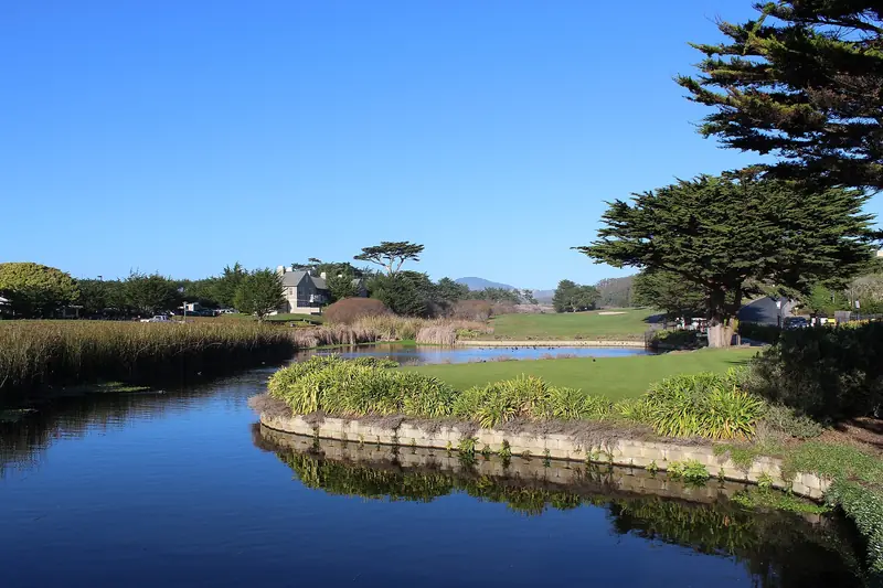
Interstate 280 has been called the World's Most Beautiful Freeway since its scenic section between Cupertino and Woodside was finished in the late 1960s. North of Woodside it runs above Crystal Springs Reservoir and San Andreas Lake, which sit in the valley carved by the San Andreas Fault. It is the calm way to reach San Francisco when Highway 101 is jammed.
8. Cañada Road past Filoli
Cañada Road runs north from Woodside beside the reservoir lands, past Filoli and the Pulgas Water Temple. On Sundays from 9 a.m. to 3 p.m. San Mateo County closes 3.8 miles between the Filoli entrance and Highway 92 to cars for Bicycle Sunday, so drive it on another day. The county cancelled the November 29 and December 27, 2026 closures for the holidays.
9. Alpine Road and Portola Road
For a short drive close to town, take Alpine Road from Junipero Serra Boulevard into Portola Valley, then loop back on Portola Road past Windy Hill and through Woodside. Rossotti's Alpine Inn and Roberts Market sit along the way. Pavement on Alpine Road ends near Coal Creek Preserve, where a dirt trail continues for hikers and riders only.
Summit roads east of the bay
10. Mount Hamilton Road to Lick Observatory
From east San Jose, Mount Hamilton Road climbs about 19 miles to Lick Observatory at 4,209 feet. The road is narrow with many sharp curves and takes close to an hour from the bottom. There is no gas on the mountain. Since a December 25, 2025 storm the main building and Great Refractor have been closed, but the East Grounds and the Shane Telescope gallery are open daily from 9 a.m. to 5 p.m. with free admission. Read our Lick Observatory guide.
11. Mount Diablo summit road
North Gate Road from Walnut Creek and South Gate Road from Danville meet below the summit, where Summit Road climbs to a lot beside the visitor center at 3,849 feet. Gates open at 8 a.m. and close at sunset. California State Parks charges $6 per vehicle, rising to $10 at peak times. Trailers and motorhomes over 20 feet are not allowed. Plan on about 1.5 hours from Palo Alto. See our Mount Diablo day trip.
When to go
Each season changes these drives. Winter brings the clearest air, green hills and the best long views from Mount Hamilton and Mount Diablo, usually on the day after a storm. It also brings fallen trees, mud and the occasional road closure on the coast side. Spring adds wildflowers along Skyline and Highway 1. Summer is the foggiest time on the coast, when Half Moon Bay can sit cool and gray while the valley bakes, so a ridge drive with the fog below you is often the highlight. Fall is warm and clear, with pumpkin traffic on Highway 92 on October weekends and a higher risk of fire weather closures.
Weekday mornings are the calmest time on every route here. Weekend afternoons bring motorcycles to Skyline and visitor traffic to the coast. Highway 92 can back up for miles toward Half Moon Bay on fall weekends.
Planning a drive
| Drive | Time from Palo Alto | Best for |
|---|---|---|
| Page Mill Road to Skyline | 25 to 35 minutes up | A quick view after work |
| Skyline, Highway 84 and Highway 92 loop | Half a day | Ridge, redwoods and coast |
| Highway 1 to Pescadero | About 1 hour each way | Beaches and farm stands |
| Mount Hamilton | About 1.5 hours each way | Clear winter days |
| Mount Diablo | About 1.5 hours each way | Big views after a storm |
Good to know
- Mountain roads close after big storms and on extreme fire danger days. Check QuickMap and park alerts first.
- Fill the tank in town. Gas is scarce on Skyline, the coast south of Half Moon Bay and Mount Hamilton.
- Use turnouts to let faster cars and groups of cyclists pass.
- Visiting without a car? Compare car rentals near Palo Alto and our car rental guide lists local branches.
Frequently asked questions
What is the most scenic drive near Palo Alto?
Skyline Boulevard (Highway 35) along the crest of the Santa Cruz Mountains is the local favorite. It passes open space preserves with views of the bay on one side and the Pacific on the other. Combine it with Highway 84 down to the coast and Highway 92 back for a half day loop.
Is Page Mill Road safe to drive?
It is a public road but narrow, steep and full of blind curves above Arastradero Road. Drive slowly, stay in your lane and expect cyclists, especially on weekend mornings. Large RVs and trailers are a poor fit.
Is Highway 84 to La Honda open?
Yes, but Caltrans began resurfacing Highway 84 between La Honda and Woodside on September 14, 2026 and expected work to continue through winter 2026. Crews use one-way traffic control in places. Check Caltrans QuickMap before you go.
Can you drive Cañada Road on Sundays?
Not all of it. San Mateo County closes 3.8 miles of Cañada Road between the Filoli entrance and Highway 92 to cars for Bicycle Sunday, from 9 a.m. to 3 p.m. The county cancelled the November 29 and December 27, 2026 dates for the holidays.
How long does it take to drive to Lick Observatory from Palo Alto?
Plan on about 1.5 hours each way. The last 19 miles up Mount Hamilton Road from San Jose are narrow with many sharp curves and there is no gas station on the mountain. The observatory's East Grounds and Shane Telescope gallery are open daily from 9 a.m. to 5 p.m.