On this page
Palo Alto sits on a flat plain between the Santa Cruz Mountains and San Francisco Bay. That location brings three hazards that affect what a home costs to own: creek and bay flooding on the low side, earthquakes everywhere and wildfire in the foothills. Each shows up in the seller's Natural Hazard Disclosure, each can affect insurance and some can limit what you build.
This page explains the official maps and how insurance works. It is general information, not insurance or legal advice. Get quotes and coverage advice from a licensed insurance agent and check maps for your own address. For what to do when storms or quakes actually hit, see our guides to rain and storm season and earthquake safety.
FEMA flood zones
The Federal Emergency Management Agency maps flood risk on Flood Insurance Rate Maps. Palo Alto's first map dates from February 15, 1980. The zones that matter most:
| Zone | What it means |
|---|---|
| A, AE, AO and other A zones | Special Flood Hazard Area: at least a 1 percent chance of flooding in any year |
| Shaded X | Moderate risk, often protected by levees or with shallow flooding |
| X (unshaded) | Minimal mapped risk |
In Palo Alto the higher-risk areas are mostly near San Francisquito Creek and on the low ground toward the bay. Check any address on FEMA's Flood Map Service Center. If your lot sits higher than the mapped flood level, you can ask FEMA for a Letter of Map Amendment. The city says its role in that process is limited. Public Works Engineering answers questions at (650) 329-2151.
San Francisquito Creek and the 1998 flood
San Francisquito Creek forms the border with Menlo Park and East Palo Alto. In the early hours of February 3, 1998, it overflowed. Water spread through neighborhoods in all three cities. The Palo Alto Daily Post's timeline puts the number of damaged properties at about 1,700 and the repair estimate at $40 million, revised from an early $28 million. Our history of San Francisquito Creek covers earlier floods.
The flood led the three cities and the two counties' flood agencies to form the San Francisquito Creek Joint Powers Authority on May 14, 1999. Progress since then:
- Reach 1, Highway 101 to the bay. Wider channel, new levees and floodwalls. Work began in August 2016 and was completed in 2019.
- December 31, 2022. The creek overtopped again, which put the upstream plan on hold for review.
- Newell Road bridge. Replacement began with a groundbreaking on May 21, 2026. The Almanac reported completion was expected in spring 2027.
- Pope-Chaucer bridge and channel work. Not yet built. The Almanac reported the U.S. Army Corps of Engineers plans to start design in 2028 and channel construction in 2030.
Homes near the creek in Crescent Park and nearby streets may stay in mapped flood zones until the upstream work is finished and FEMA revises the maps. Do not assume a map change is coming on any particular date.
The bay side
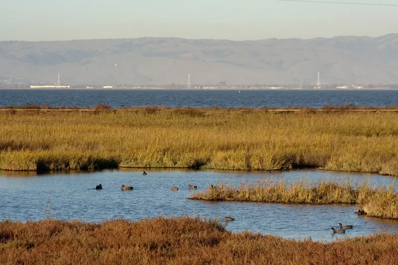
East of Highway 101, Palo Alto's shoreline is a mix of marsh, the airport, the golf course and the former landfill, held back by levees. Much of it is low. Sea level rise is the long-term concern. The creek authority's SAFER Bay effort and regional shoreline projects aim to raise protection along the bay edge. If you are buying in the low-lying parts of the city, read the flood zone on the disclosure and ask an insurance agent for a quote before you remove contingencies. The Baylands Nature Preserve is a good place to see how the levees and marsh fit together.

How flood insurance works
- Required or not. Lenders must require flood insurance for federally backed mortgages on buildings in a Special Flood Hazard Area. Elsewhere it is optional.
- Where to buy. Through the National Flood Insurance Program, sold by insurance agents, or from private flood insurers.
- Limits. NFIP residential policies cover up to $250,000 for the building and $100,000 for contents.
- Waiting period. New NFIP policies generally take 30 days to start, except when bought with a new loan.
- Pricing. NFIP prices each building individually based on its features and flood risk.
Standard homeowners policies do not cover flood damage. Owners outside the high-risk zones still file flood claims, so a low-cost policy can be worth pricing anywhere near a creek.
Earthquake insurance
Standard homeowners and condo policies exclude earthquake damage. The California Earthquake Authority is a publicly managed, privately funded provider that sells policies through participating insurers. You need a homeowners policy from one of those insurers to buy a CEA policy. Its homeowners brochure lists these options:
| Coverage | Options |
|---|---|
| Dwelling deductible | 5, 10, 15, 20 or 25 percent of the dwelling limit |
| Personal property | $5,000 up to $200,000 |
| Loss of use | $1,500 up to $100,000, with no deductible |
| Retrofit discount | Up to 25 percent for a verified seismic retrofit of an older house |
Private insurers also sell earthquake coverage, so compare. Retrofits can lower both risk and premiums. The state's Earthquake Brace + Bolt program has offered grants of up to $3,000 to retrofit pre-1980 wood-frame houses on raised foundations in program ZIP codes, chosen by random draw. Palo Alto promoted the last registration period we found, which ran from August 20 to October 17, 2025. No 2026 round had been announced as of November 1, 2026. Our earthquake retrofit guide covers the work and the grant programs. A separate soft-story program offered up to $13,000. The NHD will also tell you whether a property lies in a state seismic hazard zone for liquefaction, which is more common on the softer soils toward the bay.
Wildfire zones in the foothills
CAL FIRE maps Fire Hazard Severity Zones as moderate, high or very high. It released updated maps for local responsibility areas in Palo Alto at the end of February 2025. According to the city's April 2025 announcement, areas generally west of Junipero Serra Boulevard and Foothill Expressway were mapped as moderate. Areas in the Palo Alto Hills were mapped as high or very high. The council was scheduled to consider adopting the maps by ordinance that summer. Look up an address with the State Fire Marshal's tool.
Zone status matters in several ways. It appears on the NHD. Very high zones bring stricter building standards for new construction and defensible space rules. Some insurers limit new policies in high-risk areas. The California FAIR Plan serves as a last resort. SB 9 projects are also restricted in high and very high zones. Our emergency preparedness guide covers evacuation planning.
Steps for buyers and owners
- Read the NHD early. It lists flood, fire, fault and seismic hazard zones in one place. Our buying guide explains when you receive it.
- Ask the seller about water. Past flooding, sump pumps, drainage work and insurance claims should appear on the disclosure statement. Ask follow-up questions if anything is vague.
- Get quotes for every hazard. Price homeowners, flood and earthquake coverage together so you see the full yearly cost.
- Look at the structure. Raised foundations, cripple walls and older chimneys affect earthquake risk and premiums. A retrofit can earn a discount.
- Plan for sellers' duties too. When you sell, you will disclose the same hazards. Our selling guide lists the forms.
Good to know
- Check the flood zone, fire zone and seismic hazard zone on the NHD before you bid.
- Get insurance quotes during your contingency period, not after.
- New flood policies usually take 30 days to start.
- Earthquake damage needs a separate policy.
- Free sandbags are available at city stations from November 1.
Frequently asked questions
How do I know if my Palo Alto home is in a flood zone?
Look up the address on FEMA's Flood Map Service Center, which shows the official Flood Insurance Rate Map. Zones starting with A are high-risk Special Flood Hazard Areas. The seller's Natural Hazard Disclosure also states whether the property is in one. City Public Works Engineering can help interpret the map.
Is flood insurance required in Palo Alto?
Lenders must require flood insurance for federally backed mortgages on buildings in a Special Flood Hazard Area. Outside those zones it is optional but often inexpensive. National Flood Insurance Program policies usually take 30 days to start, so do not wait for a storm forecast.
When was the big San Francisquito Creek flood?
The creek overflowed early on February 3, 1998, flooding homes in Palo Alto, Menlo Park and East Palo Alto. The Palo Alto Daily Post put the number of damaged properties at about 1,700. The creek also overtopped on December 31, 2022.
Does homeowners insurance cover earthquakes in California?
No. Earthquake coverage is a separate policy. The California Earthquake Authority sells policies through participating insurers with deductibles from 5 to 25 percent of the dwelling limit. Private insurers also offer earthquake coverage.
Is Palo Alto in a high fire hazard zone?
Parts of it are. CAL FIRE's 2025 maps for Palo Alto show areas in the Palo Alto Hills as high or very high fire hazard severity zones and areas generally west of Junipero Serra Boulevard and Foothill Expressway as moderate. Check a specific address with the state's lookup tool.