On this page
Most visitors to the Bay Area pick San Francisco as their base without thinking about it. For many trips Palo Alto works better. It sits about 35 miles south of the city and 20 miles north of San Jose, roughly at the midpoint of the Peninsula. Electric Caltrain trains run through the middle of town in both directions. Three roads climb from the edge of the city over the Santa Cruz Mountains to the Pacific. Highway 101 and Interstate 280 run north and south a few minutes away and the Dumbarton Bridge leads to the East Bay.
The result is that a surprising number of the region's best day trips start within an hour of a Palo Alto hotel. This page explains which trips that geography favors, which ones it makes harder and how to choose where in town to sleep. For full guides to each destination, see our day trips hub.
Why Palo Alto works as a base
- A train in both directions. Express trains reach San Francisco in about 40 minutes on weekdays. San Jose Diridon is closer still. You can tap a contactless card on the platform, so there is no ticket line.
- Short roads to the ocean. Highway 92 reaches Half Moon Bay in 40 to 50 minutes. Highway 84 through Woodside and La Honda is slower and prettier. Page Mill Road and Alpine Road lead up to Skyline Boulevard and the redwood parks.
- The south is close. Santa Cruz is about an hour over Highway 17 and Monterey about two hours. From San Francisco you would add another hour to each.
- Two airports. San Jose airport is about 15 miles away and SFO about 20, so you can fly into whichever is cheaper.
- Quiet evenings. You come back from a long day to a small, walkable downtown with easy dinner reservations on most weeknights.
The trade-off is the far north. Marin, Point Reyes and wine country all sit beyond San Francisco, which means crossing the city or the bay twice in a day.
Day trips ranked for a Palo Alto base
| Trip | Distance | Best way | Verdict from Palo Alto |
|---|---|---|---|
| Filoli and Woodside | About 15 miles | Car | Easy half day |
| San Jose | About 20 miles | Caltrain | Easy full or half day |
| Half Moon Bay and Pescadero | 30 to 35 miles | Car | Excellent full day |
| San Francisco | About 35 miles | Caltrain | Excellent full day |
| Redwood parks | 20 to 50 miles | Car | Excellent full day |
| Santa Cruz | About 45 miles | Car | Excellent full day |
| Berkeley and Oakland | About 40 to 45 miles | Caltrain and BART, or car | Good full day |
| Monterey and Carmel | 85 to 90 miles | Car | Long day, better overnight |
| Napa and Sonoma | 75 to 90 miles | Tour or car | Better as an overnight |
| Yosemite | About 190 to 200 miles | Car | Not a day trip |
The best trips by train
San Francisco
This is the trip Palo Alto does best. Driving into the city means traffic and expensive parking. The train drops you at Fourth and King, a short walk from the Embarcadero and the Ferry Building. It is a three-zone fare: $8.50 for an adult in October 2026 and $9.00 from January 1, 2027. Two or three San Francisco days work fine from a Palo Alto hotel, though weekend trains run less often, so check the Caltrain timetable for the last one home. Our Caltrain guide explains fares, zones and Clipper.
San Jose
Southbound trains reach Diridon in roughly 20 to 35 minutes. From there you can walk to the SAP Center area or ride light rail to The Tech Interactive downtown. The Winchester Mystery House and Santana Row are a short rideshare away.
Berkeley and Oakland
Ride Caltrain north to Millbrae and change to BART for downtown Berkeley or Oakland. It takes longer than driving on a clear day but avoids the bridges at rush hour. Our Berkeley day trip covers the campus, the Campanile and Shattuck Avenue.
The best trips by car
The coast
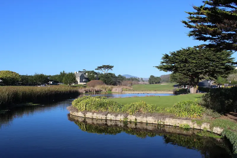
Half Moon Bay is the closest ocean and it pairs well with Pescadero, Pigeon Point and, from December 15 to March 31, the guided elephant seal walks at Año Nuevo. Go out on Highway 92 and come back over Highway 84 or Alpine Road to make a loop. The coast is often 10 to 20 degrees cooler than Palo Alto, so bring a jacket.

The redwoods
Palo Alto sits close to several redwood parks that San Francisco visitors rarely reach. Purisima Creek and Huddart Park are 30 to 40 minutes away. Portola Redwoods is deeper in the hills. Big Basin is open for day use with parking reservations recommended, though its campgrounds remain closed and the Berry Creek Falls trail should be treated as closed. Muir Woods needs a parking or shuttle reservation and sits north of San Francisco, so it is a much longer drive from here. Our redwood forests guide compares them.
Santa Cruz
An hour south over Highway 17, Santa Cruz combines the Boardwalk, West Cliff Drive and Henry Cowell Redwoods State Park, which sits just inland. Outside summer the Boardwalk rides run mostly on weekends and holidays, so check its hours first. Avoid Highway 17 on summer weekend afternoons.
Woodside and Filoli
The shortest trip on the list. Filoli, at 86 Cañada Road, has 16 acres of formal gardens on a 654-acre estate and runs on timed tickets. Its holiday lights run from November 14, 2026 to January 10, 2027. Pair it with lunch in Woodside village or a walk in Huddart Park.
If you flew in, you will want a car for these days only. Agencies in town keep short weekend hours, so it can be simpler to compare rental cars at SJC or SFO and keep one for the second half of the trip.
Trips that stretch the base
Monterey and Carmel are about 85 to 90 miles away. A day trip works if you leave by 7:30 a.m., reach the aquarium near opening and accept a long drive home. One night in Monterey lets you add Carmel, 17-Mile Drive and Point Lobos without rushing.
Napa and Sonoma are a different story. They sit 75 to 90 miles away on the far side of San Francisco or the East Bay and the drive can top two hours each way in traffic. Nobody who tastes should drive home. A guided tour from San Francisco, reached by Caltrain, or one night in the valley makes far more sense. You can browse wine country and coast tours that start in the city.
Big Sur, Yosemite, Lake Tahoe and Mendocino are not day trips from anywhere in the Bay Area. Yosemite Valley alone is about four hours away. Treat them as overnight trips and keep your Palo Alto room booked if you will be back. Our Yosemite guide covers 2026 entry rules.
Timing and traffic
- Leave early on weekends. Out by 8 a.m. beats most beach and wine country traffic.
- Avoid weekday rush hours. Highway 101 and Interstate 280 are slowest roughly 7 to 10 a.m. and 3 to 7 p.m. on weekdays.
- Mind the bridges. Bay Area bridges collect tolls electronically in one direction only and the Golden Gate Bridge has no cash lanes. Ask your rental company how it bills tolls.
- Watch Highway 84. Caltrans began resurfacing work between La Honda and Woodside on September 14, 2026, with one-way traffic control at points through winter. Check Caltrans QuickMap before you go.
- Short days. In November and December the sun sets around 5 p.m., so plan coastal and mountain drives to finish in daylight.
Where in Palo Alto to stay
Choose by the trips you plan. If San Francisco and San Jose are the core of your week, stay downtown within a short walk of the Palo Alto station. Our guide to hotels near Caltrain lists the closest ones. If most days are by car, a hotel on El Camino Real with parking puts you a few minutes from both freeways. Weekend rates at business hotels are often lower than weekday ones, which suits a trip built around weekend day trips. Compare hotels near Palo Alto station and pick a refundable rate while plans settle.
Good to know
- Cell service drops out in the Santa Cruz Mountains and on the coast south of Half Moon Bay. Download offline maps.
- Many state parks charge a vehicle day use fee, often $10. Some also want advance parking reservations.
- Do not leave bags visible in a parked car at beaches, trailheads or in San Francisco.
Frequently asked questions
Is Palo Alto a good base for exploring the Bay Area?
Yes, for most trips. It sits about halfway between San Francisco and San Jose on the Caltrain line, so both cities work without a car. The coast, the redwoods, Santa Cruz and Woodside are all within about an hour by car. Only wine country and the far north of the region are much easier from San Francisco.
Should I stay in Palo Alto or San Francisco?
Stay in San Francisco if most of your days are in the city or in Marin and wine country. Stay in Palo Alto if you want Stanford, the coast, Santa Cruz, Monterey and Silicon Valley, with San Francisco as one or two train days. Palo Alto also puts you closer to SJC and about as close to SFO.
Which day trips from Palo Alto work without a car?
San Francisco and San Jose by Caltrain are the easy ones. Berkeley and Oakland also work by riding Caltrain to Millbrae and changing to BART, though the trip takes longer. The coast, the redwood parks, Filoli and wine country need a car or a guided tour.
Can you do Monterey as a day trip from Palo Alto?
You can, but it is a long day. Monterey is about 85 to 90 miles away and the drive takes 1.5 to 2 hours each way. Leave by 7:30 a.m. to reach the aquarium near opening, or stay one night and add Carmel and Point Lobos the next morning.
Where in Palo Alto should I stay for day trips?
Stay downtown near the Palo Alto Caltrain station if your train days matter most, since you can walk to the platform. If you will drive most days, a hotel on El Camino Real with parking puts you close to Interstate 280 and Highway 101 and saves the hassle of downtown garages.