On this page
From almost anywhere in the South Bay you can pick out a blocky white shape on the ridge above San Jose. That is the old radar tower on Mount Umunhum. Since 2017 you can drive or hike right up to it. The summit is the crown of Sierra Azul Open Space Preserve, the largest of the open space lands managed by the Midpeninsula Regional Open Space District, known as Midpen. The preserve protects more than 19,000 acres of the Sierra Azul range above Los Gatos and the Almaden Valley.
It is a bigger outing than the preserves along Skyline. The drive takes about an hour from Palo Alto, the trails are steep and exposed and the summer heat is real. The payoff is one of the widest views in the Bay Area and a summit that tells a story running from the Amah Mutsun creation story to the Cold War.
Getting there and the summit road
From Palo Alto, take Highway 85 south toward San Jose's Almaden area and follow your map app to Hicks Road, which climbs into the hills past Almaden Quicksilver County Park. Mt. Umunhum Road branches off Hicks Road. Allow roughly an hour from downtown Palo Alto in light traffic.
Mt. Umunhum Road is narrow and winding. Midpen puts the Bald Mountain Parking Area about 1.7 miles up from Hicks Road and the Summit Parking Area about 5.3 miles up. Watch for cyclists climbing the grade and for oncoming cars on blind curves.
On October 31, 2026, Midpen said the road was open as of September 26, with possible delays from roadside vegetation work through mid-October. Check the official preserve page before you go, since the road can close for work or weather.
Hours, fees and parking
- Mount Umunhum area: 7 a.m. to a half hour after sunset. The entrance gate closes at sunset so everyone can get down safely.
- Rest of the preserve: a half hour before sunrise to a half hour after sunset.
- Fee: none.
- Restrooms: Midpen lists restrooms as available. Wikipedia notes restrooms among the summit facilities.
| Parking area | Spaces | Best for |
|---|---|---|
| Mount Umunhum Summit | 54 plus 3 accessible (3 more accessible at the drop-off) | Summit paths and the top of the Mount Umunhum Trail |
| Bald Mountain | 23 plus 1 accessible, plus 4 roadside | Mount Umunhum Trail and Bald Mountain Trail |
| Jacques Ridge | 11 plus 1 accessible; 7 equestrian spaces nearby | Woods Trail, near Hicks Road |
| Miller Point | 33 plus 2 accessible | Priest Rock Trail, on Lexington Reservoir County Park land |
| Kennedy roadside | 3 | Kennedy Trail, Kennedy Road in Los Gatos |
The summit
From the summit lot, stairs climb to the top. Midpen describes a 0.3-mile accessible pathway to the west summit that leads to a ceremonial circle, an east summit viewpoint, a summit shelter and interpretive displays. Midpen says the summit is accessible to visitors of all abilities.
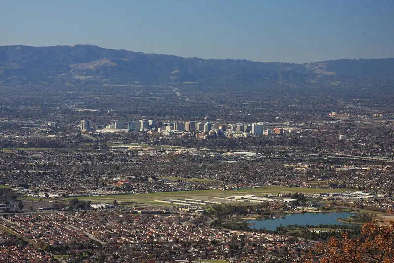
At 3,486 feet, Mount Umunhum is one of the highest peaks in the Santa Cruz Mountains. Midpen promises 360-degree views from the Pacific to the Sierra Nevada. Clear days after a winter storm give the best odds of seeing that far. Bring a layer even in summer, since the summit is usually windier and cooler than the valley.

Before you go, download Midpen's free Stories of Mount Umunhum audio tour app from the App Store. Air Force veterans, Indigenous people and others tell their stories about the mountain. The tour is also on YouTube. Midpen recommends downloading it at home because cell service on the mountain is limited.
The radar tower and the Cold War
From 1957 to 1980, Midpen says, the summit was the Almaden Air Force Station, part of a network of radar stations. The square concrete structure still standing was the base for a large Cold War radar sail. Wikipedia describes the tower, nicknamed the Cube, as about 84.5 feet tall and says its radar was completed in 1962.
The summit closed when the base was decommissioned in 1980. Midpen acquired it in 1986. In 2009, with federal funding, Midpen removed more than 3,000 cubic yards of hazardous materials, including lead paint, asbestos, fuel tanks and PCB transformers. It also took out 13,680 tons of concrete, asphalt, wood and other debris. Midpen says 97 percent was recycled or reused. The summit, road and trail opened to the public in 2017.
Demolishing the Cube was debated for years. In 2016 Santa Clara County listed it on its Heritage Resource Inventory, which protects it from demolition. The building is closed to the public; enjoy it from the paths outside.
Place of the hummingbird
The mountain mattered long before the Air Force arrived. Midpen says the name comes from the Mutsun language and means "resting place of the hummingbird." Mount Umunhum figures in the Amah Mutsun creation story, in which the hummingbird delivers fire to the people. The ceremonial circle at the summit reflects that history. Treat it with respect. Our history of the Ohlone explains the wider story of the region's first peoples.
Midpen also notes later chapters: German and Austrian refugees of the Franco-Prussian War settled the area around 1870 to be near the New Almaden quicksilver mines and planted orchards and vineyards.
Trails
Sierra Azul has about 26 miles of multi-use trail. Two of its four areas are open to the public: Kennedy-Limekiln and Mount Umunhum. Midpen describes these routes:
- Mount Umunhum Trail, 3.9 miles: from the Bald Mountain lot to the summit through chaparral, knobcone pine forest and woodland, with cliffs and rocky outcrops. At the summit it is the highest point on the Bay Area Ridge Trail. Bikes and horses may ride it as far as the Trailhead Shelter about 3.5 miles up; from there to the top it is hikers only.
- Bald Mountain Trail, 0.7 miles: a grassy hillside with views of the Almaden Valley and the Mount Hamilton range. Part of it, heading east from the Bald Mountain lot, is easy access.
- Barlow Road, 1.8 miles: a steep climb linking the Woods Trail to the Mount Umunhum Trail.
- Woods Trail: from Jacques Ridge around the north side of the mountain, climbing near the summit of Mount El Sombroso to meet the Kennedy and Limekiln trails. Eastward it connects to Almaden Quicksilver County Park.
The classic hike is Bald Mountain to the summit and back, about 7.8 miles with steady climbing. For a shorter outing, drive to the top, walk the summit paths and then stroll the Bald Mountain Trail on the way down. Midpen said the Woods Trail would stay open with possible maintenance delays through October 2026. Its calendar lists Mount Umunhum Trail maintenance on November 19.
The Cathedral Oaks and Rancho de Guadalupe areas are closed. Midpen lists opening them as priority projects under its Measure AA bond.
Dogs, bikes and horses
- Dogs: not allowed in the Mount Umunhum area at all: not on the trail, the summit, the parking lots or the road. Not even inside your car. Leashed dogs may use more than 12 miles of other trails, including the Limekiln, Priest Rock and Kennedy trails. See our dog-friendly hikes guide.
- Bikes: designated trails only. Helmets are required at all times. The speed limit is 15 mph, or 5 mph when passing or at blind turns. Our mountain biking guide covers other rides.
- Horses: designated trails only, with helmets recommended. Midpen says non-potable water for horses is available at the summit.
- Also prohibited: drones and model aircraft, fires, water contact, smoking and weapons.
Heat, wildlife and fire season
This is hot, steep country. The chaparral gives little shade. Summer afternoons on the lower trails can feel far hotter than Palo Alto. Start early, carry more water than you think you need and turn around if anyone in your group feels unwell. Our heat waves guide lists warning signs of heat illness.
Good to know
- Mountain lions: Midpen calls Sierra Azul prime mountain lion habitat. Keep children close. If you meet a lion, face it, stand tall, make noise and back away slowly.
- Rattlesnakes are active in warm weather. Ticks are present and poison oak grows along many trails.
- Fire: fires are prohibited. A small fire in the preserve was quickly contained after a ranger spotted the smoke, according to a Midpen story. On Red Flag days, check for closures before you go.
- Cell service is limited. Call 911 in an emergency; Midpen's office is 650-691-1200.
The rewards for paying attention are good. Midpen has counted nearly 350 species of flowering plants in its wildflower censuses here. The rare Santa Cruz kangaroo rat was rediscovered in the preserve in 2019. Midpen counts purple martins among its other surprising finds.
What pairs nearby
- Los Gatos: lunch downtown after a morning on the Kennedy or Priest Rock trails.
- Almaden Quicksilver County Park: next door off Hicks Road, linked by the Woods Trail, with mining history.
- Fremont Older Preserve: a gentler Midpen preserve in Saratoga where leashed dogs are allowed on every trail.
- San Jose: museums and food in the city below.
Frequently asked questions
Can you drive to the top of Mount Umunhum?
Yes. Mt. Umunhum Road climbs to the Summit Parking Area, about 5.3 miles past its intersection with Hicks Road. The lot has 54 spaces plus 3 accessible spaces. Stairs lead to the summit. A few more accessible spaces sit 0.2 miles farther up at the passenger drop-off. Midpen said the road was open as of September 26, 2026.
What are the Mount Umunhum hours?
The Mount Umunhum area opens at 7 a.m. and closes a half hour after sunset. The entrance gate on the road closes at sunset so visitors have time to drive out. The rest of Sierra Azul follows Midpen's usual hours, a half hour before sunrise to a half hour after sunset.
How long is the Mount Umunhum Trail?
Midpen lists it at 3.9 miles from the Bald Mountain Parking Area to the summit. It is open to hikers, bikes and horses up to the Trailhead Shelter near the summit lot, about 3.5 miles up. From there to the summit it is hikers only, as are all summit paths.
Can I bring my dog to Mount Umunhum?
No. Dogs are not allowed on the Mount Umunhum Trail, the summit, its parking lots or Mt. Umunhum Road. That includes dogs in cars. Leashed dogs may use more than 12 miles of other Sierra Azul trails, including the Limekiln, Priest Rock and Kennedy trails.
What is the concrete box on top of Mount Umunhum?
It is the base of a Cold War radar from the former Almaden Air Force Station, which operated on the summit from 1957 to 1980 according to Midpen. Locals call it the Cube. The station's large radar sail sat on top. Santa Clara County listed the tower as a historic resource in 2016, protecting it from demolition.