On this page
Alviso does not look like a port anymore. It is a small neighborhood of older houses at the far north end of San Jose, wedged between the Guadalupe River, Coyote Creek and miles of salt ponds. But for decades this was where the Santa Clara Valley met the bay. Steamboats ran to San Francisco from its wharves. Today the old waterfront is Alviso Marina County Park, an 18.9-acre park run by Santa Clara County Parks with a boardwalk over the marsh, a boat launch and trailheads into the Don Edwards San Francisco Bay National Wildlife Refuge.
It makes an easy outing from Palo Alto: about 20 minutes by car, flat walking, big skies and good birding most of the year. This guide covers how to get there, what the park offers, the rules for dogs and bikes, paddling the slough and the history of the town.
Getting there
From Palo Alto, take Highway 101 south to Highway 237 east. The San Francisco Bay Water Trail gives these directions from 237: exit at Great America Parkway, turn left onto Great America Parkway, right on the Gold Street connector, left on Gold Street, left on Elizabeth Street and right on Hope Street. The park is at Mill Street. From Interstate 880 the route uses the North First Street exit, which becomes North Taylor Street.
VTA bus route 58 stops near the park, according to the Water Trail. Cyclists can arrive on the Bay Trail; the park sits on one of its longest continuous stretches and on the Juan Bautista de Anza National Historic Trail.
Hours, fees and facilities
Santa Clara County's park page lists amenities but not hours or fees. The Water Trail's trailhead listing fills the gaps:
- Hours: 8 a.m. to sunset, year-round.
- Parking: two lots, including one near the launch with spaces for boat trailers. The Water Trail says parking is free with no time limit during park hours. Overnight parking is not allowed.
- Restrooms: an accessible restroom with flush toilets near the park entrance.
- Other amenities: picnic tables, barbecues, a drinking fountain, benches, interpretive signs and tide charts.
Most Santa Clara County parks charge a $6 day use fee, so Alviso is a rare free stop if the Water Trail listing is current. Check the county park page for alerts before you go.
The park as it looks today is fairly new. A first phase finished in 2005 added the boardwalk, trails, an observation deck, signs, picnic areas and parking. A second phase completed in 2010 added the new boat ramps, a trailer lot and wetland mitigation areas.
Boardwalk and levee trails
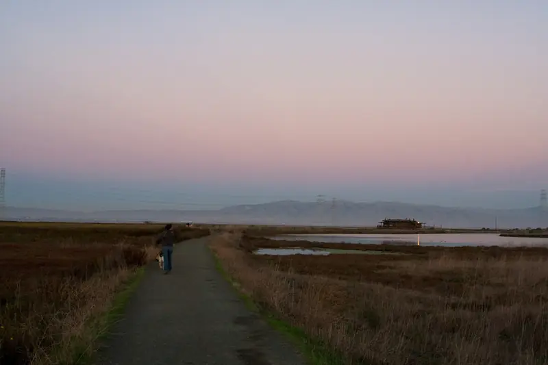
Inside the park, paved paths and a boardwalk lead out over the marsh to an observation deck. Santa Clara County says the trails give access to the salt marshes and asks visitors to stay on designated trails to protect wildlife. Beyond the park boundary, levees run out into the refuge's ponds.
| Route | Length as published | Notes |
|---|---|---|
| Alviso Slough Trail | 10.74-mile loop | Refuge levees; the refuge recommends it for bikes and says 10,000 ducks use the ponds in winter |
| Alviso Slough plus Mallard Slough | 12.3-mile loop | Combined loop with views of the Drawbridge ghost town |
| Mallard Slough Trail | 3.72-mile loop | Pelicans, cormorants and terns; starts near the refuge education center |
| New Chicago Marsh boardwalk | 0.39-mile loop | Wheelchair accessible, from the education center lot on Grand Boulevard |
The refuge levees are flat compacted dirt that turns to mud after rain. There is no shade. Bring water, a hat and a windbreaker. Our Don Edwards refuge guide covers the education center's status and the rest of the refuge.
Dogs, bikes and drones
- Dogs: allowed on the park's pathways and picnic areas only. Not allowed on the trails, levees or boardwalks. The refuge also bans dogs on its Alviso trails. Our dog-friendly hikes guide lists better options.
- Bikes: allowed on all park pathways and trails. Walk your bike on the boardwalks.
- Drones: prohibited in the refuge areas around the ponds.
- Pond edges: do not walk near them. The county's notice says this protects migrating birds and endangered species, including the western snowy plover.
- Hunting season: waterfowl hunting is allowed in parts of the refuge, generally October through January. Wear bright colors on the levees.
Paddling Alviso Slough
The launch is one of the few clear routes in the San Jose area through the marshes to open water. The Water Trail lists two concrete ramps and two floating docks, one high freeboard and one low, plus a rigging area and a boat washing spigot. It is roughly 4 miles down the winding slough to the bay.
The Water Trail's cautions are worth reading before you launch:
- Check the tide chart on the bulletin board. Low tide exposes mudflats that can strand boats.
- Stay at least 50 feet from Ridgway's rail habitat and avoid channels narrower than 100 feet, especially at high tide.
- Keep at least 300 feet from harbor seals, as federal law requires. Stay about 500 feet from haul-out sites during pupping season from March to July.
- Do not land on levees, wetlands or refuge land. The refuge surrounds the slough.
Boat owners who need to launch outside park hours can buy an annual gate key from the county. Santa Clara County also lists a free interpretive boat tour of Alviso Slough that requires registration. Our kayaking guide covers easier paddles closer to Palo Alto.
A short history of Alviso
The town takes its name from Ignacio Alviso, whose father came to California with the Anza expedition. In 1840 Ignacio Alviso moved onto Rancho Rincón de los Esteros, a holding of about 3,653 acres at the edge of the bay. Hides, tallow and beaver pelts shipped from its landing to San Francisco.
Alviso incorporated on March 26, 1852 as the shipping port for San Jose and the valley. Steamboats ran regularly to San Francisco until the railroad changed everything. The San Francisco and San Jose Railroad bypassed Alviso in 1864, though the town later became a stop on a Southern Pacific line to Oakland. Alviso Mills, founded in 1853, ground up to 300 barrels of flour a day before closing in 1885.
In 1906 the Bayside Canning Company opened here. Under Thomas Foon Chew it grew into one of the largest canners in the country in the 1920s, with a smaller plant in what is now Palo Alto's Ventura neighborhood. Our Thomas Foon Chew page tells that story. During the Depression, Wikipedia says, Alviso was known for dance halls and gambling. In the 1960s and 1970s a small boat building community grew up on the waterfront.
- 1968: Alviso voted 189 to 180 to consolidate with San Jose; it became part of the city on March 12, 1968.
- 1973: the Alviso Historic District joined the National Register of Historic Places on October 9.
- 1983 and 1995: major floods. Wikipedia says parts of Alviso lie below sea level, which makes them prone to flooding.
- 2021: the H. G. Wade Warehouse, built in 1860 to store grain and hay, burned in June.
Wikipedia lists the South Bay Yacht Club, founded in 1888, among the landmarks that remain. A short walk through the old streets shows what is left of the port town.

Seasons and events
Winter is prime time for ducks on the ponds. Spring and fall bring migrating shorebirds. Summer days are warm and often windy in the afternoon. Alviso's free Day on the Bay festival usually takes over the park on a Sunday in October, with food, music and kayak rides; it began on October 16, 2010 to celebrate the renovated park. Check the county's event listings for the next date.
What pairs nearby
- Don Edwards refuge: the education center and the New Chicago Marsh boardwalk are a short drive away on Grand Boulevard.
- Shoreline Park in Mountain View: more bay trails on the way home.
- Birdwatching near Palo Alto: compare Alviso with the Baylands.
Frequently asked questions
Are dogs allowed at Alviso Marina County Park?
Only in part of it. Santa Clara County says dogs may use the park's pathways and picnic areas but not the trails, levees and boardwalks. The surrounding Don Edwards refuge prohibits dogs on its Alviso trails, so plan on a short leashed stroll near the parking lot at most.
Is there a fee to park at Alviso Marina?
The San Francisco Bay Water Trail, a state program, says parking is free with no time limit during park hours, which it lists as 8 a.m. to sunset year-round. Santa Clara County's own page does not list a fee or hours. Overnight parking is not allowed.
Can I launch a kayak at Alviso Marina?
Yes. The park has two concrete boat ramps and two floating docks, one high and one low, used by motorized and nonmotorized boats. It is about 4 miles down Alviso Slough to open bay. Mudflats at low tide can strand boats, so check the tide chart posted by the launch.
Can I ride a bike at Alviso Marina?
Yes. Santa Clara County allows bikes on all park pathways and trails but asks riders to walk their bikes on the boardwalks. The park sits on a long continuous stretch of the San Francisco Bay Trail. The refuge levees beyond it are popular rides.
Why is Alviso part of San Jose?
Alviso was an independent town for more than a century. It incorporated in 1852 as the shipping port for San Jose and the Santa Clara Valley. Residents voted 189 to 180 to consolidate with San Jose, which took effect on March 12, 1968.