On this page
Petaluma sits on a tidal river at the southern edge of Sonoma County, surrounded by dairy farms, rolling hills and a growing number of wineries. For most of its history it was a working farm town. In the early 20th century it called itself the Egg Basket of the World, shipping eggs and poultry down the Petaluma River to San Francisco. The 1906 earthquake did relatively little damage here, so the downtown kept its 19th century commercial buildings, including rows of storefronts with ornate cast-iron facades.
That downtown is the reason to come. It has independent shops, restaurants, a riverfront promenade and a historical museum in an old Carnegie library. Add the Petaluma Adobe, one of the largest surviving buildings from Mexican California. That makes a relaxed history day. It is also a good base for Point Reyes, Bodega Bay or Sonoma wine country.
Getting there from Palo Alto
By car
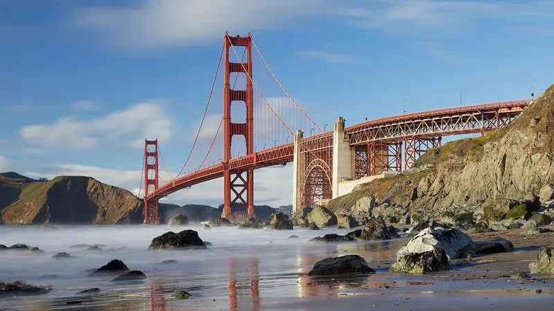
There are two main routes. The first is US 101 north through San Francisco and over the Golden Gate Bridge, then up through Marin County to Petaluma. It is about 70 miles and takes about 1.5 hours with no traffic. The Golden Gate Bridge charges its toll southbound only, so you pay on the way home: $10.25 with FasTrak since July 1, 2026. There are no cash lanes.
The second avoids the city. Cross the San Mateo Bridge, follow Interstate 880 and Interstate 580 north and cross the Richmond-San Rafael Bridge into Marin, then take US 101 north. It is about 80 miles and takes about as long. The Richmond-San Rafael Bridge charges its toll westbound, which is your direction going north: $8.50 in 2026 and $9.00 with FasTrak from January 1, 2027. Our bridges and tolls guide explains how rental cars handle tolls.
Weekday rush hour on 101 through Marin is slow in both directions, as are summer Sunday afternoons heading south. Leave Palo Alto before 7 a.m. or after 9 a.m. You can compare rental cars at SFO or SJC if you need one.

By ferry and train
Petaluma is one of the few North Bay towns you can reach by rail. Take Caltrain from Palo Alto to San Francisco's 4th and King station, then Muni or a walk along the Embarcadero to the Ferry Building. Golden Gate Ferry runs to Larkspur for about $9.50 with Clipper. The SMART train leaves from a station near the Larkspur ferry terminal. Ride north to Petaluma Downtown station, a short walk from the historic center. It is a long trip, three hours or more each way, but a scenic one. Check the Caltrain, Golden Gate Ferry and SMART schedules and plan connections carefully, especially on weekends. Our Caltrain guide covers the first leg.
Historic downtown
Downtown Petaluma runs along Petaluma Boulevard and Kentucky Street, with the river on its east side. The Petaluma Historic Commercial District is listed on the National Register of Historic Places. Walk slowly and look up: the upper floors carry Italianate cornices, cast-iron fronts and painted signs from the town's boom years. The look has drawn filmmakers for decades. Many scenes from George Lucas's "American Graffiti" were shot on these streets in 1972.
Shops lean toward antiques, vintage clothing, books, home goods and gifts. A few places worth knowing:
- The Seed Bank: Baker Creek Heirloom Seeds runs this shop of heirloom vegetable and flower seeds, first opened in the marble 1924 Sonoma County National Bank building and now half a block south beside the river at 110 Petaluma Boulevard North. Its website lists hours of 10 a.m. to 4 p.m. Sunday through Thursday. It is closed Friday and Saturday, which surprises many weekend visitors.
- Petaluma Historical Library and Museum: housed in the town's 1906 Carnegie library, with exhibits on the river, the egg industry and local families. The museum's website lists hours of 10 a.m. to 4 p.m. Thursday through Sunday. Its annual Día de los Muertos exhibition runs through November 8, 2026.
- The riverfront: a promenade follows the Petaluma River through downtown to the turning basin, where boats once loaded produce for San Francisco. Benches and patios face the water.
Petaluma Adobe State Historic Park
About four miles east of downtown, the Petaluma Adobe was the headquarters of Rancho Petaluma, the vast estate of General Mariano Guadalupe Vallejo. State Parks calls it the largest private rancho in California between 1834 and 1846. Indigenous workers, many of them Coast Miwok, did most of the labor that built and ran it. The two-story adobe, with its wide wooden verandas, holds rooms set up as workshops, storerooms and living quarters. The surrounding grounds keep the open feel of the old ranch.
The state park page, checked November 1, 2026, lists:
| Detail | Information |
|---|---|
| Address | 3325 Adobe Road, Petaluma |
| Hours | Daily, 10 a.m. to 5 p.m.; adobe building closes at 4:30 p.m. |
| Closed | Thanksgiving, Christmas and New Year's Day |
| Admission | $3 adults, $2 youths, free for children 5 and under |
| Parking | Free in the lower lot near the Adobe Road entrance |
| Dogs | Developed areas only; not in historic buildings or along Adobe Creek |
Allow about an hour. The park is a good stop on the way to or from Sonoma, about 20 minutes east, where Vallejo's later home and the Sonoma Mission are part of Sonoma State Historic Park. Our Napa and Sonoma guide covers that side of the valley.
Getting outdoors
Helen Putnam Regional Park, on the western edge of town, has oak-studded hills, a small pond and trails with views over the farmland toward the bay. Sonoma County Regional Parks charges a parking fee there. Shollenberger Park, on the river south of downtown, is a flat wetland loop popular with birders. For a bigger outing, the Point Reyes National Seashore is about 45 minutes west through dairy country. Jack London State Historic Park in Glen Ellen is about 40 minutes northeast.
When to go
Spring is lovely, with green hills, lambs and calves in the pastures and the town's Butter and Eggs Day parade, traditionally held in late April. Summer days are warm, with an afternoon breeze through the Petaluma Gap that keeps it cooler than Sonoma or Napa. Fall brings harvest and clear weather. Winter is quiet and green, with some rain. Our weather guide explains Bay Area microclimates.
Where to eat
Downtown has the widest choice, from bakeries and coffee shops to brewpubs, taquerias and sit-down restaurants with river views. The surrounding farms supply plenty of local cheese, dairy and produce, which shows up on many menus. Weekend brunch is busy, so book ahead or arrive early. Many restaurants close one or two days a week. If you plan a farm or creamery visit outside town, check hours on the business's own site first.
A sample day
- 8:30 a.m. Leave Palo Alto after the worst of the traffic.
- 10:15 a.m. Petaluma Adobe when it opens.
- 11:30 a.m. Drive into downtown, park and walk the river promenade.
- 12:30 p.m. Lunch downtown.
- 2 p.m. The historical museum (Thursday to Sunday) and the Seed Bank (Sunday to Thursday).
- 4 p.m. Helen Putnam Park for the late light, then home via the Golden Gate.
Petaluma's hotels and inns cost less than those in Sonoma or Napa. The town makes a handy base for a weekend in the North Bay. You can compare hotels in Petaluma. Browse all our day trips from Palo Alto for more ideas.
Frequently asked questions
How far is Petaluma from Palo Alto?
Petaluma is about 70 to 80 miles north of Palo Alto, depending on the route. Driving takes about 1.5 to 2 hours, through San Francisco and over the Golden Gate Bridge or through the East Bay and over the Richmond-San Rafael Bridge. Weekday traffic in Marin County can add a lot.
What are the Petaluma Adobe hours?
California State Parks lists Petaluma Adobe State Historic Park as open daily from 10 a.m. to 5 p.m., with the adobe building closing at 4:30 p.m. It closes on Thanksgiving, Christmas and New Year's Day. Admission is $3 for adults and $2 for youths, with free parking in the lower lot.
Can you get to Petaluma by train?
Yes. SMART trains stop at Petaluma Downtown and Petaluma North. From Palo Alto, ride Caltrain to San Francisco, take a Golden Gate Ferry from the Ferry Building to Larkspur and board SMART at the Larkspur station near the ferry terminal. Allow three hours or more each way and check all three schedules.
Was American Graffiti filmed in Petaluma?
Many scenes of George Lucas's 1973 film American Graffiti were shot on the streets of downtown Petaluma, along with other locations in Marin County. Petaluma's well preserved downtown has appeared in several other films since. The town sometimes celebrates the connection with car shows.
Is downtown Petaluma walkable?
Yes. The historic downtown is compact, with the river, Petaluma Boulevard, Kentucky Street and the side streets all within a few blocks. Park once and walk. The Petaluma Adobe is about four miles east of downtown, so you need a car or a ride to reach it.