On this page
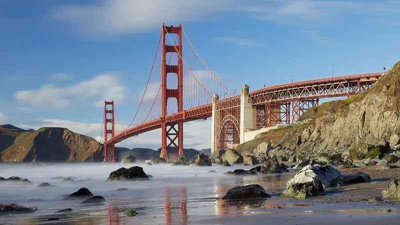
The Golden Gate Bridge is the one sight every visitor to the Bay Area wants. It is easy to see from a car window. Walking or biking across it is something else entirely. The deck hums with traffic, the orange towers rise 746 feet above the water and on a clear day you can see out past the Golden Gate to the open Pacific and back across the bay to the East Bay hills. The wind and the cold surprise almost everyone.
Our San Francisco guide covers the city and our Marin Headlands guide covers the viewpoints across the strait. This page is the practical guide to the bridge itself: how to get there from Palo Alto, the 2026 sidewalk rules for walkers and cyclists, parking, the visitor plaza at the south end and Fort Point underneath.
Getting there from Palo Alto
By car
Take Interstate 280 north into San Francisco and follow signs for Highway 1 and 19th Avenue. Highway 1 runs north through the Sunset District and Golden Gate Park, then becomes Park Presidio Boulevard and joins US 101 at the bridge. The trip is about 35 miles and takes 45 minutes to an hour in light traffic. For the visitor area at the south end, take the last San Francisco exit before the toll plaza, signed "Golden Gate National Recreation Area View Area". Turn left at the stop sign into the lot.
By Caltrain and bus
The bridge district recommends transit over driving. From Palo Alto it is easy. Ride Caltrain to the 4th and King station, then take Muni to the Salesforce Transit Center downtown. From the Bus Plaza at Bay A, Golden Gate Transit routes 101, 130 and 150 stop at the northbound toll plaza stop beside the visitor area. To start on the Marin side instead, ride route 130 to its first stop after the bridge and walk the path back to Vista Point. Check schedules on 511.org, since service varies by day.
Walking across
Pedestrians, including people using wheelchairs and other mobility devices, may use only the east sidewalk, the side facing San Francisco Bay and the city. According to the bridge district's bikes and pedestrians page:
- Pacific Standard Time (early November to early March): 5 a.m. to 6:30 p.m.
- Pacific Daylight Time (early March to early November): 5 a.m. to 9 p.m.
Automatic gates close the sidewalk at night. Daylight saving time ended on November 1, 2026, so winter hours are in effect until March 14, 2027. The bridge is 1.7 miles long from abutment to abutment, so a round trip on foot is well over three miles. Allow 40 minutes to an hour each way at a strolling pace with photo stops. The sidewalk is 10 feet wide and shared with cyclists on some days, so keep right and watch for bikes, especially at the towers.
Several things are banned on the sidewalks: electric scooters, skateboards, roller skates and inline skates, pushcarts and non-service animals, including dogs. Drones are banned over and near the bridge and on the surrounding national park land. If you or someone you know is struggling, the district partners with crisis lines: text GGB to 741741 at any time.
Biking across
Cyclists ride free, 24 hours a day, but the sidewalk they use changes by day and time. Indicator lights at the approaches show where to go. During Pacific Standard Time:
| Day | Time | Sidewalk for bikes |
|---|---|---|
| Weekdays | 5 a.m. to 3:30 p.m. | East (shared with walkers) |
| Weekdays | 3:30 p.m. to 6:30 p.m. | West |
| Weekends and holidays | 5 a.m. to 6:30 p.m. | West |
| Every night | 6:30 p.m. to 5 a.m. | East, through buzzer-operated security gates |
The speed limit is 15 mph, slowing to 5 mph around the towers. Cyclists must yield to pedestrians. All classes of e-bikes are allowed. High winds or special events can close the west sidewalk at short notice. There are no bike rentals at the bridge itself, so rent in the city and ride out along the Crissy Field waterfront. A popular plan is to ride across to Sausalito and take the ferry back. Our Sausalito guide covers the ferry. You can compare bike rentals in San Francisco.
The visitor plaza at the south end
The southeast end of the bridge has the most to see. The bridge's visiting page lists:
- Welcome Center: open daily from 9 a.m. to 6 p.m. with exhibits, history and merchandise. It displays the original 12-foot stainless steel test tower used in 1933.
- Outdoor exhibits: a path through the plaza leads into an old bunker with more displays on the bridge's science and construction.
- The Round House: the round building by the plaza is now an Equator Coffee, with views of the span.
- Free walking tours: San Francisco City Guides, a nonprofit linked with the San Francisco Public Library, leads free bridge tours on Wednesdays and Saturdays. Check its schedule.
Restrooms and several viewpoints sit around the plaza, including the newer Golden Gate and Pacific Overlooks. On the Marin side, Vista Point has restrooms and the classic view back toward the city.

Parking
Parking is the hard part. The bridge district calls it extremely limited and urges visitors to use transit, rideshare or bikes. If you must drive:
- Southeast lot by the Welcome Center: 37 spaces, including 26 general and 3 accessible spaces. $5 an hour with a maximum of three hours, open 7 a.m. to 9 p.m. every day. Pay at the meters or with ParkMobile.
- Southwest satellite lot: may open on weekends and holidays only.
- Northeast Vista Point lot on the Marin side: free with a four-hour limit. From San Francisco, cross the bridge and take the first exit.
- Presidio and Crissy Field: more lots lie a longer walk away in the park. Check the posted rules and rates.
The district closed its parking lots on weekends and holidays from May 25 to October 12, 2026. Those dates have passed, but similar closures could return, so check the alerts on its site before you go. Car break-ins are a real problem at the bridge lots. Leave nothing in your car, move valuables to the trunk before you arrive and lock up.
Fort Point, under the bridge
At the end of Marine Drive below the south anchorage sits Fort Point, a brick fortress built between 1853 and 1861. It was the only fort of its type built on the West Coast. Engineers designed a steel arch to carry the bridge over it rather than tear it down. The National Park Service lists the fort as open Thursday to Monday from 10 a.m. to 5 p.m., with roof access closing at 4:30 p.m. It is closed on Thanksgiving, Christmas and New Year's Day. The roof gives an unusual view straight up at the bridge deck. Pets are allowed on the grounds but not inside.
Just east along the shore, Presidio Tunnel Tops is a free park over the highway tunnels, with a big nature playground, lawns and food vendors whose hours change by season.
Best time to go
Fog is the deciding factor. Summer mornings often hide the towers completely, while September and October bring the clearest days of the year. Winter days between storms can be crisp and spectacular, but sidewalks close at 6:30 p.m. Go early on weekends to beat the crowds and the parking rush. Whatever the season, bring a windproof jacket. It is always colder and windier on the span than you expect. Our weather guide explains why.
A sample day
- 8:30 a.m. Caltrain from Palo Alto to San Francisco, then a bus to the bridge.
- 10 a.m. Welcome Center and the plaza exhibits, with coffee at the Round House.
- 11 a.m. Walk across to Vista Point and back on the east sidewalk.
- 1 p.m. Lunch from the vendors at Presidio Tunnel Tops.
- 2:30 p.m. Fort Point and the view from its roof, if it is a Thursday to Monday.
- 4 p.m. Walk the Crissy Field shore, then head back to Caltrain.
If you drive instead, cross north afterward for sunset at the Marin Headlands viewpoints. The toll is charged on your way back south. See our bridges and tolls guide for payment options. Browse all our day trips from Palo Alto for more ideas.
Frequently asked questions
Can you walk across the Golden Gate Bridge?
Yes. Pedestrians use the east sidewalk, the side facing San Francisco. During Pacific Standard Time, from early November to early March, it is open from 5 a.m. to 6:30 p.m. During daylight saving time it is open from 5 a.m. to 9 p.m. The span is 1.7 miles from end to end.
Where do you park to visit the Golden Gate Bridge?
The southeast visitor lot by the Welcome Center has 37 spaces at $5 an hour, with a three-hour limit, from 7 a.m. to 9 p.m. A satellite lot on the southwest side may open on weekends and holidays. On the Marin side, the Vista Point lot is free with a four-hour limit. All fill fast, so the bridge district recommends transit.
Can you bike across the Golden Gate Bridge?
Yes, 24 hours a day and free. Cyclists switch between the east and west sidewalks depending on the day and time. At night they buzz through security gates on the east side. The speed limit is 15 mph, slowing to 5 mph around the towers. All classes of e-bikes are allowed.
How much is the Golden Gate Bridge toll?
The toll is charged only southbound, into San Francisco. From July 1, 2026 a two-axle car pays $10.25 with FasTrak, $10.50 with a license plate account or one-time payment and $11.25 by invoice. There are no cash lanes.
Can you bring a dog on the Golden Gate Bridge?
No. Non-service animals, including dogs, are not allowed on the bridge sidewalks. Service animals are always permitted. Dogs are also not allowed inside Fort Point, though they may be on its grounds.